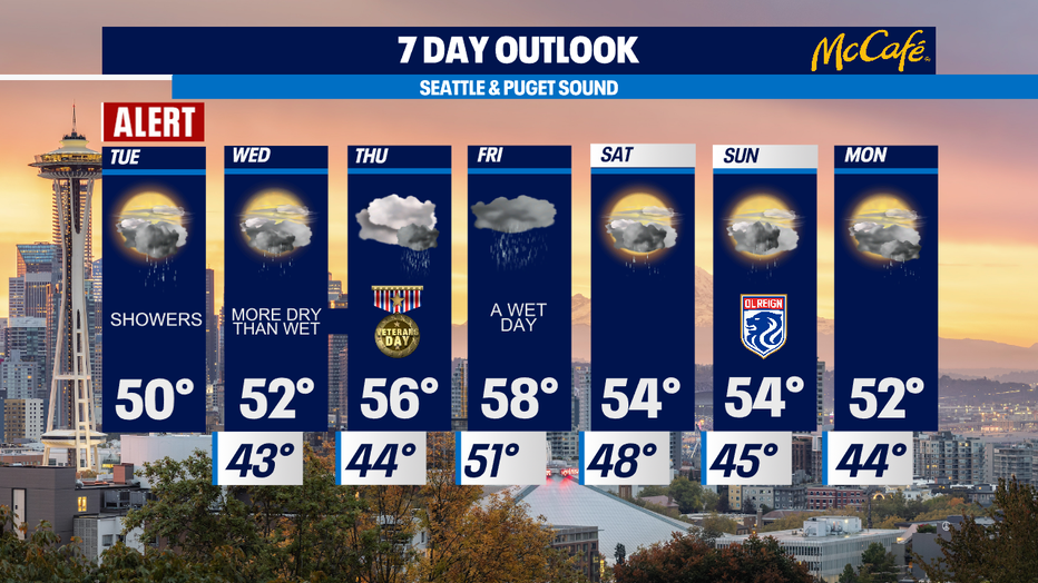
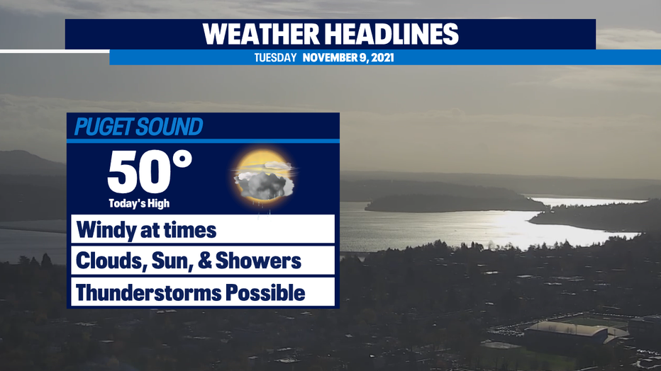
Showers and possible thunderstorms Tuesday afternoon
Seattle - It was a windy morning across Western Washington with thousands of power outages across the area.
Saturated ground from rainfall this month helped contribute to downed trees in some spots. Peak wind gusts topped out between 40-50 mph in King, Pierce, and Snohomish counties. A few spots had 50+ mph gusts, like the Tacoma Narrows Bridge and Friday Harbor.
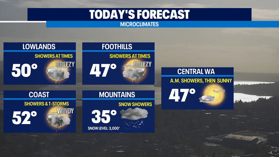
Winds should die down this afternoon and evening. We will have a mix of sunshine, clouds, and the occasional downpour today. There's a chance for thunderstorms as well, especially along the Washington Coast. Keep your eye on the sky this afternoon on the coast and Olympic Peninsula. The chance for a severe thunderstorm is heightened today.
Snow will continue to fall in the Cascades. Expect an additional 6-10" of new powder at White Pass, Snoqualmie Pass, and Stevens Pass. Heavier snow showers will arrive this afternoon and evening on the mountains with snow levels down to 3,000 feet.
Wednesday will be more dry than wet, with just a few scattered showers and slightly warmer temps. Think of it as a break between systems, because Thursday late afternoon/evening and Friday, another atmospheric river takes aim at our area. This could cause some flooding issues on area rivers as snow levels rise. Snow melt combined with heavy rain could be problematic. Stay tuned!
The weekend looks showery with more breaks from the rain on Saturday than Sunday.