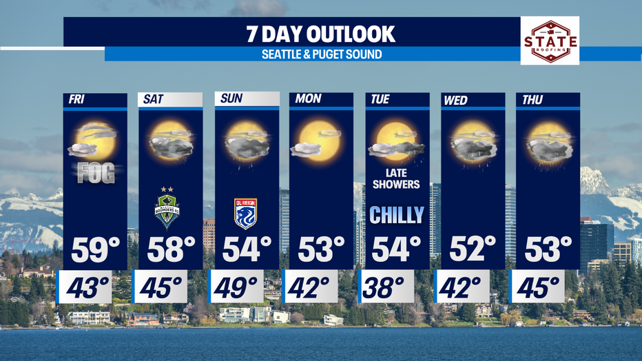
Settling into Autumn with a mixed forecast; Cool and dry to start the weekend, then chilly and showery.
Seattle - Happy Thursday! Highs struggling again to get out of the 60s today. Most of us landing in the mid 50s to upper 50s. The normal seasonal high for this time of year is 64 today and dropping to 63 Friday.
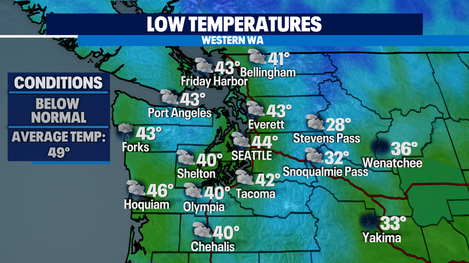
Overnight we'll cool down to below average again as well. Look for temperatures to sit in the low to mid 40s with near freezing or slightly colder conditions over the passes. Brr!
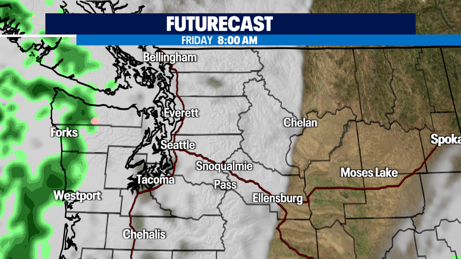
Clouds will increase overnight as a front starts to push into the region. Most of the moisture will hang along the coast and the Olympic Peninsula. Highs near 60.
A stronger system heads our way Saturday mid-day packing rain and wind through Sunday. Expect periods of heavy showers with winds gusting between 25-45mph at times. Snow levels will decrease through the weekend as well. By Sunday into Monday, we could see a dusting over Snoqualmie Pass around 3,500'. The Summit sits around 3,000' so some of the slopes might see a light coating of white.
The lowlands will dry out briefly Monday, but showers return late Tuesday and take us through the rest of the week. Make sure to pull out the warm jackets too as overnight lows will dip into the upper 30s to low 40s around the metro area mid-week.
Have a great night! ~Erin Mayovsky, FOX13 Forecaster