September sunshine on tap through Friday with a slight chance of showers Saturday with sunny 70s Labor Day!
Seattle - Happy Wednesday all!
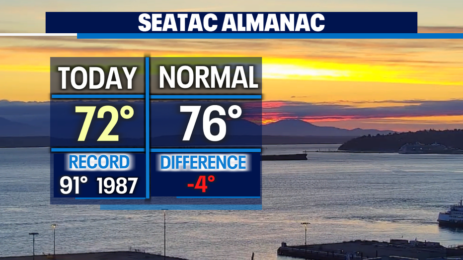
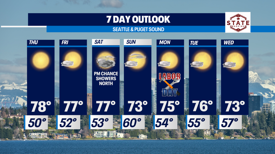
Beautiful blue skies took over much quicker today than yesterday! Highs were warmer too! Most of us landing in the low 70s with some spots slightly warmer.
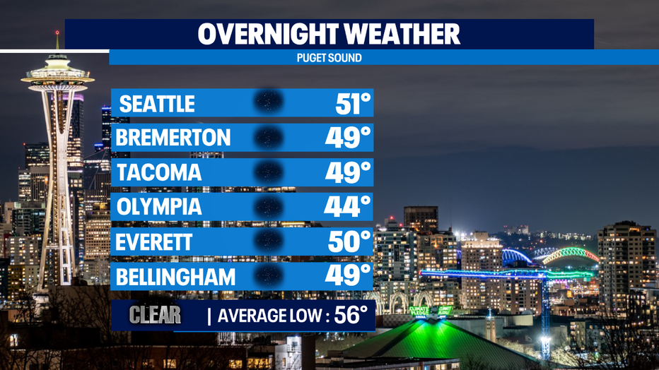
Another repeat forecast for the overnight hours. Lows will run in the mid to upper 40s for most with a few spots sitting at 50 like, Seattle and Everett.
A decent ridge will cross the region as we move into the later half of the week giving us a dry and warm pattern. Look for mostly sunny skies with highs jumping into the upper 70s. The seasonal average for this time of year is 76.
By Friday afternoon clouds will increase as a front approaches from the west. That system should fall apart before reaching the coast, but on the heels is another front that will drop in from the NW WA coast first and spread light showers into the North Sound. We'll see how far the rain will stretch south, but most of us should be fairly dry from the metro down the I-5 corridor. Highs will hang in the mid 70s.
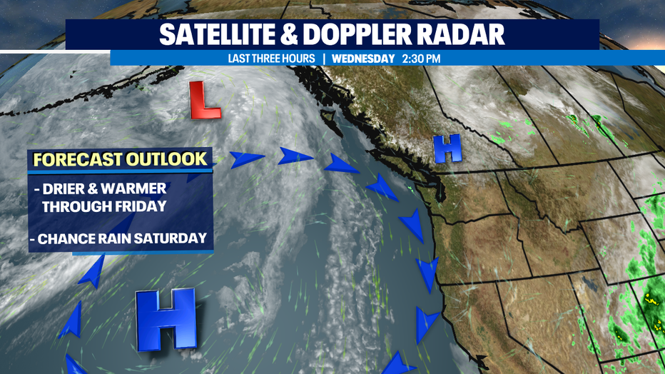
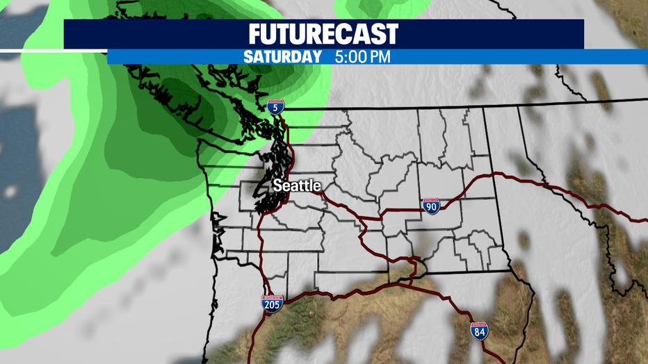
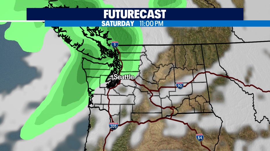
Futurecast shows rain moving in Saturday evening into the overnight hours of Sunday before drying out.
A few showers may linger into Sunday otherwise skies will be partly sunny with highs landing in the low to mid 70s.
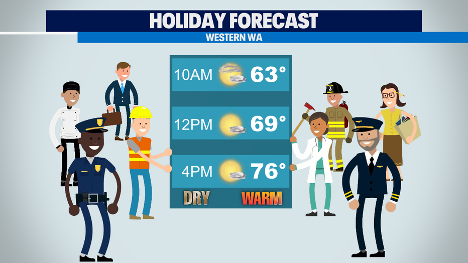
Our beautiful sunshine will carry over into Labor Day this year! Look for dry conditions with highs in the mid to upper 70s!
Next week is pleasant with temperatures at or slightly below average in the low to mid 70s under mostly sunny skies!
Have a great night all ! ~Erin Mayovsky, Q13 Forecaster
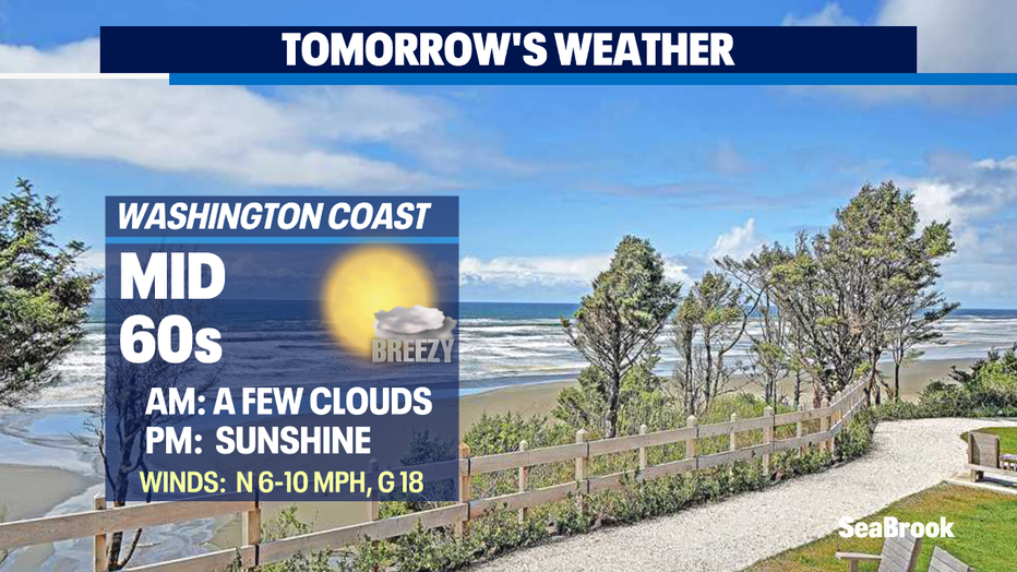
*Beach Forecast
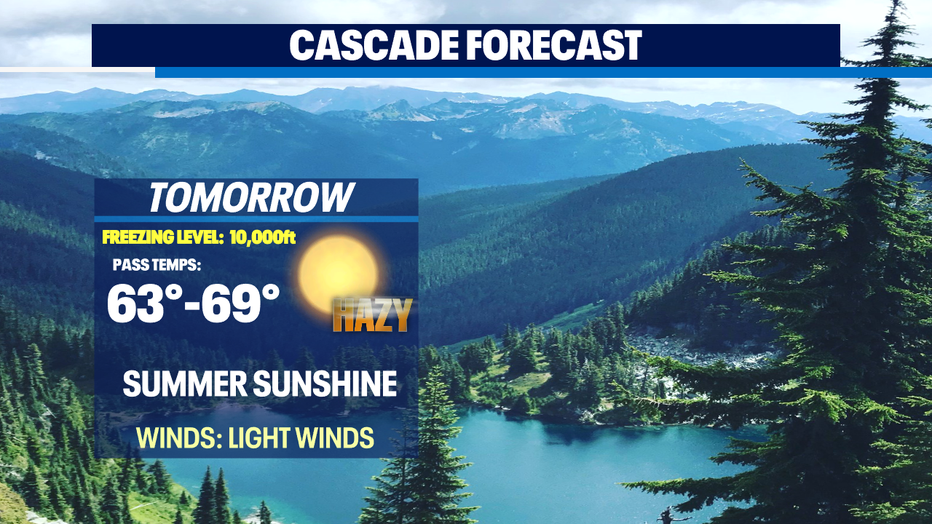
*Mountain Forecast
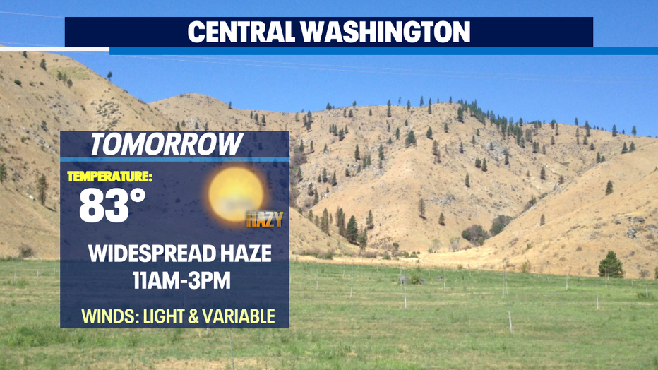
*Central WA Forecast
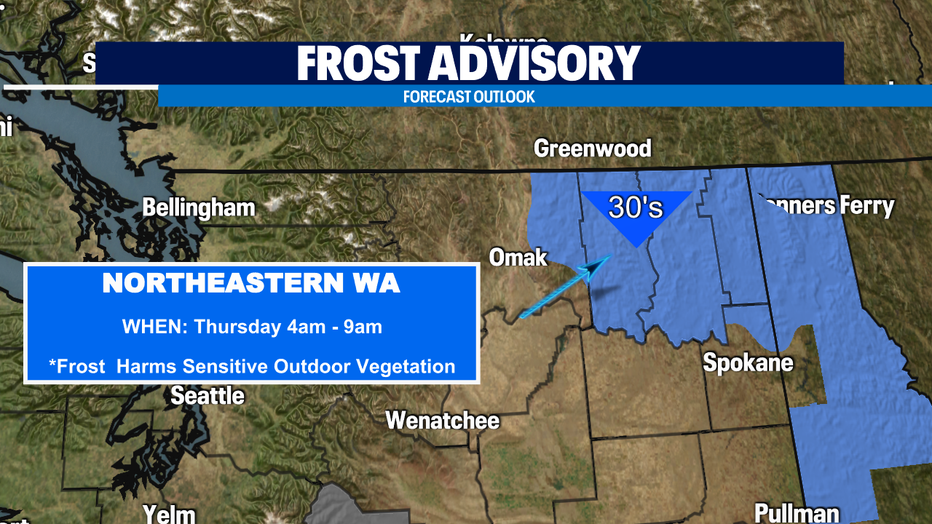
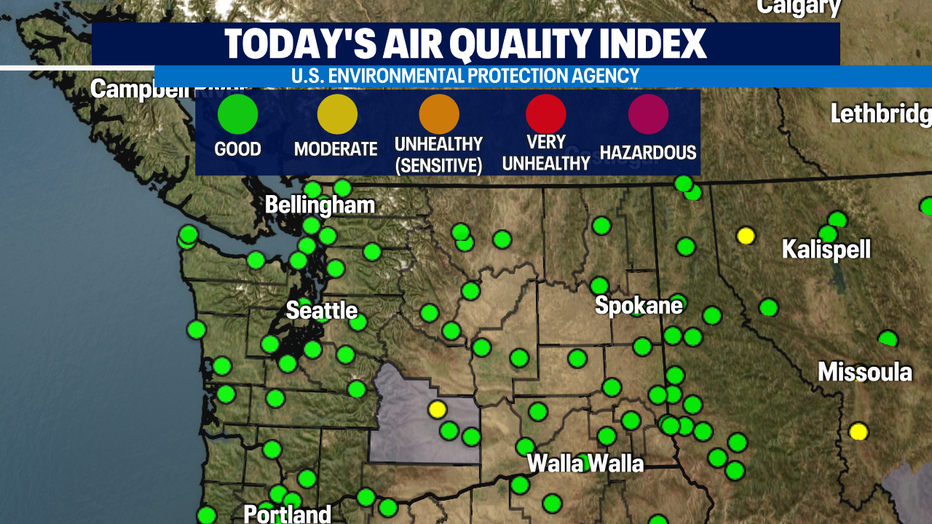
*Air Quality