Stormy Friday night ahead for Western Washington
Seattle - Widespread rain, heavy mountain snow, and gusty winds will hit Western Washington Friday night.
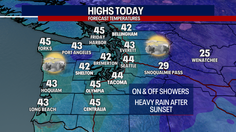
Before sunset, it should be a quiet day with highs in the mid 40s and a few scattered showers. Rain and snow will start moving into the Olympic Peninsula this afternoon, with rain pushing into the Puget Sound lowlands early this evening.
If you're heading out Friday night, be prepared for moderate to heavy rain at times.
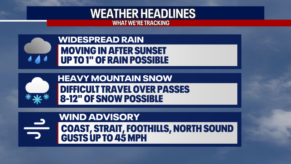
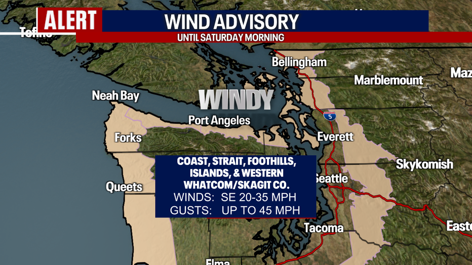
Power outages are possible tonight as strong offshore winds develop. Winds could gust up to 45 mph on the coast, the strait, the north sound, and the Cascade foothills. Gusts will range between 15-25 mph in most of the Puget Sound lowlands, so I'm not expecting much damage for most, but tree limbs could fall higher up in the foothills.
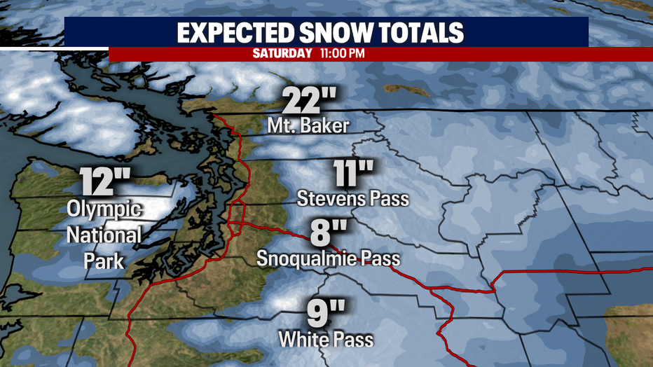
At the Cascade passes, 8 to 12 inches of snow is expected through Saturday, with most of it coming tonight.
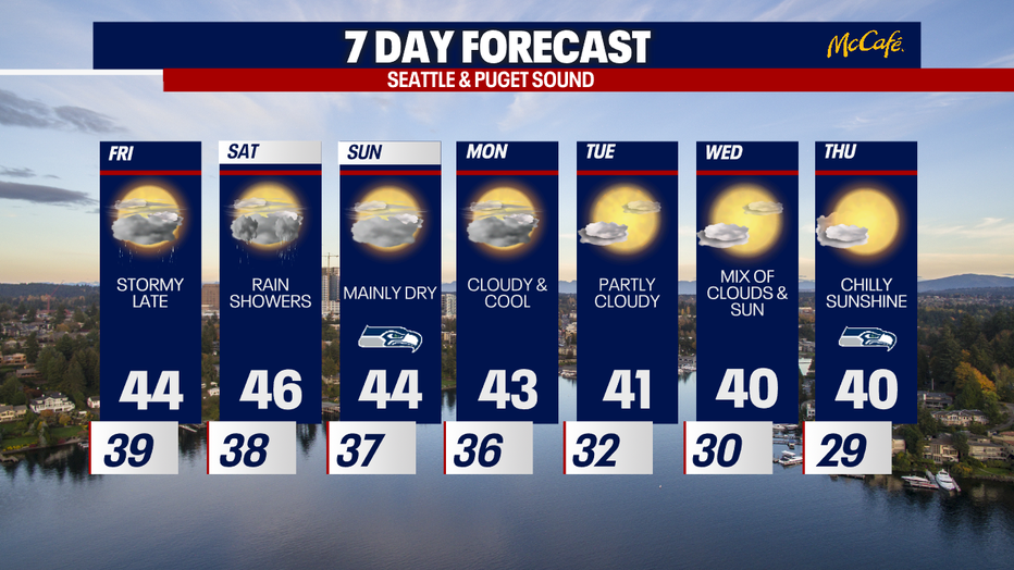
Most of the action will pass by Saturday morning and Western Washington will be left with on and off showers the rest of Saturday. By Sunday, a ridge of high pressure will begin to settle in over the area bringing drier and sunnier conditions by midweek. It will be cool though, with highs around 40 degrees and overnight lows below freezing.