

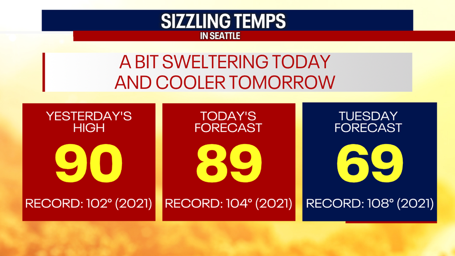
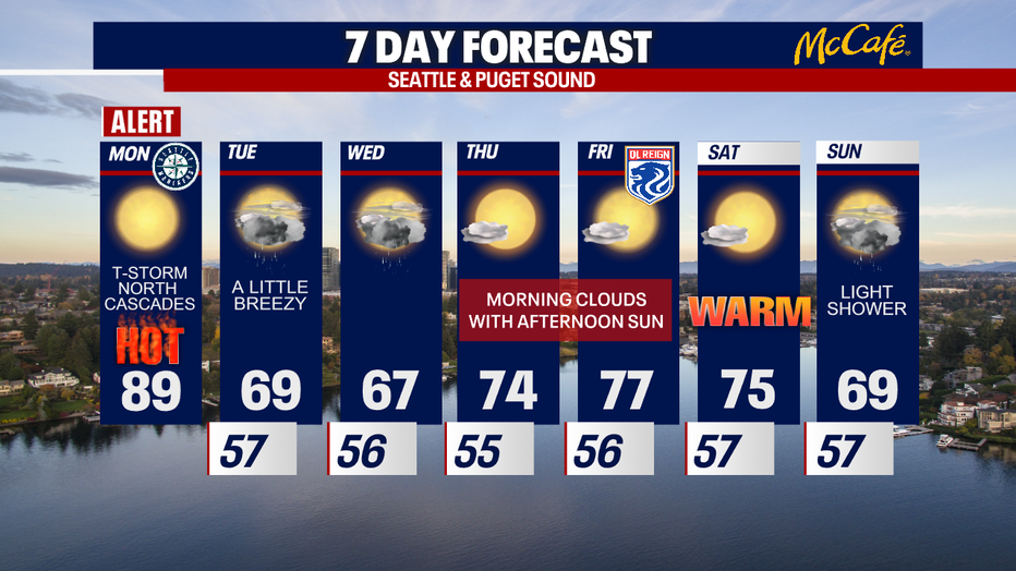
Seattle weather: Scorching Monday afternoon, major cooling Tuesday
SEATTLE - We're tracking one final day of scorching temps for Puget Sound before major cooling arrives Tuesday.
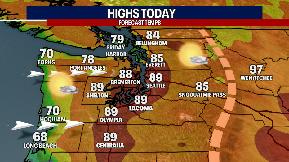
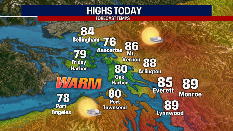
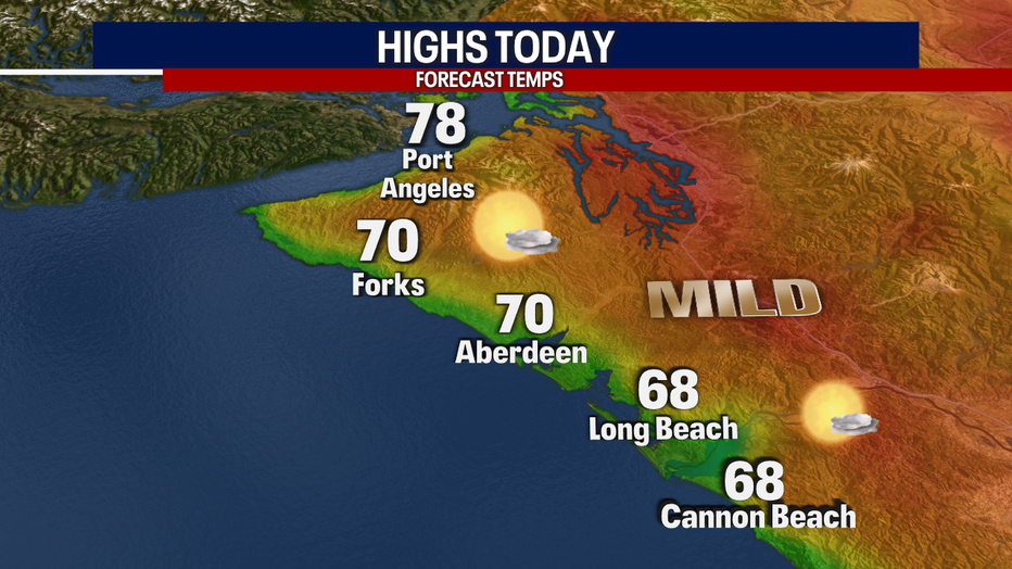
Today, cool westerly winds start blowing along the coast. This will drop highs for the coastal beaches by about 20 degrees compared to last year!
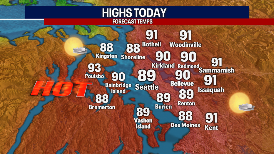
It'll take longer for the cooler marine air to push into Puget Sound. That's why backyards in the greater Seattle area will soar into the upper 80s and low 90s once again this afternoon.
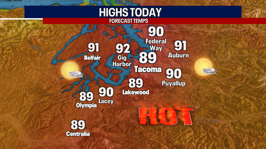
Over the South Sound, communities like Olympia will be several degrees cooler than Sunday but still warm.
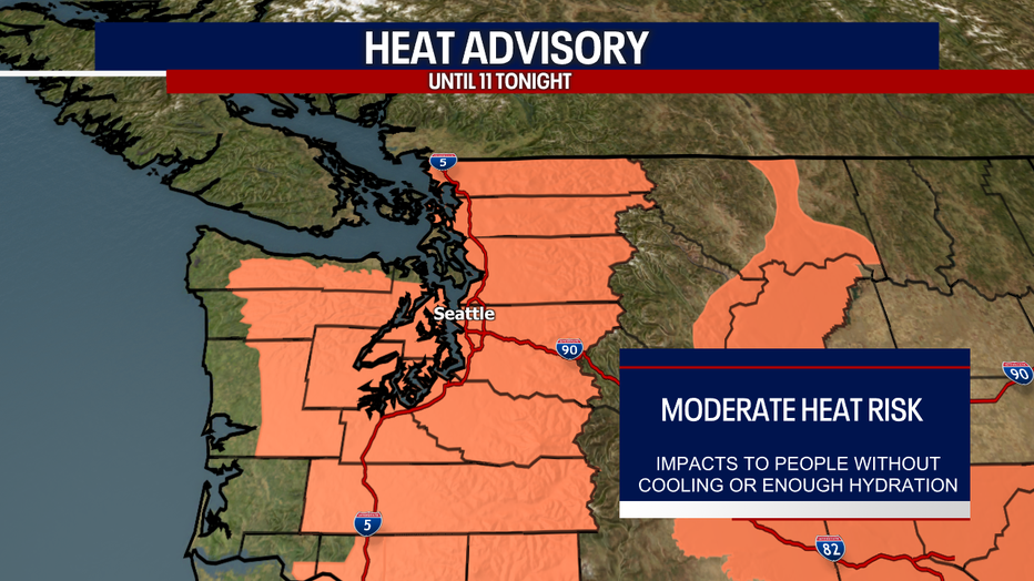
The National Weather Service is continuing this Heat Advisory until 11 p.m. Monday. With the sizzling temps, there's a moderate risk for heat-related illnesses. Take extra care of your children, seniors and pets. Remember to never leave people or pets in a hot car!
If you're heading to the water to cool off, make sure to wear a life jacket. The water in rivers, creeks, lakes (and of course, Puget Sound) are dangerously cold.
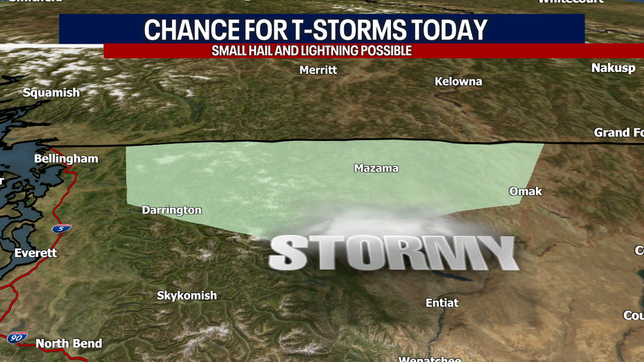
There's a slight chance for a spotty thunderstorm in the North Cascades today and tomorrow. Otherwise, it'll be dry in Western Washington today. Isolated showers return tomorrow and Wednesday.
Today, some of the hotter spots will once again be in the Cascade valleys and foothills. Check out the high temps around the region:
Tomorrow will be significantly cooler around the region. Highs in Seattle will only boost to the upper 60s! It should feel refreshingly cool after this weekend.
Thursday and Friday look absolutely glorious. You can expect morning clouds and afternoon sunshine. Saturday should be spectacular with highs comfortably soaring to the mid 70s. A passing shower is possible Sunday.
Thanks so much for choosing FOX 13. We're thankful for your viewership!
Warmly,
Meteorologist Abby Acone
Follow me on Twitter @abbyacone, Instagram @abbyaconewx, TikTok @abbyaconetv, Facebook (Meteorologist Abby Acone)