

Winter Storm Warning: Round 2 of heavy lowland snow arrives late Friday through Saturday
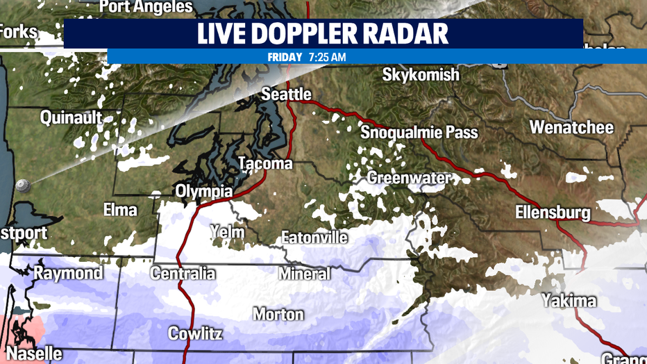
SEATTLE - After a night of snow and ice for some, as of 7 a.m. Friday, light snow showers were falling south of Seattle in Thurston County, south Pierce County, Lewis County, Pacific County and portions of Grays Harbor County - and it's sticking.
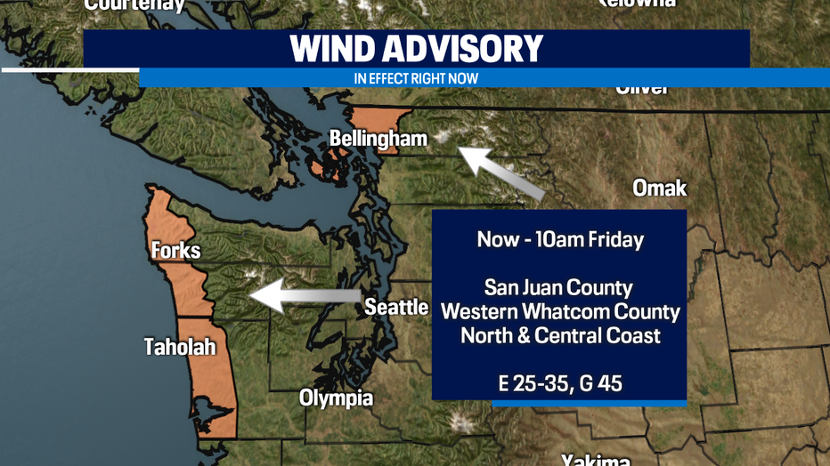
A Wind Advisory is in effect for San Juan, Western Whatcom counties and the north and central coast where it was gusting 30-40mph Friday morning.
TRACK SNOW AND BELOW FREEZING TEMPERATURES WITH THE Q13 WEATHER APP
Wind chill values were in the single digits for Bellingham and in the teens on the coast. There were already power outages in Whatcom county Friday morning. Downed tree limbs and more outages are possible.
Snow activity will pick up by Friday afternoon with Round 2 and we will all see snow through Saturday.
Arrival of lowland snow:
Early Afternoon: South of the Sound
Late Afternoon: Coast
Tonight: South & Central Sound
Late Tonight: Whatcom, Skagit, Snohomish Counties
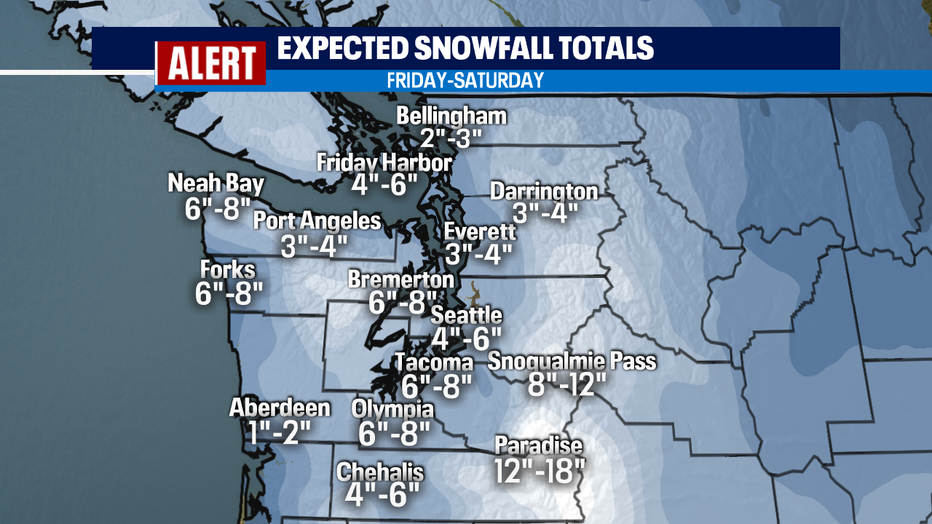
Snow will be heavy with most accumulation happening overnight tonight into Saturday.
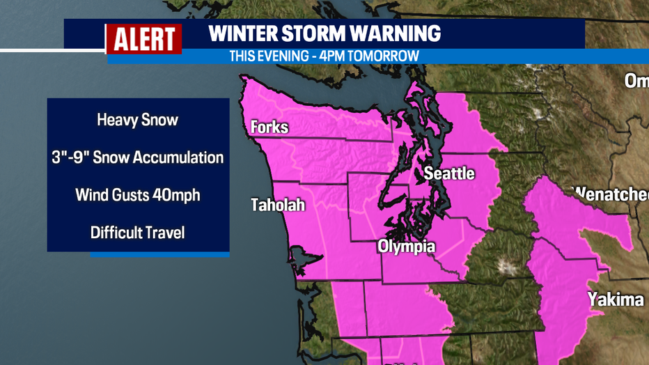
A Winter Storm Warning goes into effect Friday evening through 4 p.m. Saturday. Snow accumulation of 3"-9" expected and wind gusts of 40 mph. This will make travel difficult to impossible.
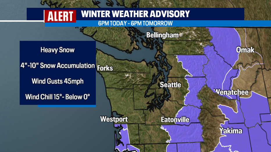
A Winter Weather Advisory will go into effect for the south coast and western slopes of the Cascades from 6 p.m. Friday to 6 p.m. Saturday. Heavy snow and accumulations of 4"-10" are expected. Gusts of 45 mph will produce a wind chill ranging from 15° to below 0°!
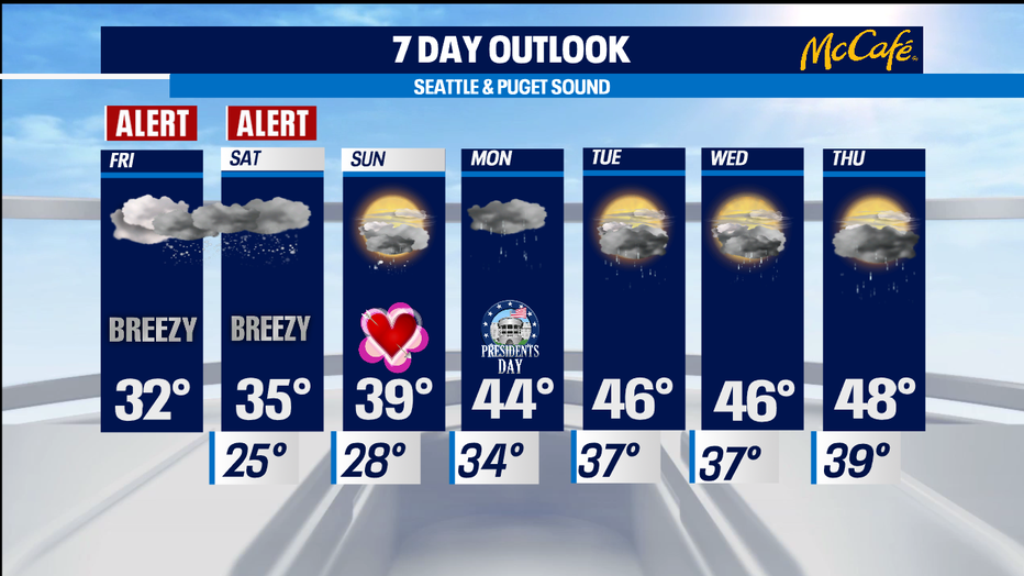
Some lingering snow showers are possible on Sunday as the cold air remains in the area.
Additional significant accumulations are not likely. Next week, highs will rebound into the mid to upper 40s and lows will be above the freezing mark. Rain looks widespread on Monday and there is a chance for rain each day through Thursday.
Stay tuned for updates!
-Q13 Meteorologist Grace Lim