Seattle weather: Record-setting heat expected Monday
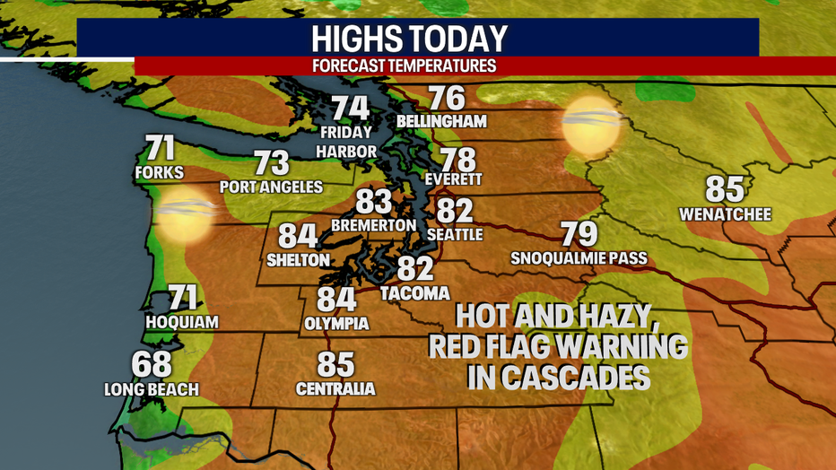
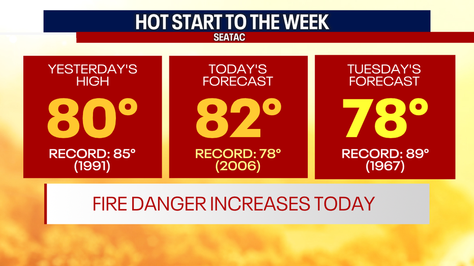
Seattle - Toasty temperatures are back to start the work week along with high fire danger. Temperatures will soar into the 80s around the Puget Sound area, likely setting new records for the day.
A ridge of high pressure will remain over the Northwest through Tuesday. Expect hot and hazy conditions Monday with summer-like afternoon temperatures.
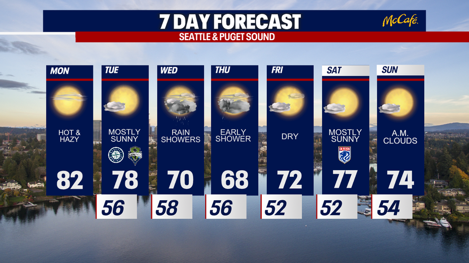
Temps will cool a bit on Tuesday, but they will still be ten degrees above average for this time of year.
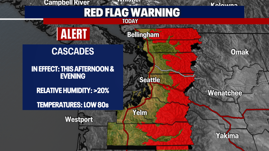
A Red Flag Warning is in effect for the Cascades and western foothills as conditions turn ripe for wildfire spread. Low humidity, hot temperatures, and dry fuels are a concern Monday afternoon and evening.
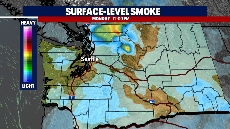
Smoke from the Bolt Creek Fire burning near Skykomish will push into the Puget Sound area Monday. Smoke will be thickest at the surface in Whatcom and Skagit counties this afternoon.
Tuesday night, expect increasing clouds and onshore flow as a frontal system pushes through the region. This will bring much-needed widespread rain showers to the area. While the system looks to fall apart as it makes landfall, most areas will see some rain Wednesday. Showers could linger into Thursday morning.
Friday through next weekend turns nice and warm again, with highs back into the 70s.