

Western Washington preparing for record-breaking heat this weekend
SEATTLE - Are you prepared for the heat?
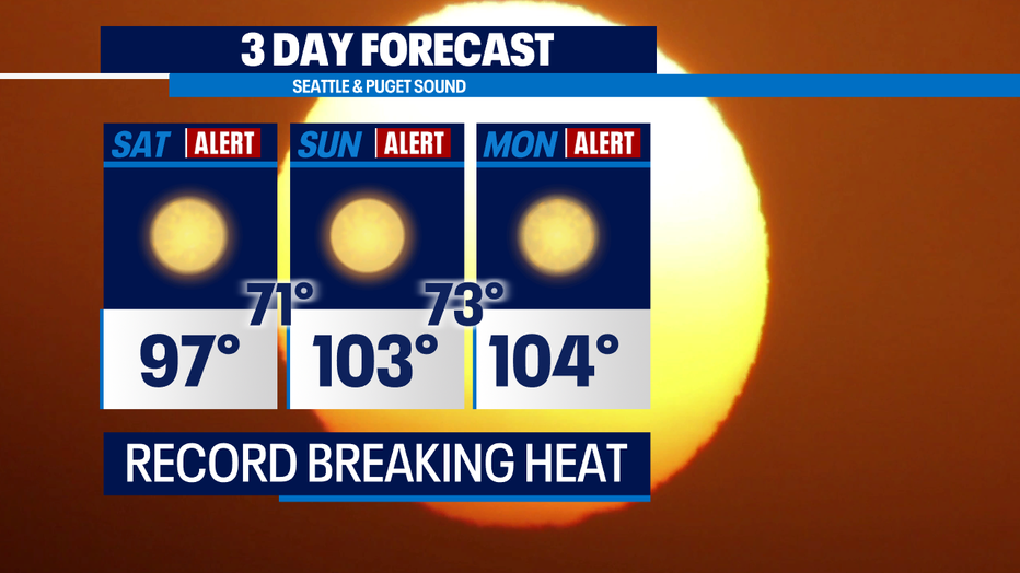
We're talking about breaking multiple records for the day, month, year and possibly the all-time record high for Sea-Tac. Phew! This heat wave is cause by high pressure strengthening over the PNW.
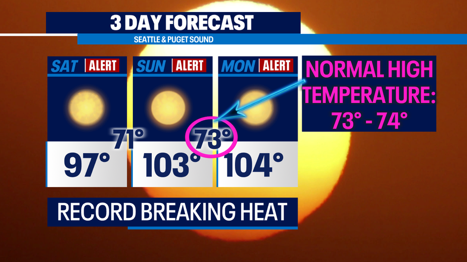
We have never seen a system like this develop across our region before. It'll begin Friday and continue through next week. Below is a look at the Weather Alert Day's. Now remember, our normal high temperature this time is 73F-74F. Meaning, our overnight lows are closer to where our afternoon highs should be!
RELATED: Beating the heat: Hot weather do's and don'ts
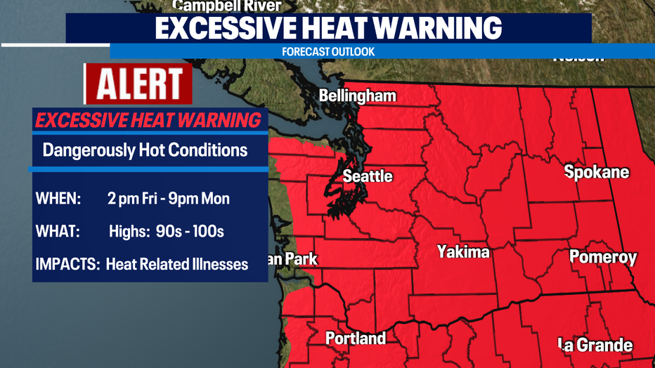
The Excessive Heat Watch has been upgraded to a Warning! This goes into effect on Friday and remains in effect until Monday night. Heat-related illnesses will have to be top of mind!
Here is a look at our temperature swing this week. It'll begin to get hot tomorrow and ramp up through the weekend. There isn't a lot of relief after that. The coolest day this week will be Wednesday and it's still over 10 degrees above average!
RELATED: What makes this heat wave so unusual?
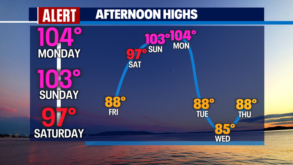
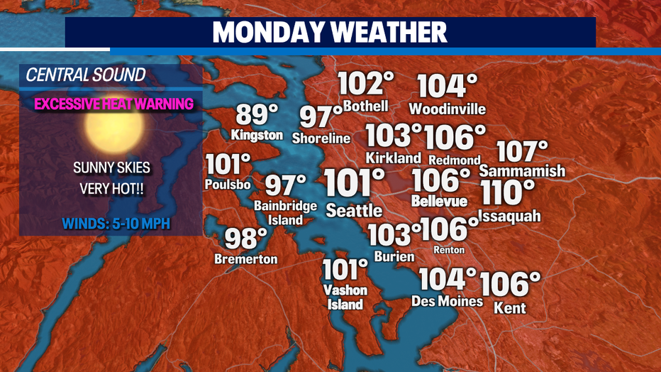
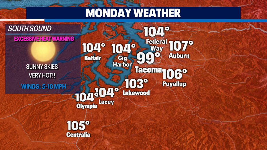
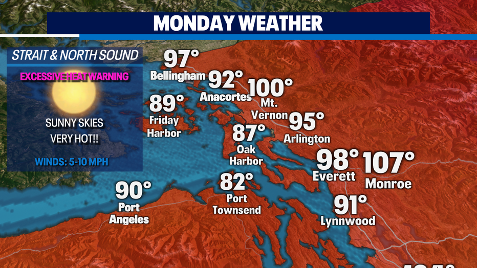
With Monday being the hottest day this week, I thought I would leave you with a look at your forecast across the Sound. I'll continue to adjust these temperatures in the coming days to keep you informed.
Have a good one and I'll see you on Q13!
Q13 FOX WEATHER RESOURCES:
DOWNLOAD: Q13 Weather and News Apps
WATCH: Forecast and Radar
READ: Closures and Delays
CHECK: Latest Weather Alerts and Live Traffic Map
INTERACT: Submit your Weather Photo
FOLLOW: Lisa Villegas, MJ McDermott, Tim Joyce, Erin Mayovsky, Grace Lim and Scott Sistek