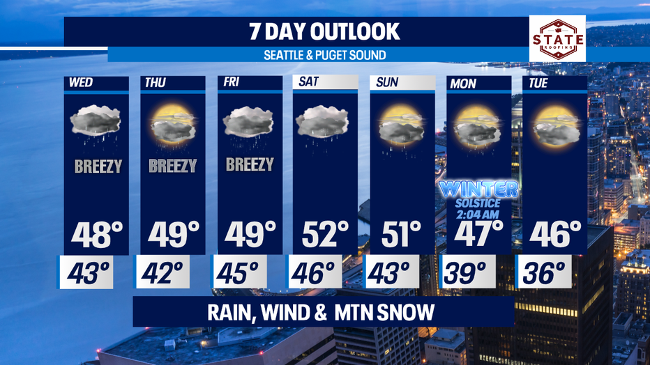
Rain, wind and mountain snow on the way
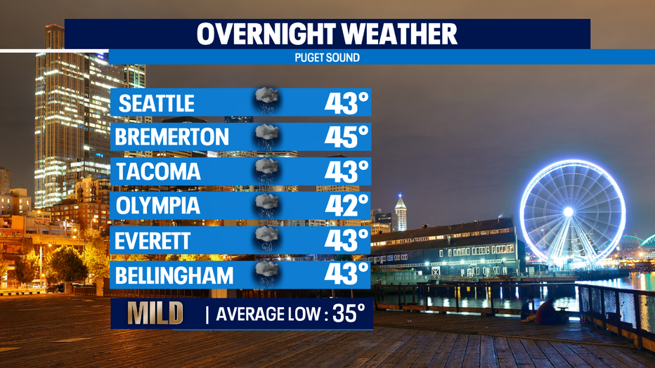
seattle - Happy Tuesday all! We're a little warmer than the norm of 45. Today we landed in the upper 40s for most. And tonight, we'll be mild for sure with overnights hanging well above average, in the low to mid 40s.
Tomorrow starts out with some lingering showers. Some of us will remain dry while others north and south of Seattle see some rain drops. By about lunch time the next weather maker rolls in off the SW WA coast delivering shower for everyone by the evening commute.
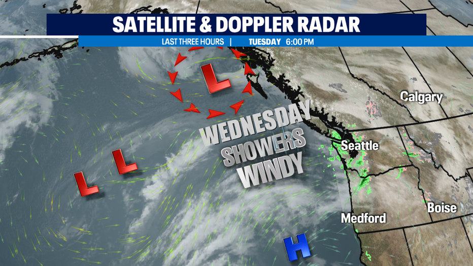
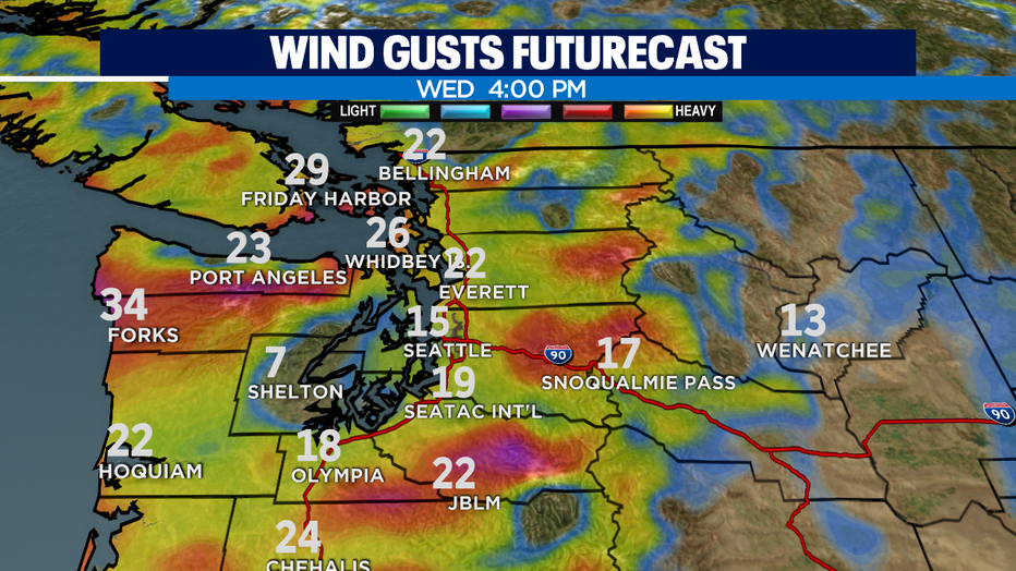
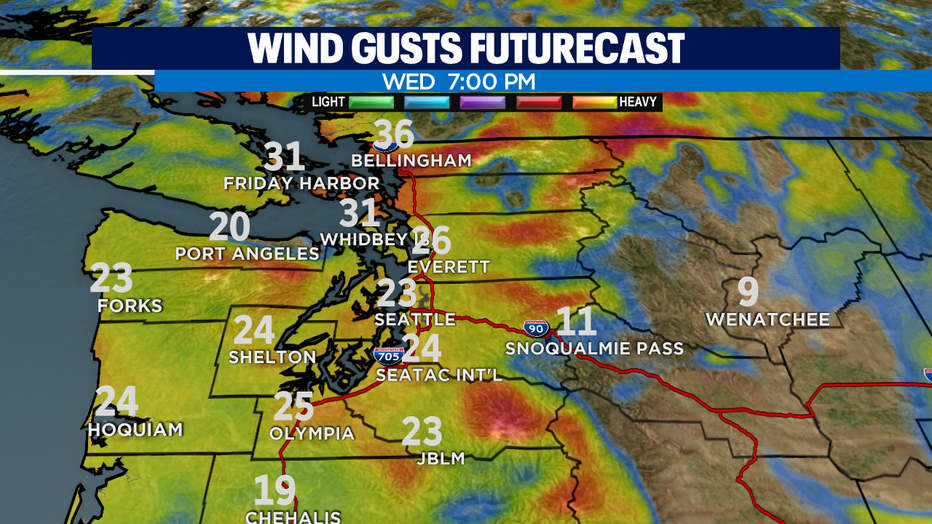
Showers and breezy to windy conditions hang with us through evening before we start to dry out and relax our winds. We do expect winds to be very gusty at the coast at times and the North Sound. Peek gusts will be between 30-40mph. The metro area will see winds close to 30 mph by Wednesday night and will remain blustery through the overnight hours.
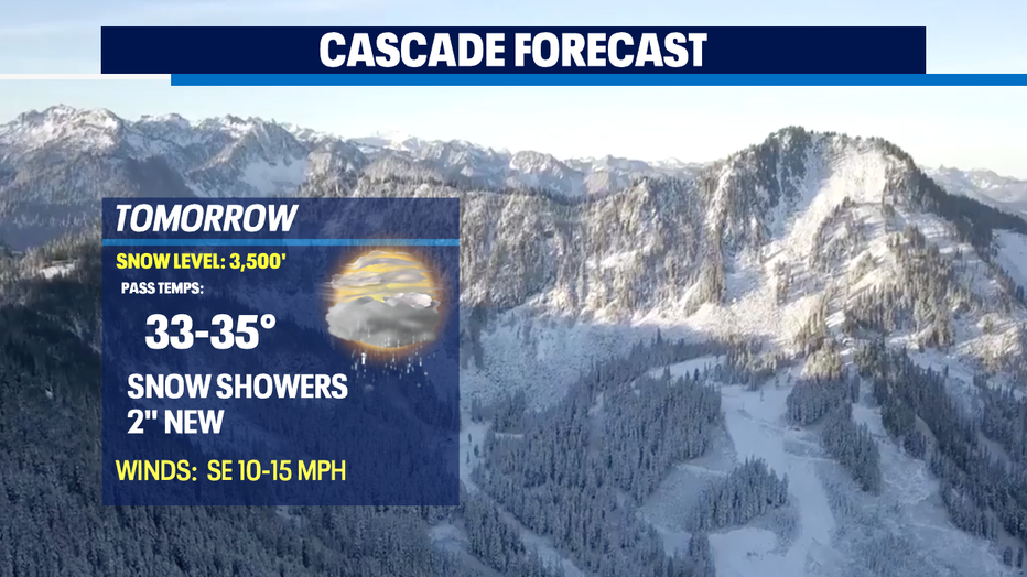
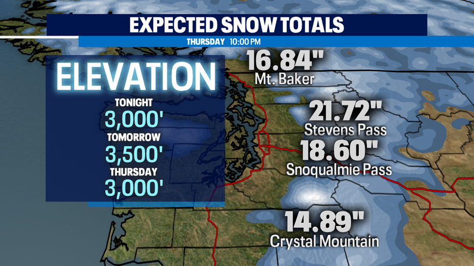
We are also keeping an eye on the Cascades. Travel will become very tricky at times with snow picking up this week. Snow levels will hang between 2,000-4,000ft through the weekend. Wednesday night snow totals will add up. We expect new accumulations through Thursday up to a foot.
There will be brief breaks of drying out in between systems. Another front will arrive late Friday morning giving way to a soggy day. Wind also another possibility too. Highs run warm as well, into the low 50s. Overnights hand in the mid to upper 20s.
Saturday a weak ridge tries to build in to give us a quick break before showers return later in the day. Some spots will see showers linger into Sunday. At this point models suggest we may try to dry out a bit on Sunday as an upper-level trough looks to push most of our soggy weather to the far south. We will wait and see!
We welcome our Winter Solstice Monday very early, 2:04am! Looks like we will see more showers ride back into the region! Enjoy!
Have a great night! ~Erin