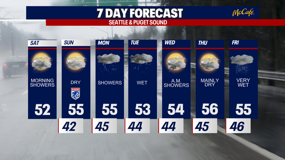
Rain finally returns to Western Washington
Seattle - Rain and cooler temperatures are finally back in the Pacific Northwest as showers continue Saturday morning.
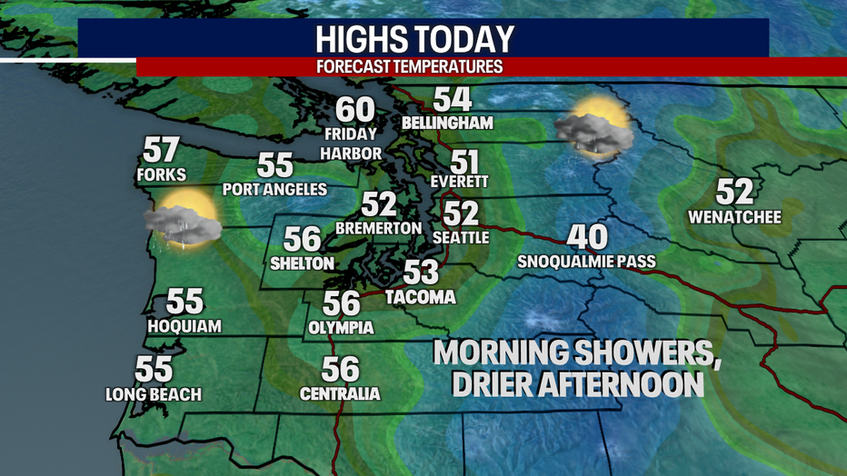
A cool weather system will continue to bring a few isolated showers through the afternoon, but most spots will remain dry. High temperatures will remain cool, in the low to mid 50s.
The mountain passes could also see a rain/snow mix this morning.
Western Washington will remain dry most of Saturday night and Sunday with a break in between weather systems.
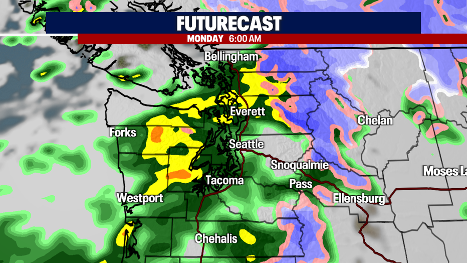
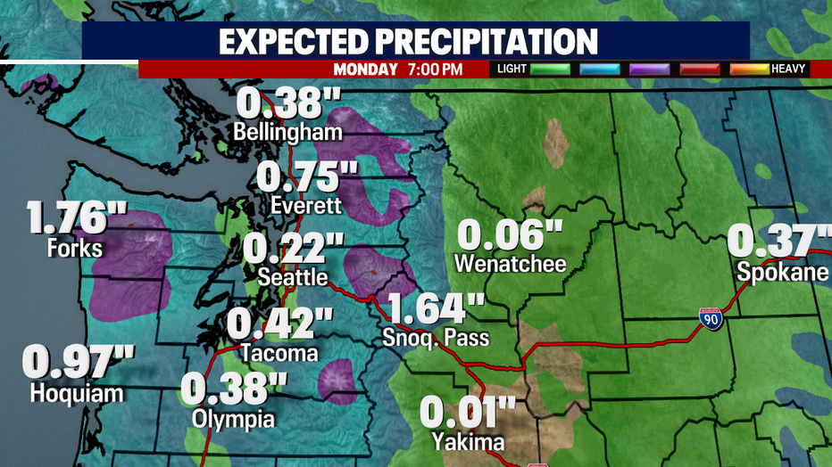
The next storm system will arrive on Monday morning with rain pushing in ahead of a cold front. This could bring another .25 to .50 inches of rain to the Puget Sound area. This system could also bring some gusty wind in spots and a few inches of snow in the higher elevations of the Olympics and Cascades.
Next week looks like a very typical late October forecast with rain showers and temps in the 50s. If you are looking for a dry day next week, Thursday looks like our best bet.