

Seattle weather: A dry and cold weekend with areas of morning fog
SEATTLE - Get ready for a chilly forecast as colder, drier, and foggy days hang with us through next week!
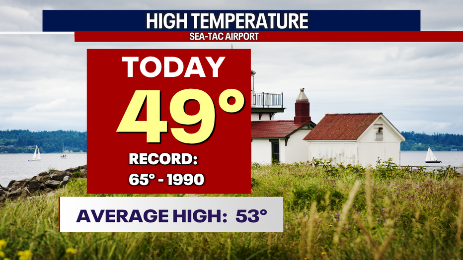
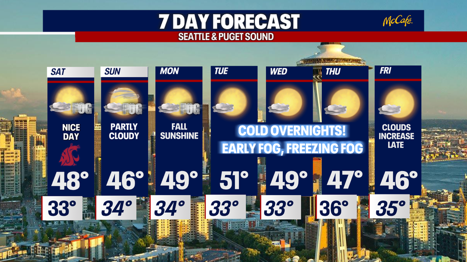
Friday's highs only warmed into the upper 40s around Western WA. Our seasonal high for this time of year is 53 and drops to 52 on Monday.
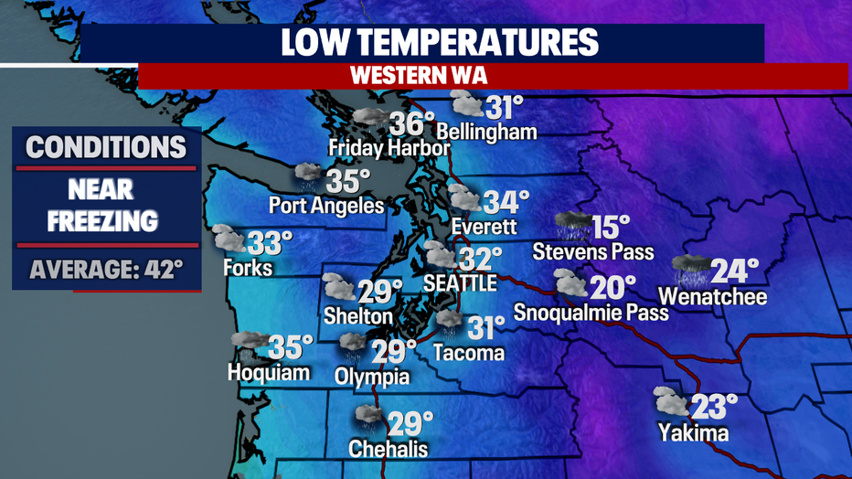
Skies will slowly start to clear overnight with lows bottoming out in the upper 20s across the North and South Sound with slightly warmer conditions, near freezing for Seattle.
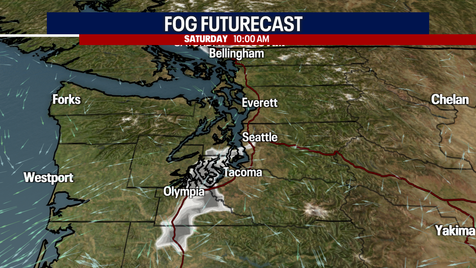
As most of the clouds clear out into the early morning hours of Saturday, we will start to develop areas of patchy fog, mainly south of downtown.
Communities to watch: Bremerton, Shelton, Lacey, Olympia, and south into the valleys of Chehalis and Centralia.
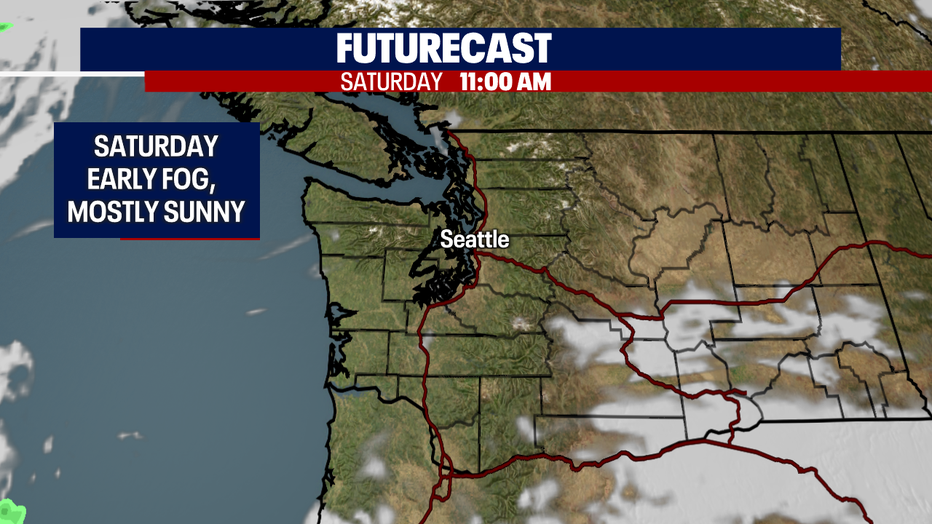
By 11 a.m. fog lifts and the skies are beautiful with plenty of blue above!
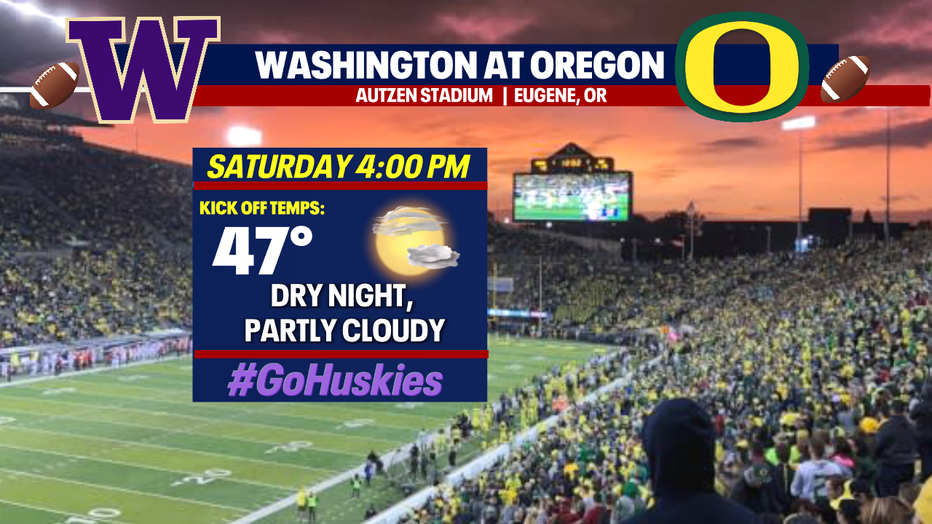
If you're looking for the Husky game day forecast, we have you covered! Autzen Stadium will be packed with Duck fans for sure as the Dawgs look for their first win in Eugene since 2016. Kick-off conditions at 4 p.m. look perfect for a UW win!
Back home in Western WA, temperatures will warm into the upper 40s for most with the coast potentially heating into the low 50s!
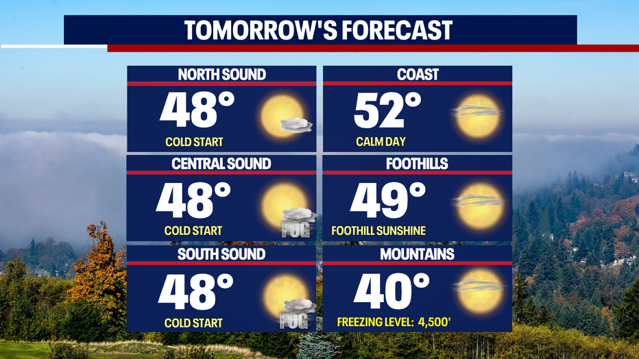
We have plenty of fall sunshine on tap through the weekend into next week folks, but please be mindful of early morning fog along with freezing fog. Allow for extra time when heading out the door.
Temperatures will run cooler than normal, especially lows with many plummeting into the upper 20s to low 30s.
Have a great weekend all! ~Erin Mayovsky, FOX 13 Forecaster
*Seahawks Forecast: Munich, Bavaria, Germany - Allianz Arena
