

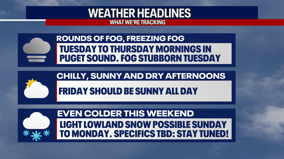
Seattle weather: Plummeting temps and freezing fog this week
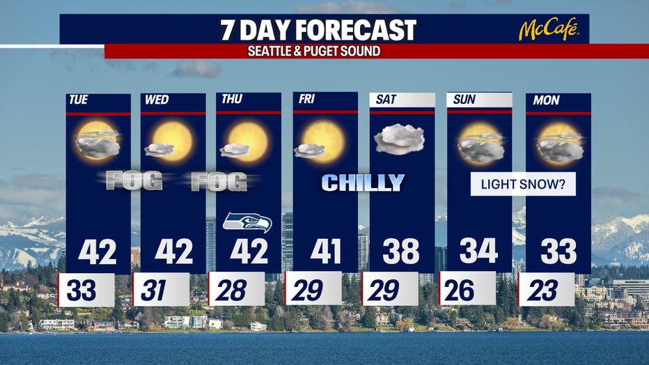
Get ready for plunging temperatures this week! Fog, even freezing fog, is forecast each morning through Thursday. By Sunday and Monday, a little lowland snow is possible.
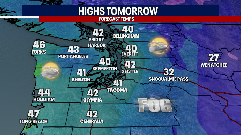
In the short-term, we're tracking temperatures in the upper 20s and low 30s early Tuesday. Highs tomorrow will be below-average in the low 40s.
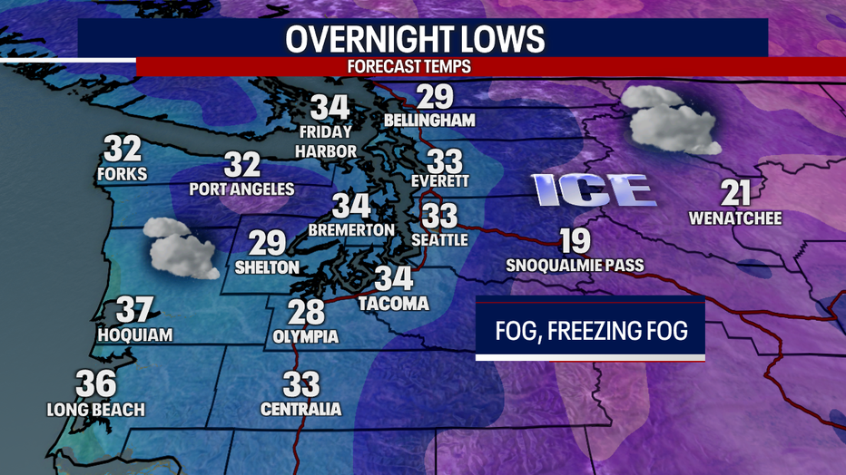
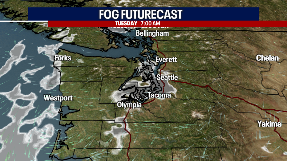
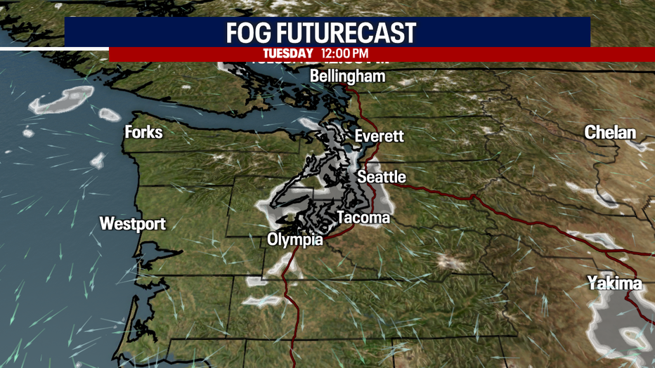
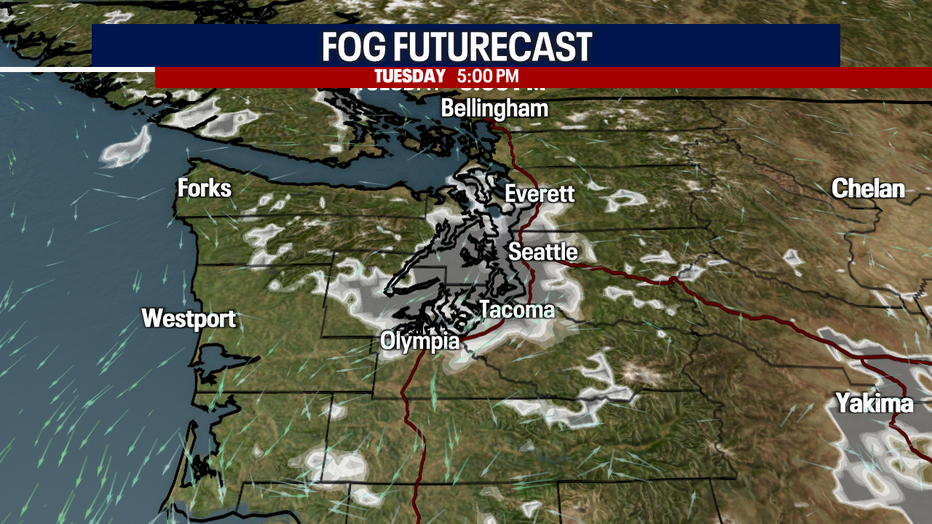
Tomorrow morning, fog and freezing fog could develop in the Central and South Sound. Where this happens, there could be icy spots (especially on bridges, overpasses and sidewalks). Drive carefully!
Fog tomorrow could be rather persistent. In fact, one of our forecast models is suggesting that many backyards in Central and South Puget Sound stay foggy all day! If this happens, temperatures may only range in the 30s. Otherwise, fog should clear for afternoon sunbreaks. The North Sound, coast and the mountains have the best chance for sunshine tomorrow.
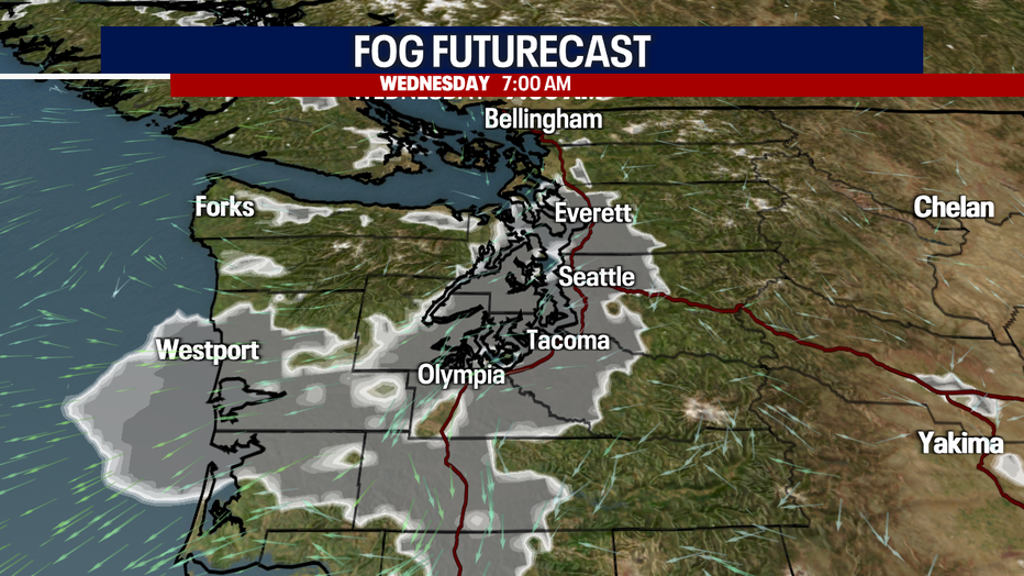
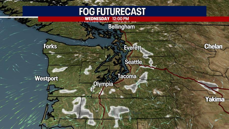
Here's a look at our fog futurecast:
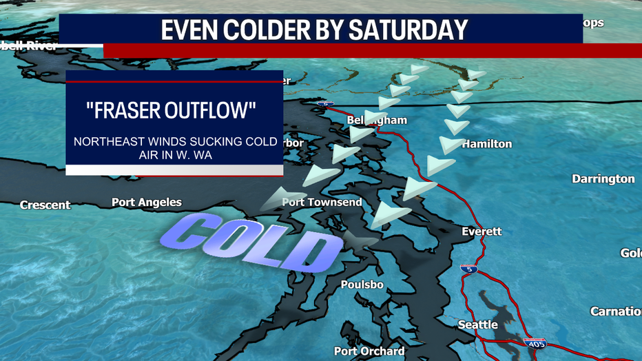
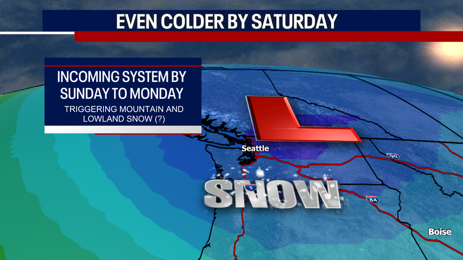
Temperatures take a dramatic dive into next weekend. This is due to frigid northeasterly winds blowing from the Fraser River Valley. These winds will pick up on Saturday. An area of low pressure could come barreling down into our state by Sunday and Monday, triggering some mountain and lowland snow. Right now, it looks like snow accumulations would be rather light in the lowlands. However, there's still a lot of time for this forecast to change in any direction. Stay with us!
Friday looks to be the bright spot in our seven-day forecast. Chilly sunshine is on tap from beginning to end.
Warmly,
Meteorologist Abby Acone
Follow me on Twitter @abbyacone, Instagram @abbyaconewx, TikTok @abbyaconetv and Facebook (Meteorologist Abby Acone)