

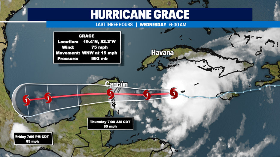
Perfectly normal and comfortable August day, with a brand new hurricane in the Caribbean
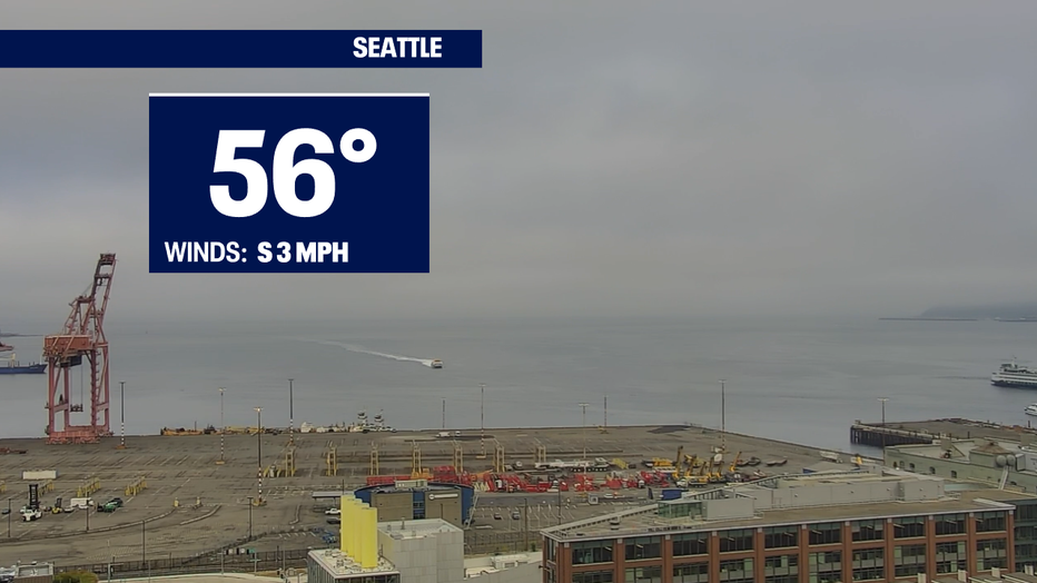
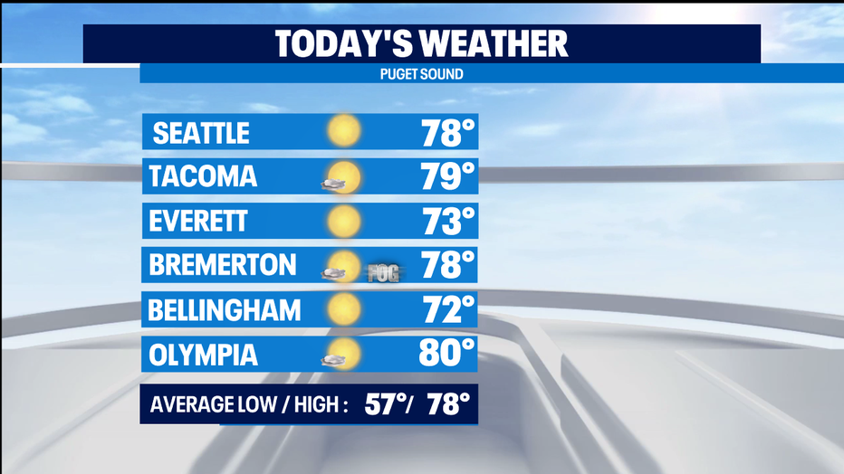
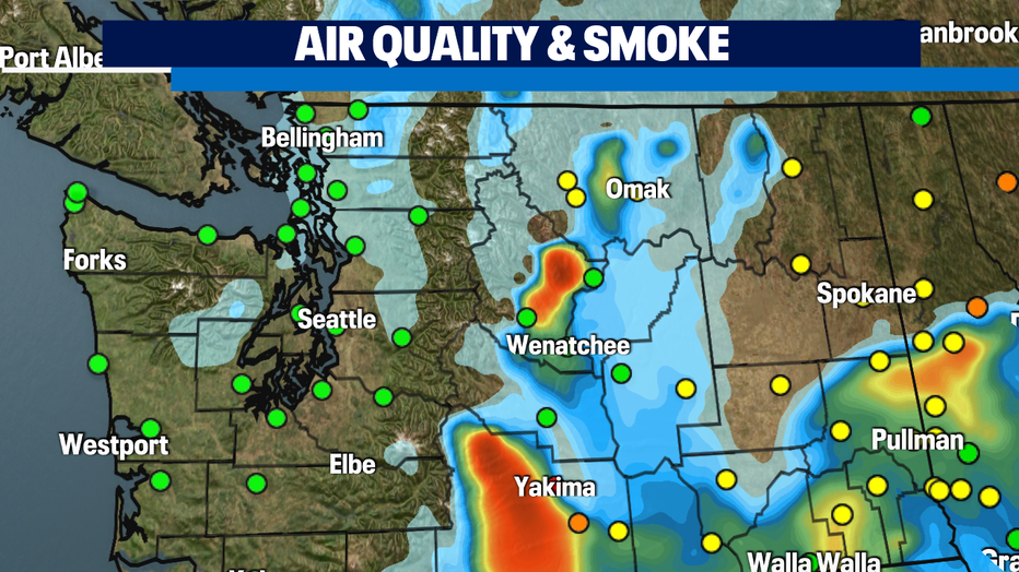
Seattle - We're starting out with areas of fog, but will break out into nice sunshine this afternoon. There is a chance of a little smoke wafting into the area from fires in Eastern Washington and British Columbia. If that happens, hopefully the smoke will stay at upper elevations, and air quality will remain good at the surface. Highs today will be around normal today - 78 for Seattle.
Air quality is good (green dots) in Western Washington this morning, and a lot of areas of Central and Eastern Washington too.
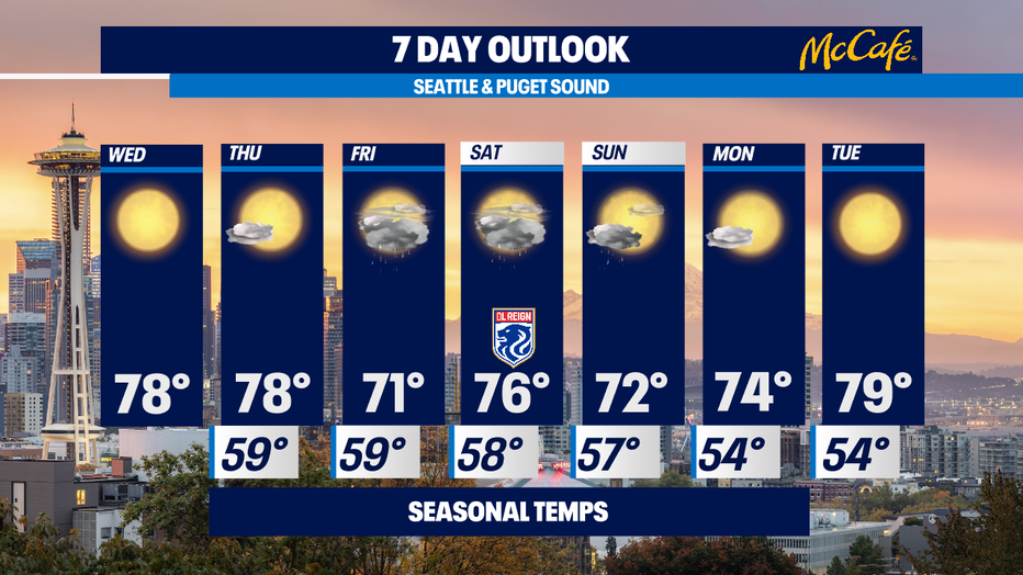
Tomorrow will be a carbon copy of today, with perhaps some cloud cover moving in late in the day. Highs in the upper 70s again.
Friday will be mostly cloudy with a slight chance of a little rain. It'll be cooler, with highs around 70.
Saturday looks partly sunny with highs in the mid 70s. Slight chance of a wee bit of afternoon rain.
Sunday starts out cloudy with perhaps a bit of morning rain, then we'll see afternoon clearing with highs in the low 70s.
Next week we get sunny and warmer again.
Grace has just become the second hurricane of the 2021 season. Hurricane Grace is a Category 1 hurricane with 75 mph sustained winds and looks likely to intensify to a strong Cat 1 hurricane with 85 mph winds as it slams into the Yucatan Peninsula. Cancun looks likely to be affected. And Playa del Carmen is right in the cone of possibility for a direct hit when Grace makes landfall tomorrow morning.
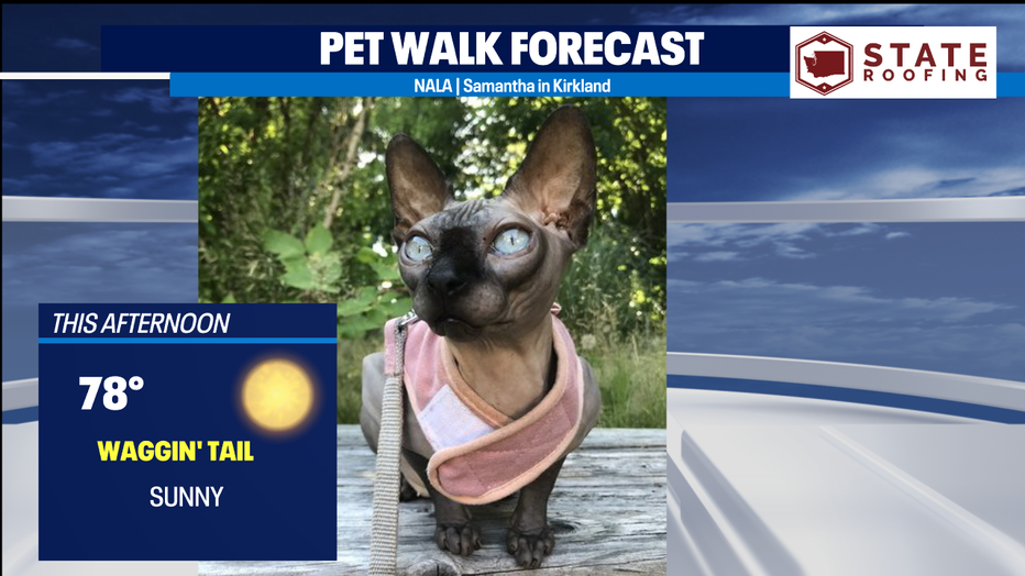
With sunny skies and highs in the comfortable upper 70s, it's a Waggin' Tail Day for the Pet Walk Forecast today, including this cool-looking Sphinx kitty!
Meteorologist M.J. McDermott