

Perfect summer weather for last week of July
SEATTLE - Praise the onshore flow! I call this "Nature's air conditioning." Winds from the west and south have been keeping that Pacific air over us and also keeping smoke from the fires in Eastern Washington away from us. So, we're enjoying a super comfortable July, and this comfy weather looks likely to last through the end of the week and into the first day of August, at least.
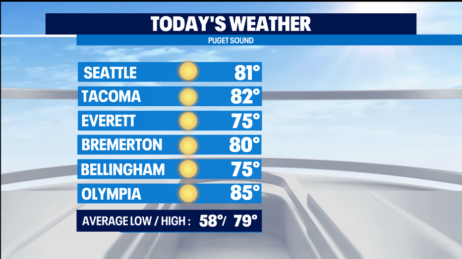
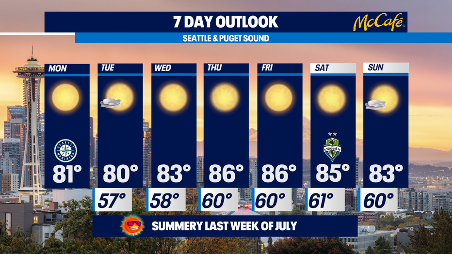
Today, we've got a bit of morning cloud and fog, but by the afternoon we'll all be enjoying sunny skies and high temps around 80 degrees. Normal for Seattle for this time of the year is 79, so we're seasonally warm.
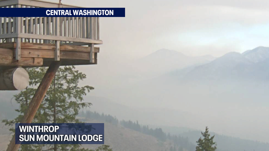
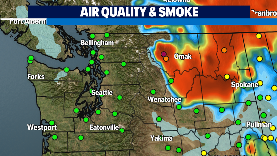
Fires continue to burn in Eastern Washington, with the worst of them charring Okanogan County and producing smoke that is reducing air quality. This morning, the town of Winthrop is seeing thick smoke and air quality is at "hazardous" - the purple dot on the map below, west of Omak. Meanwhile, Western Washington is enjoying "good" air quality - the green dots.
Tomorrow will be a carbon copy of today - sunny, with highs around 80.
Wednesday, we start to warm up a bit. It'll be sunny with highs in the low-to-mid 80s.
Thursday and Friday will be warmer still. Expect abundant sunshine with highs in the mid-to-upper 80s. Warm, but not too hot.
The weekend looks a tad cooler again, with sunny skies and highs in the low-to-mid 80s. Praise the onshore flow!
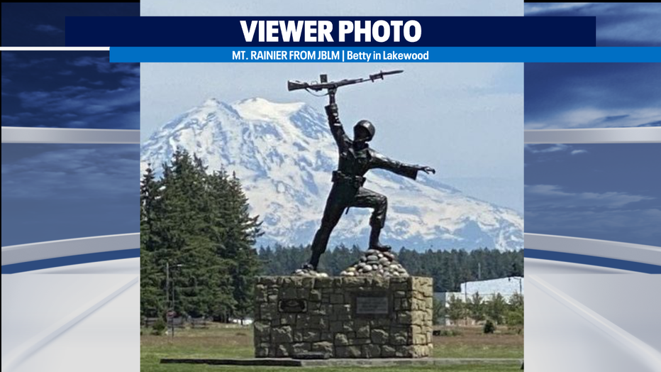
It's Mountain Monday and here's Mt. Rainier with the statue of a soldier at Joint Base Lewis-McChord in front of it.
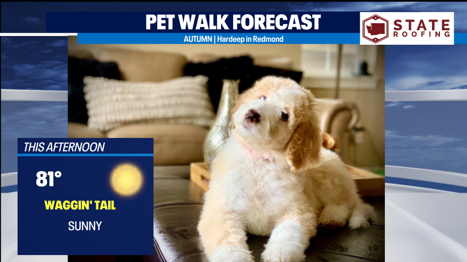
With sunny skies and highs around 80, it's another Waggin' Tail Day for the Pet Walk Forecast.
-Meteorologist M.J. McDermott
Q13 FOX WEATHER RESOURCES:
DOWNLOAD: Q13 Weather and News Apps
WATCH: Forecast and Radar
READ: Closures and Delays
CHECK: Latest Weather Alerts and Live Traffic Map
INTERACT: Submit your Weather Photo
DAILY BRIEF: Sign Up For Our Newsletter
FOLLOW: Lisa Villegas, MJ McDermott, Erin Mayovsky, Grace Lim and Scott Sistek