

One more dry day before we flip the forecast back to April showers
SEATTLE - Happy Thursday!
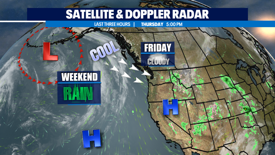
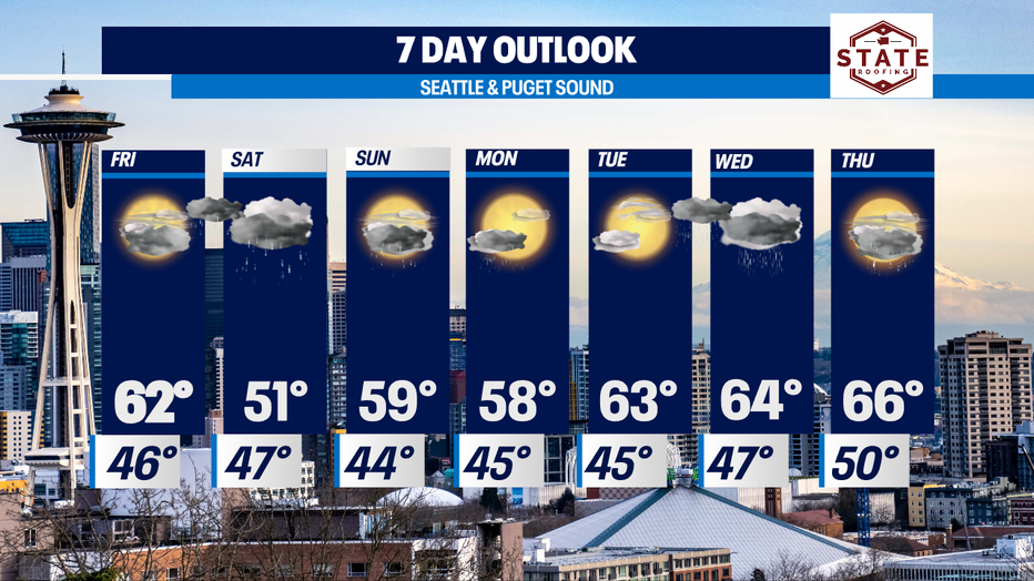
As we head into the weekend change is coming! Our next weather maker is on track to deliver rain early Saturday along with much cooler temperatures. We'll go from the 60s to the 50s! Brr! Normal seasonal high for this time of year is now 60. So, Saturday will feel chilly!
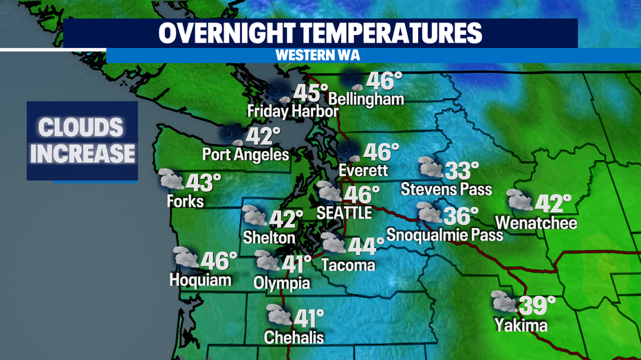
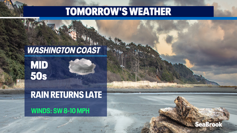
Dry tonight with increasing clouds. Lows fall off into the 40s. We may see a few areas with patchy drizzle during the morning commute, mainly along the Coast.
Most of Friday will remain dry as the next front approaches. With this system we'll dial in a good dose of moisture to help make up what we've been missing for the month of April. Prepare for a cool and rainy weekend!
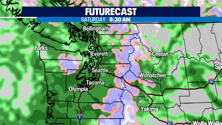
Here's a look at 8:30 a.m. Saturday as widespread showers take over the region.
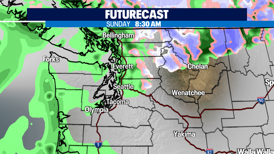
Showers start to let up Sunday morning a bit to the south, but we'll see a chance of afternoon showers popping back up before completely drying out. We're also keeping an eye on a chance for isolated thunderstorms Sunday afternoon south and west of Puget Sound.
The start of the workweek brings a chance of a few showers lingering into Monday as another disturbance moves through the area. We rebound Tuesday as a week ridge builds in for a little more sunshine and warming highs into the low 60s. Our sunshine probably won't last long as we're keeping an eye on another low deepening in the Gulf of Alaska that would send a potentially good plume of moisture our way again. We shall wait and see so stay tuned!
Have a great night!
*Beach Forecast
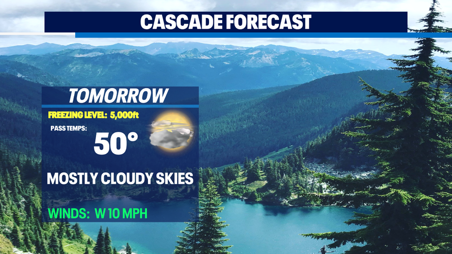
*Mountain Forecast
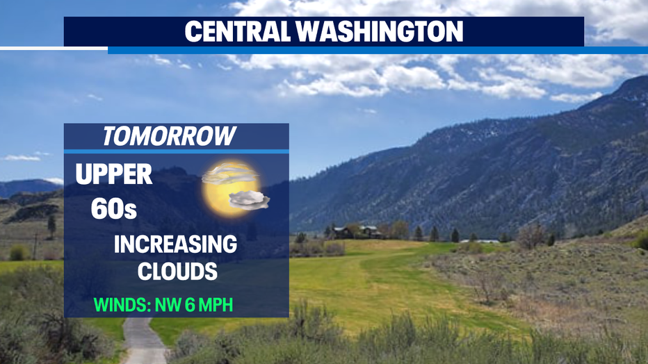
*Eastern WA Forecast
Q13 WEATHER RESOURCES:
DOWNLOAD: Q13 Weather and News Apps
WATCH: Forecast and Radar
READ: Closures and Delays
CHECK: Latest Weather Alerts and Live Traffic Map
INTERACT: Submit your Weather Photo
FOLLOW: Lisa Villegas, MJ McDermott, Tim Joyce, Erin Mayovsky and Grace Lim