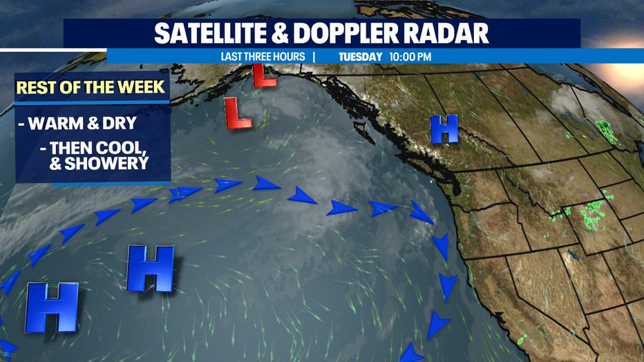
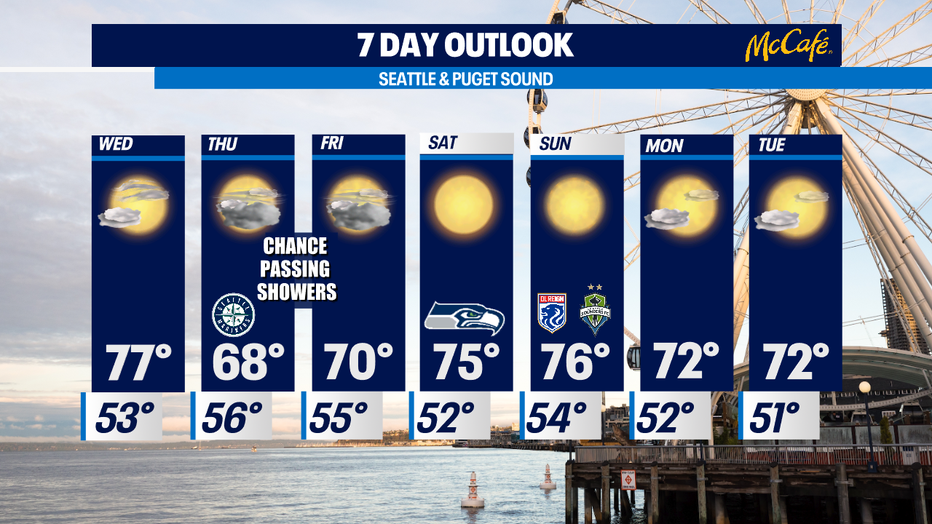
One more day of summer warmth before cooling off with a few scattered showers.
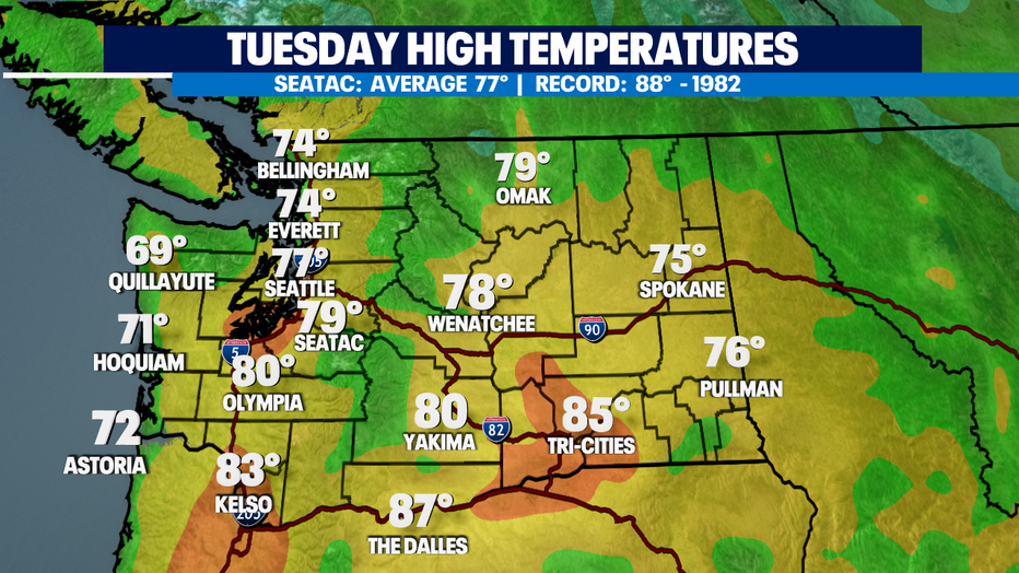
Seattle - What a gorgeous summer day around the Pacific Northwest. Highs soaring to near average and above for many places.
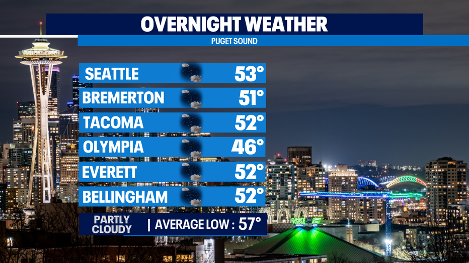
Overnight temps will drop down below average again for a chilly start to your Wednesday! Some of us will see a little low-lying fog too, like at the coast and South Sound.
We're looking at another nice summer day Wednesday with dry and warm conditions. Expect highs in the mid to upper 70s near our seasonal average of 77 for this time of year.
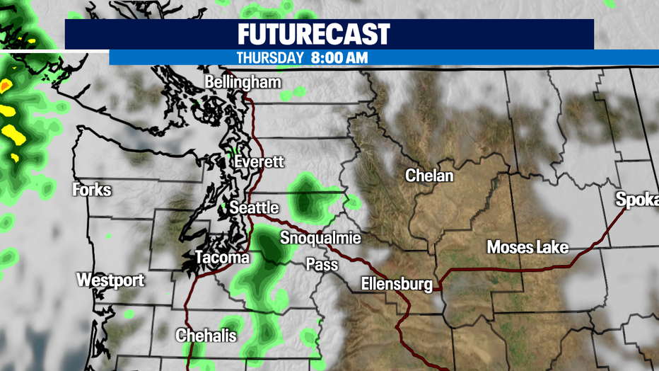
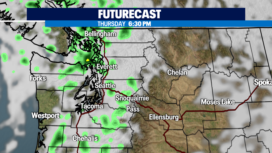
As we push into the end of the week it will feel more like Fall than Summer. Autumn like weather will roll in cooling our highs down into the mid to upper 60s. Brr! Those kinds of highs are what we see at the end of September beginning of October. This all thanks to a couple of disturbances that will swing through Western WA for a chance of light scattered showers. Most shower activity will pop up over the coast, mountains, and North Sound with less chances for moisture over the metro area.
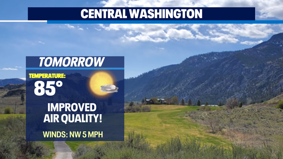
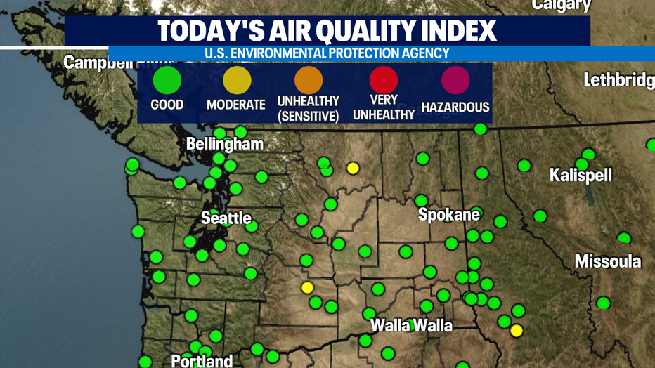
Air quality is looking good! Most of us are in the green bubble zone and that's where we want to be for easy, healthy breathing. Portions of Okanogan and Yakima Counties are seeing yellow bubbles meaning air quality is in the moderate zone, just below good. This is much better than the very unhealthy levels we were seeing over the weekend and last week for Eastern WA.
If you're not into Fall yet don't panic! We have more summer like weather heading our way this weekend and into the start of next week as an upper ridge scenario sets up across the region. Later next week temps will cool some with a slight chance of a few more passing showers possibly, but that's still a ways out. Enjoy!
Have a great night! ~Erin Mayovsky, Q13 Forecaster
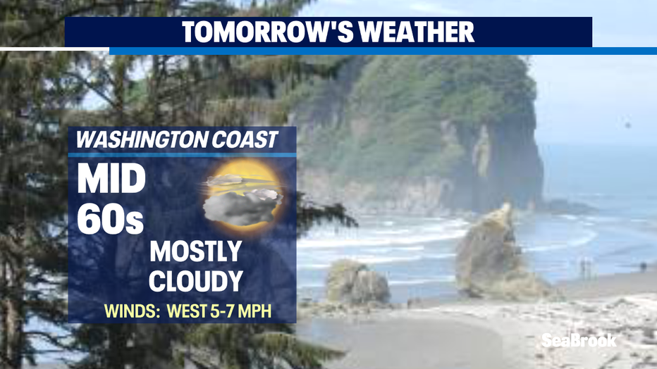
*Beach Forecast
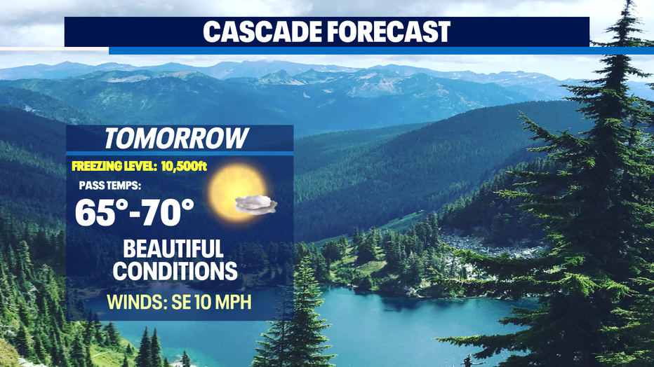
*Mountain Forecast
*Central WA Forecast