

One dry day with some sun
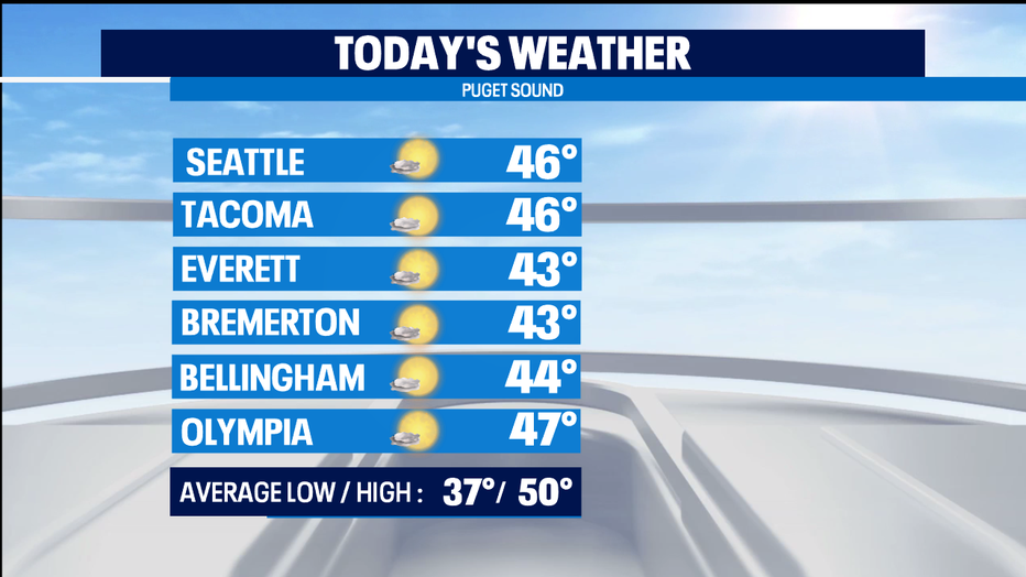
Seattle - Get out and take a walk today because it'll be dry, with a mix of blue sky and clouds and highs in the mid 40s. We only get one dry day this week and it's TODAY!
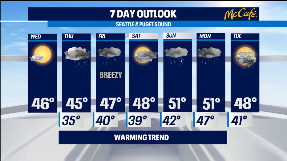
Rain returns tomorrow, with rain on the coast by 6 a.m. and moving onto the I-5 corridor late in the morning. With early morning lows near freezing, we could see little snow or a rain/snow mix early in the morning, then it'll be all rain the rest of the day. The mountains will get more snow, with the snow level starting out around 400 feet, then rising to 1,000 feet in the afternoon.
Friday will be rainy and breezy with highs in the mid-to-upper 40s. It's be rain/snow for the mountains with a snow level of 2,000 feet.
Saturday looks mostly cloudy with a chance of morning showers and more rain likely in the afternoon, topping out in the upper 40s.
Sunday and Monday will feature rain at times. Finally, our highs will top our around normal, around 50 degress. The mountains will get more snow, with that snow level around 1,500 feet on Saturday and rising to 3,500 feet on Sunday.
Don't get out the shorts and Hawaiian shirts yet -- next week looks colder again.
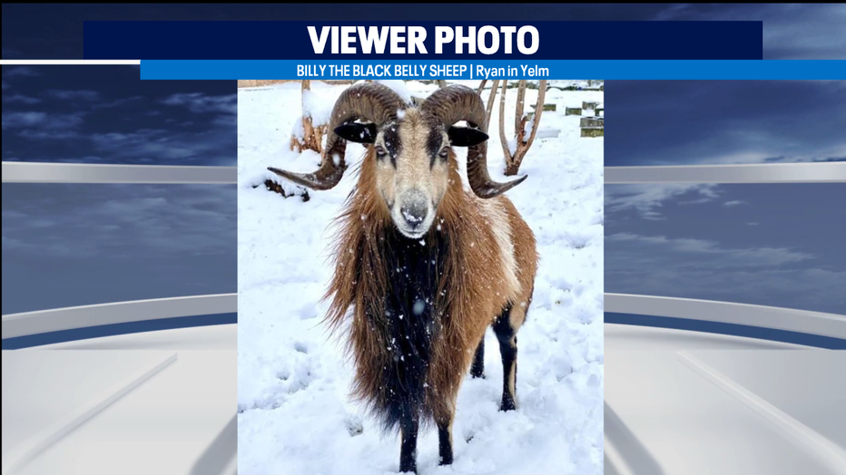
We got SO MANY snow photos from viewers! Here are a couple of fun ones - Elsa and Olaf from Frozen, and a black belly sheep named Billy.

Meteorologist M.J. McDermott