

No big warmup on the horizon
For those wishing for warmer weather, you'll need to be patient for at least another week or two.
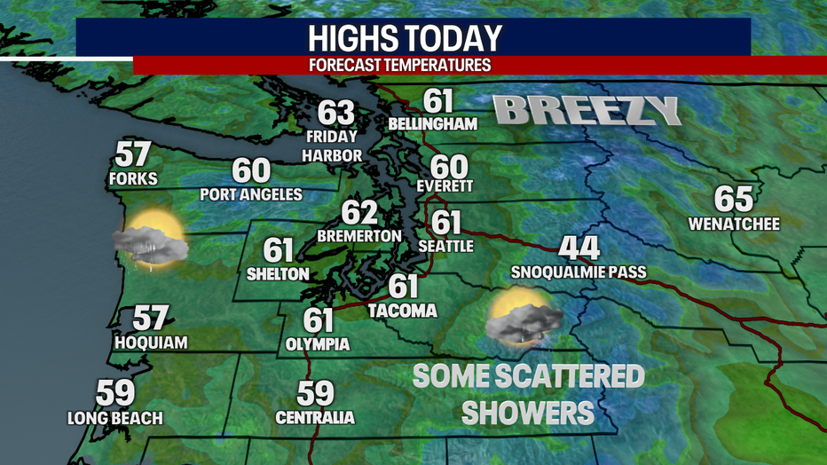
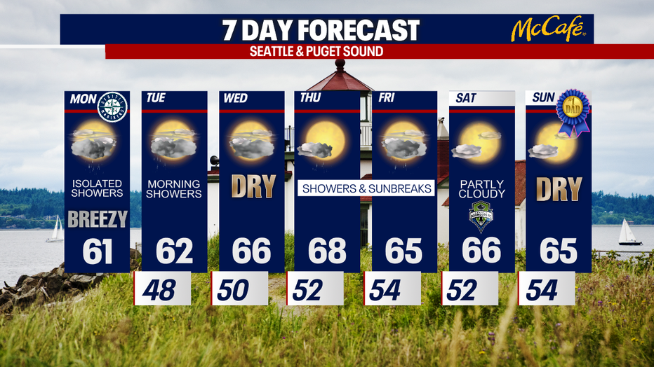
This afternoon, highs will stay well below-average, only reaching the upper 50s to low 60s! Mostly cloudy skies are on tap. Isolated to scattered showers are possible. It'll be breezy, too.
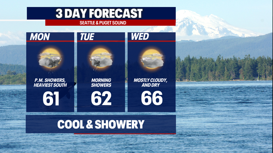
A convergence zone could keep showers going Tuesday morning before tapering in the afternoon. Wednesday looks dry and mild, but there will still be more clouds than sun.
Thursday, morning clouds will be followed by partly sunny skies for the second half of the day. Highs will reach the upper 60s. Spotty showers can't be ruled out.
The workweek will wrap with mainly overcast skies, a few sunbreaks and a light, passing shower. Highs on Friday will only reach the mid 60s.
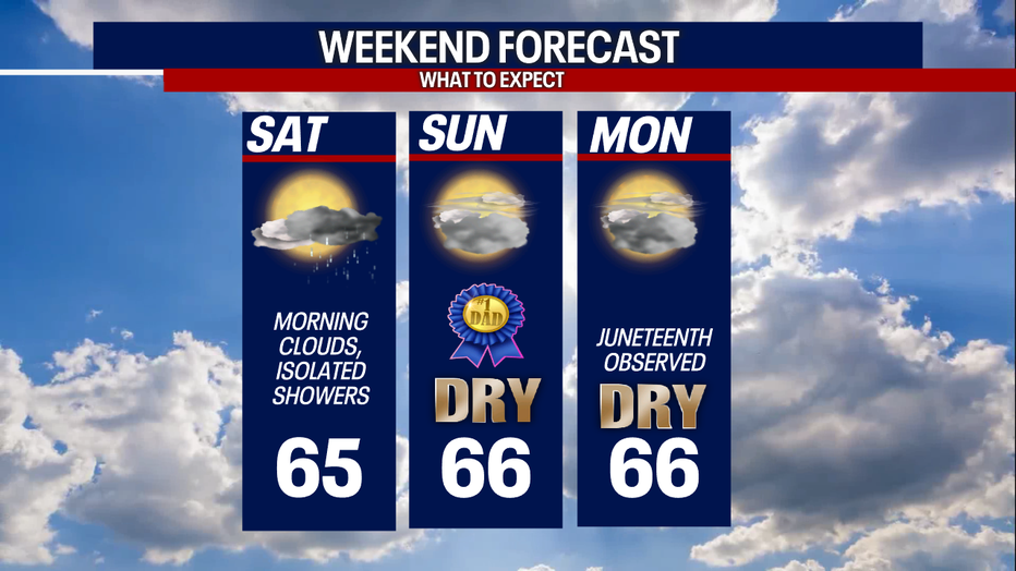
Saturday, morning clouds will clear for sunshine in the afternoon.
If we can't have the 70s and sunshine for Father's Day, we'll take the mid 60s with dry weather :) The quiet and shower-free weather continues into Monday when Juneteenth will be observed.
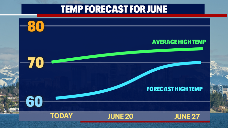
Looking ahead to the rest of this month, long-range models are still calling for below-average temps. Normally, highs range in the low 70s through the end of June. We'll likely stay in the 60s through next week – possibly getting into the 70-degree territory for the final week. Time will tell - this forecast could change! Stay tuned.
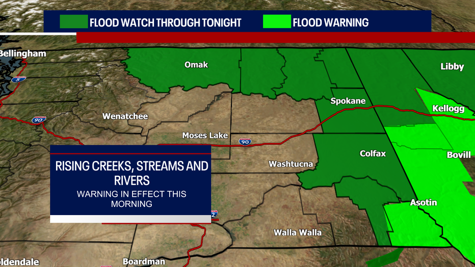
Note: if you're spending any time in Eastern Washington today, be aware that flooding could be an issue. A Flood Watch remains in effect through tonight due to the potential for rising creeks, rivers and streams. For Asotin County, a Flood Warning is posted for this morning.
Hope your Monday goes smoothly!
Warmly,
Meteorologist Abby Acone
Follow me on Twitter @abbyacone, Instagram @abbyaconewx, TikTok @abbyaconetv and Facebook (Meteorologist Abby Acone)