

Mostly dry week ahead
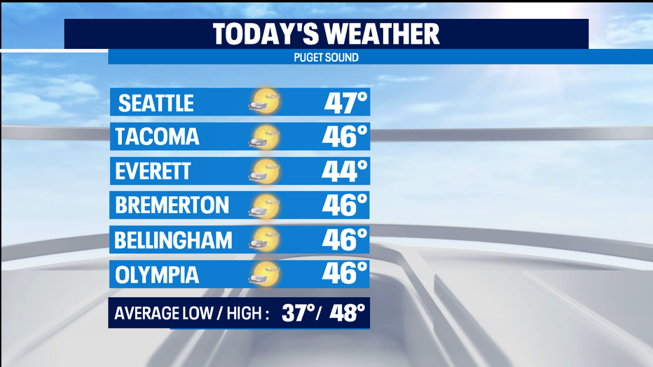
SEATTLE - Compared to the really soggy start to January, we're actually quite pleasant this week by comparison. Today a fantastic day to check out the free Nat'l Parks for the MLK holiday. And if you're doing service projects around the region-- we'll have dry weather with nice sun breaking out this afternoon around the region. High temps close to the seaonal norms for this part of winter.
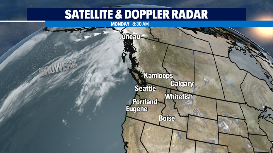
We'll see a dry day tomorrow too, but increasing clouds and likely seeing rain moving in from the NW by the later evening hours. Most of the weather system off shore takes aim at Alaska and northern BC. We end up getting that quick shot of passing showers from the weakening trailing front behind it.
Wednesday is trending back to just a mix of clouds & sun. Thursday looks like our wettest day of the week-- but only light steady rain that looks confined to the morning hours.
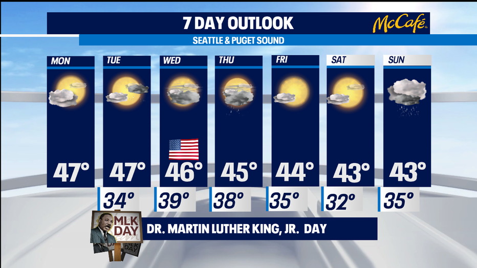
We start trending to a much colder weather pattern. With a low dropping down on us Saturday night into Sunday. That does bring in the possibility of lowland snow, albeit briefly. Accumulation amounts are not looking that impressive at this point-- only an inch or two at best for the lowlands. We'll get more clarity as we get closer to the weekend. -Tim Joyce