

Morning freezing fog, lowland snow potential tomorrow morning
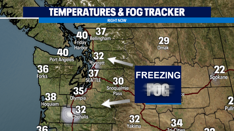
seattle - There's still freezing fog in Everett and Chehalis as of writing this at 11:30am. As temperatures continue to warm, we should see the fog lift in a couple of hours and we'll see plenty of sunshine today!
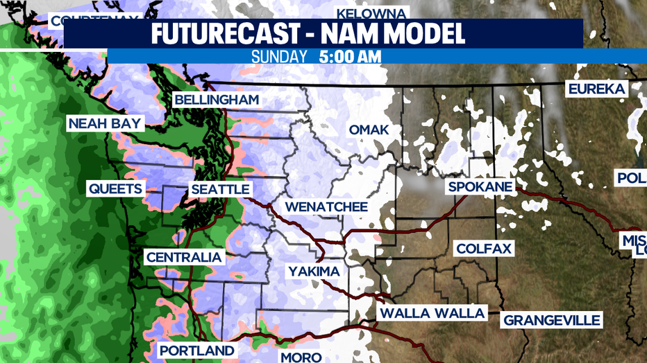
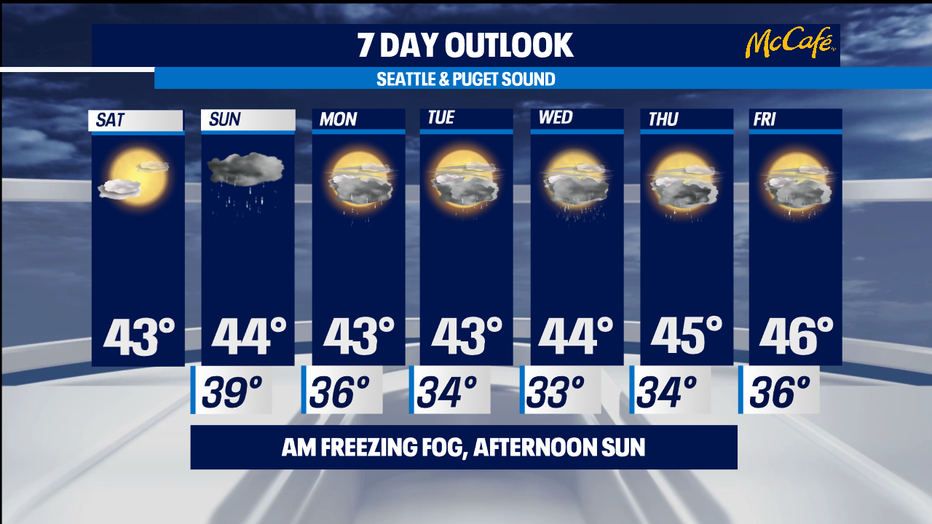
Our next system will increase clouds by late afternoon and this evening and bring rain through the overnight hours and into much of Sunday. Snow levels drop to 500'-1,500' through Monday and there is a chance for lowland snow, mainly in Whatcom County and the Cascade foothills tomorrow morning. Not much accumulation is expected as temperatures will be too warm. The rest of the lowlands can expect a mix or just rain.
Another system will bring the chance for lowland snow Tuesday night through Thursday. Accumulation looks to be minor with this system with the lowlands receiving less than an inch, although some spots might reach an inch, and the Cascades and Olympic foothills receiving 1"+, some spots accumulating 2".
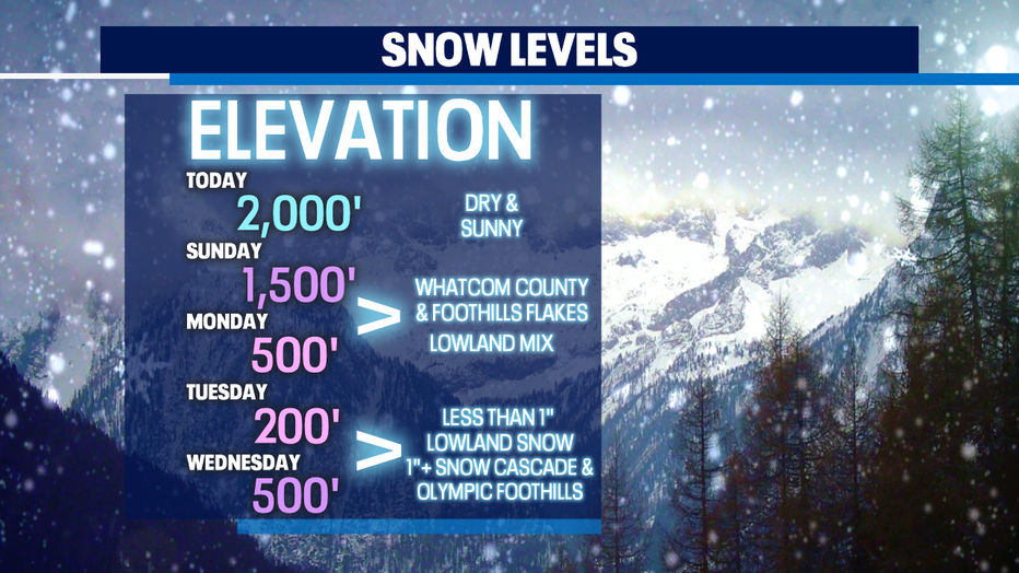
We'll warm up Friday with snow levels rising to 1,000'-2,000' decreasing our chance for lowland snow accumulation.
Have a great day!
-Q13 Meteorologist Grace Lim