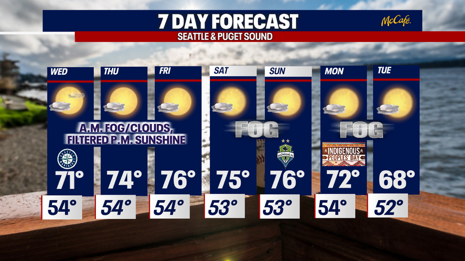
Seattle weather: Unseasonably warm start to October stretches through the weekend
SEATTLE - It was a slow warm-up this morning as skies were quite foggy from the get-go. Highs Tuesday climbing into the mid 60s for the Seattle area with warmer highs to the south while to the north folks were stuck in the upper 50s to low 60s.
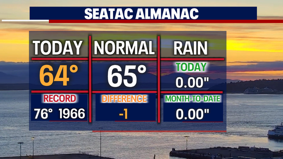
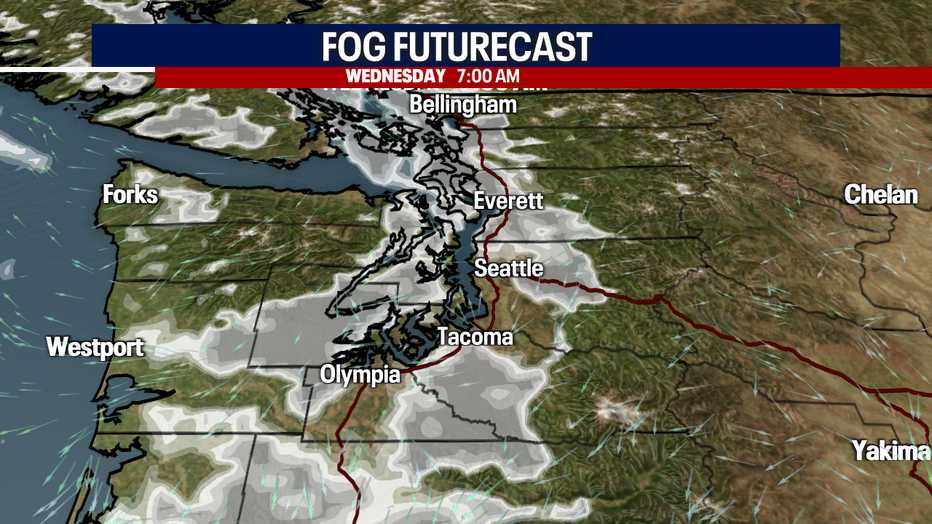
Overnight we expect a similar set-up with clouds increasing and patchy fog developing for the morning commute. Lows will remain above average cooling into the low to mid 50s. Normal for this time of year is now 49.
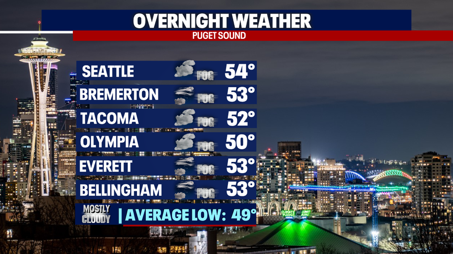
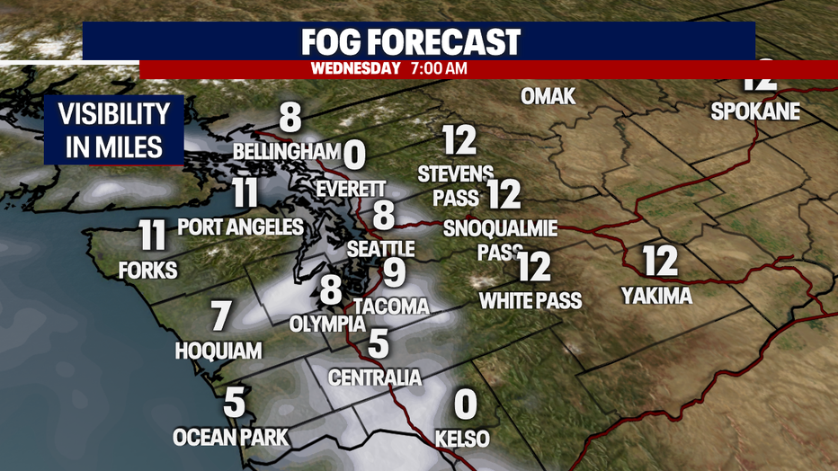
Some areas, like Snohomish County, will see less visibility tomorrow morning as fog is a touch denser in those communities. Everett may drop as low as zero to one mile visibility before sunrise. Stay aware and allow extra drive time when heading out the door this week.
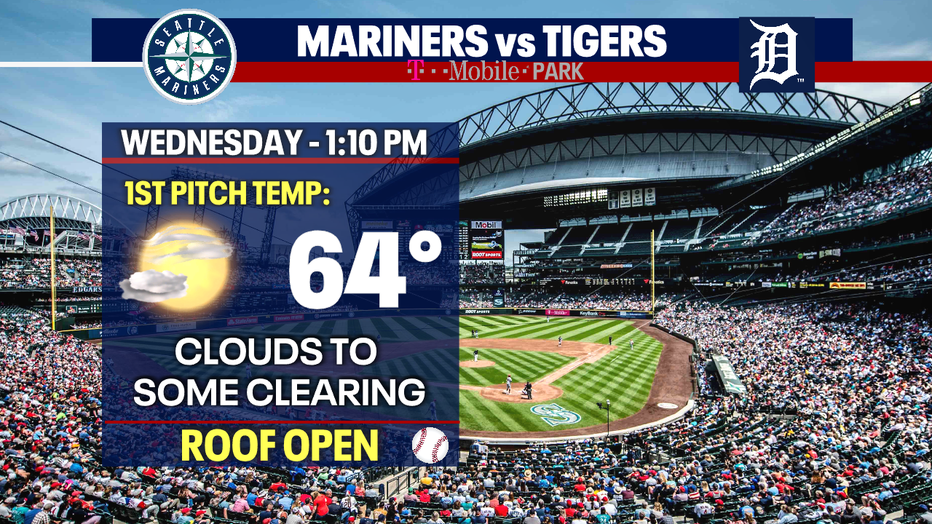
If you're planning on heading to the Mariners game last game of the regular season look for partly sunny conditions as morning clouds and fog burn off.
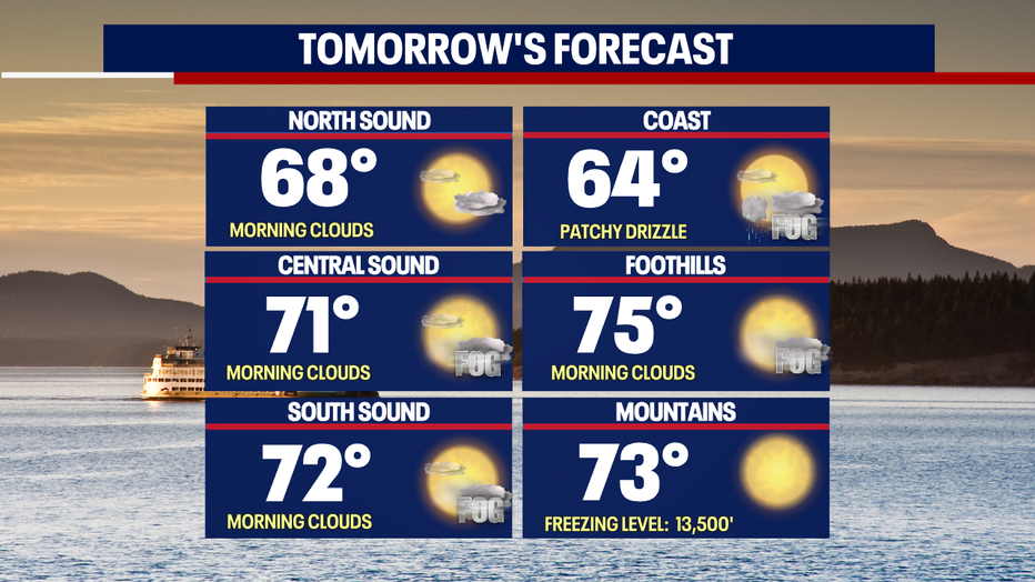
Highs on Wednesday are forecast above average again as our ridge of high pressure holds strong. We may see a little patchy mist or drizzle along with fog early tomorrow, but that any moisture won't last too long.
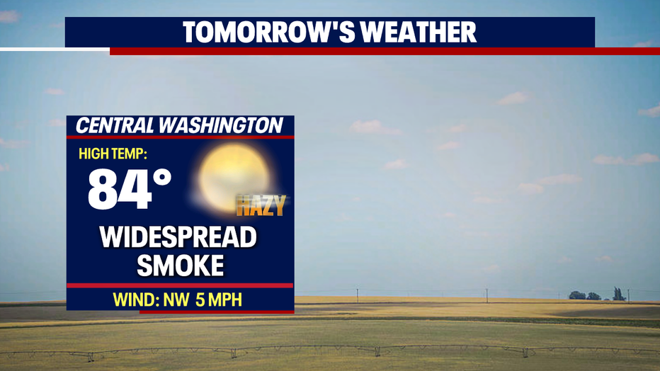
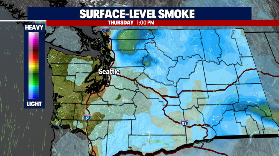
Upper-level smoke and haze will cause some areas, especially to the north, to see reduced air quality into the "moderate" zone this week.
The rest of the week and into the weekend has us seeing temperatures 5-10 degrees above our normal Fall highs. Enjoy!
And at this point we're not seeing much of a chance for rain in the near future as upper-level ridging continues to hold strong over the region.
Have a great week all! ~Erin Mayovsky, FOX 13 Forecaster
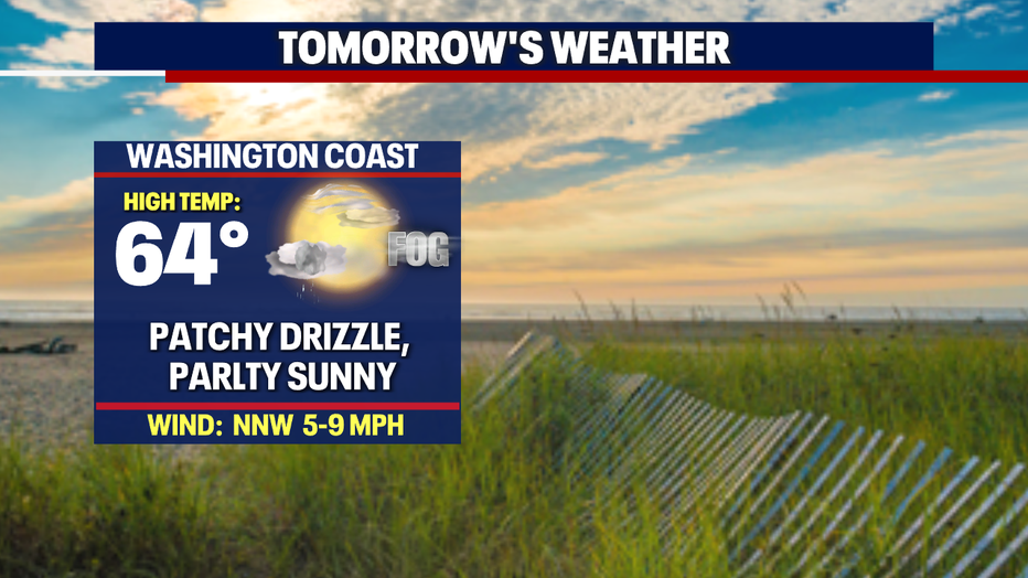
*Beach Forecast
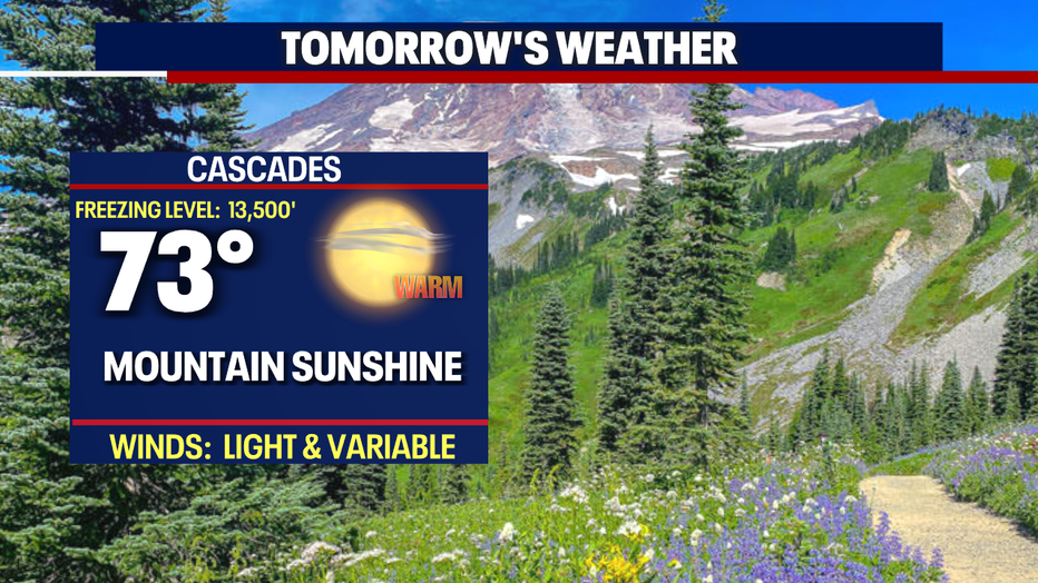
*Mountain Forecast
*Central WA Forecast