

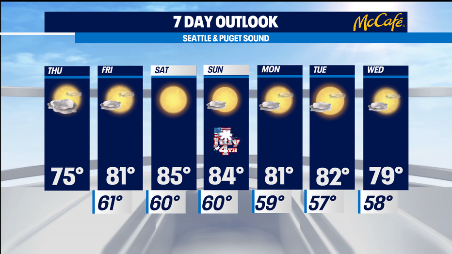
Mild Thursday, then warm and dry conditions elevate fire danger into the 4th of July weekend
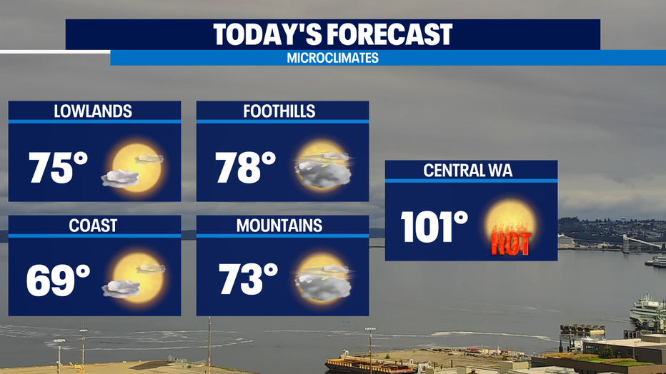
SEATTLE - FINALLY! High temperatures will be near normal across Western Washington today thanks to onshore flow and extensive cloud cover. Clouds should gradually clear by late afternoon.
Unfortunately, Central and Eastern Washington will continue to bake through the 4th of July weekend. An Excessive Heat Warning remains in effect until Sunday evening. Gusty winds and isolated thunderstorms may also spark wildfires in that part of the state.
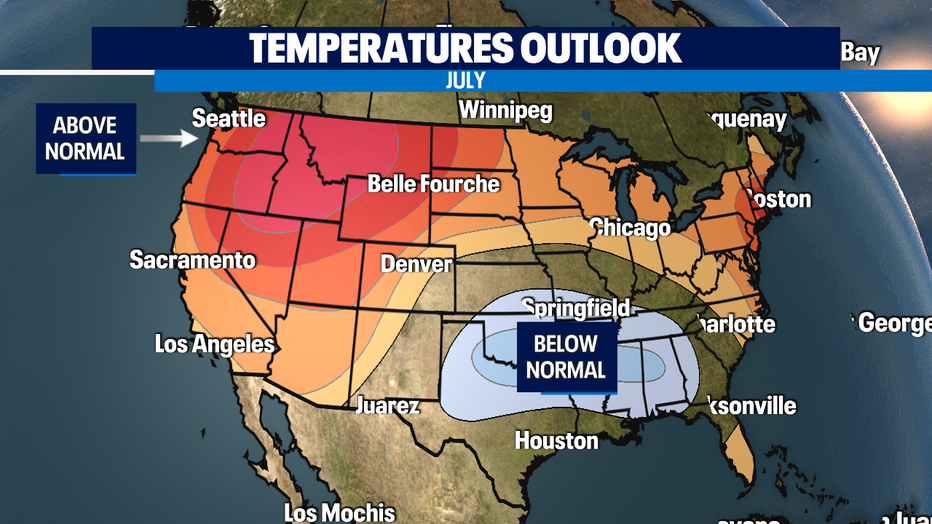
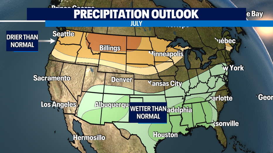
Enjoy the mild temperatures today because long range forecasts increasingly point to warmer and drier than normal conditions for the month of July. This is very concerning for fire danger, especially as we head into the 4th of July weekend.
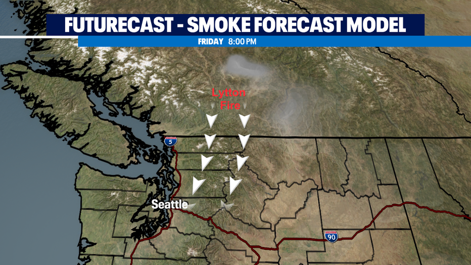
Some smoke from a fire in Northern California is drifting into portions of the Eastside, so you may notice hazy conditions. By Friday afternoon one Hi-res model is also indicating smoke drifting south into Seattle from the Lytton fire in B.C. currently burning now. The smoke looks to stay aloft and not at the surface which is good news, so you may just notice haze. This is a good and early reminder to get those filters before it's too late!
We'll be back into the 80s by Friday and the 4th of July weekend will be warm and sunny in the mid-80s. We'll carry the sunshine and above normal temperatures into next week.
Have a great day!
-Q13 Meteorologist Grace Lim
Q13 FOX WEATHER RESOURCES:
DOWNLOAD: Q13 Weather and News Apps
WATCH: Forecast and Radar
READ: Closures and Delays
CHECK: Latest Weather Alerts and Live Traffic Map
INTERACT: Submit your Weather Photo
DAILY BRIEF: Sign Up For Our Newsletter
FOLLOW: Lisa Villegas, MJ McDermott, Erin Mayovsky, Grace Lim and Scott Sistek