

Magnificent March weather ahead
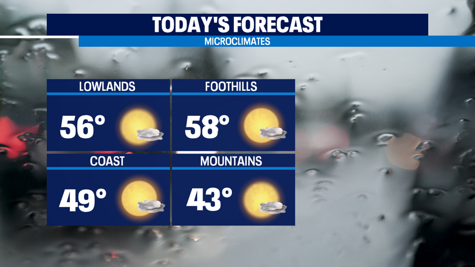
Seattle - We've got some magnificent March weather, at least momentarily. While we're starting out frosty and frozen in some spots in the South Sound, we'll see a 30 degree temperature swing by the afternoon as temps get into the mild mid-50s.
We'll be in the low 40s in the Cascades. Avalanche danger remains high in the backcountry areas and I-90 closes at 10a up at the pass for avalanche control work.
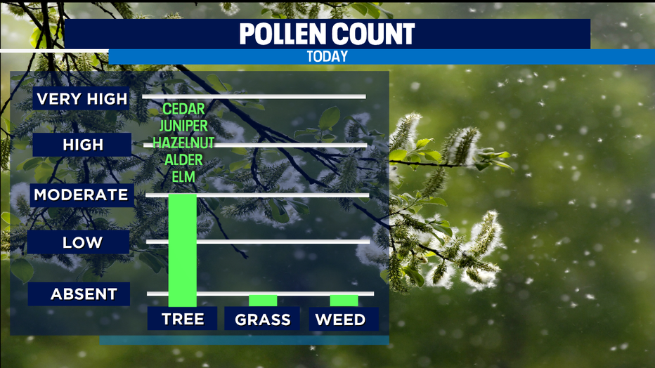
We’re likely even warmer tomorrow as highs get close to 60 for our warmest day of the week. These mild days the trees celebrate releasing a lot of pollen-- so expect those sensitive to tree pollen to really feel it getting into today and tomorrow to the High and Very High categories.
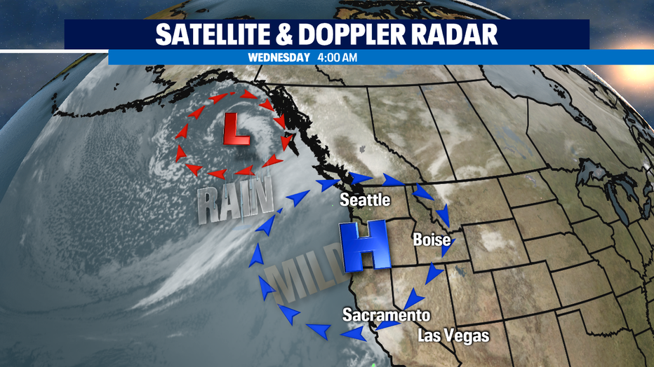
High pressure that's sitting right on top of us looks to hold off the rain until late afternoon along the coast and inland around Puget Sound until very late evening/overnight.
Once the rain gets here, we'll see soggy conditions at times on Friday. Both Saturday and Sunday have some showers, though at this point it looks like Sunday looks like the wetter of the two weekend days. Temps this weekend will be back down towards the normal high of 52.
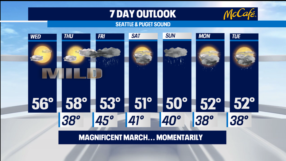
This coming Saturday is our first sunset of 2021 after 6p. Sunday March14 will be our first sunset after 7p. (And perhaps could be our last ever "spring forward" time jump if Congress allows the Pacific Time Zone to finally do its own thing.) Spring officially starts on the 20th. -Tim Joyce