Seattle weather: Lowland snow possible Friday night
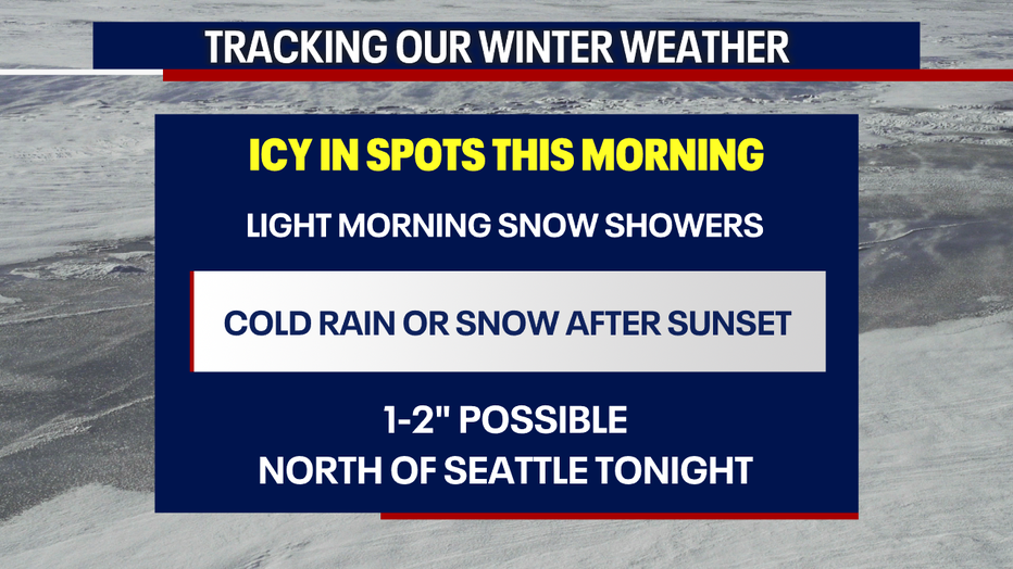
Seattle - Light snow showers made for some icy spots Friday morning, as Western Washington braces for the chance of another round of snow Friday night.
A system will move through Western Washington this evening, with heavy snow expected in the Olympics and around Hood Canal. This system is expected to be weaker than Tuesday's storm, but many areas could wake up to fresh snow Saturday morning.
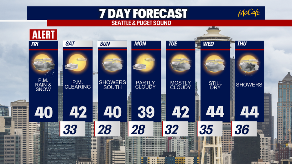
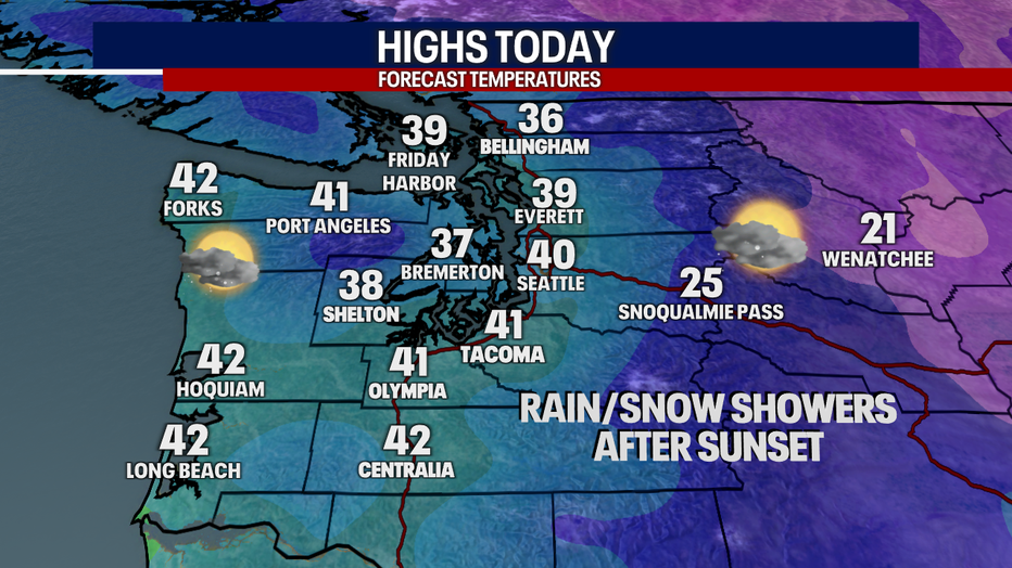
Afternoon high temperatures will be slightly warmer than Thursday, back close to 40 degrees. However, temperatures will quickly drop after sunset, bringing in a chance for more winter weather tonight.
Snow showers or just cold rain showers could arrive as soon as the evening commute in the Puget Sound area. It's going to be another tough call, where 2-3 degrees can make all the difference.
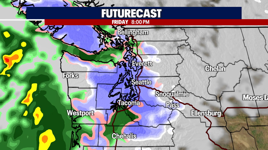
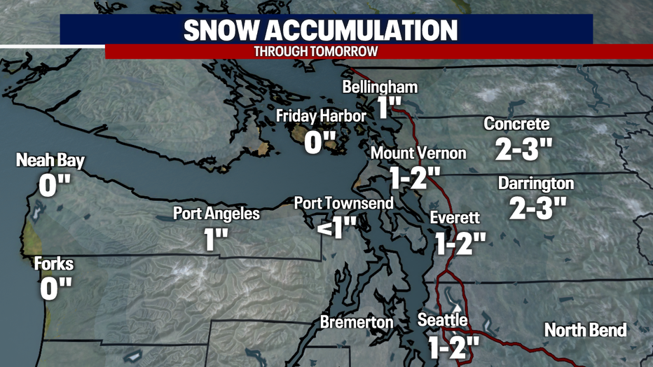
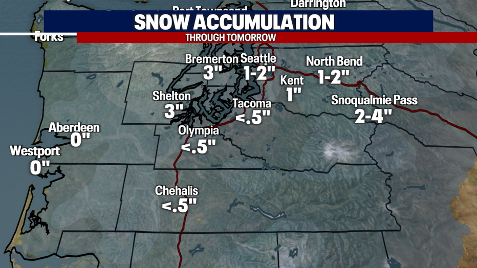
Models are mainly suggesting snow totals in the 1-2" range north of Seattle, with warmer conditions and more of a rain/snow mix south of the city. The rain/snow line may move around a bit, so here's what we are thinking for totals right now.
Showers will wrap up by early Saturday morning. We should see some nice clearing late Saturday morning into the afternoon. Early next week looks to stay dry through Wednesday with temps staying cool, in the low to mid 40s.