Lowland rain and mountain snow wraps up Wednesday afternoon giving way to dry holiday conditions.
seattle - Happy holiday week all! Stay healthy and safe during these trying times.
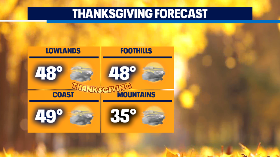
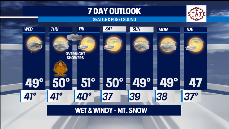
Right out of the gate I want to break down the holiday forecast! Here's a look at our mainly dry Thanksgiving. No major storms for the end of the week. Highs will round out in the mid to upper 40s with mountain pass temperatures in the mid 30s.
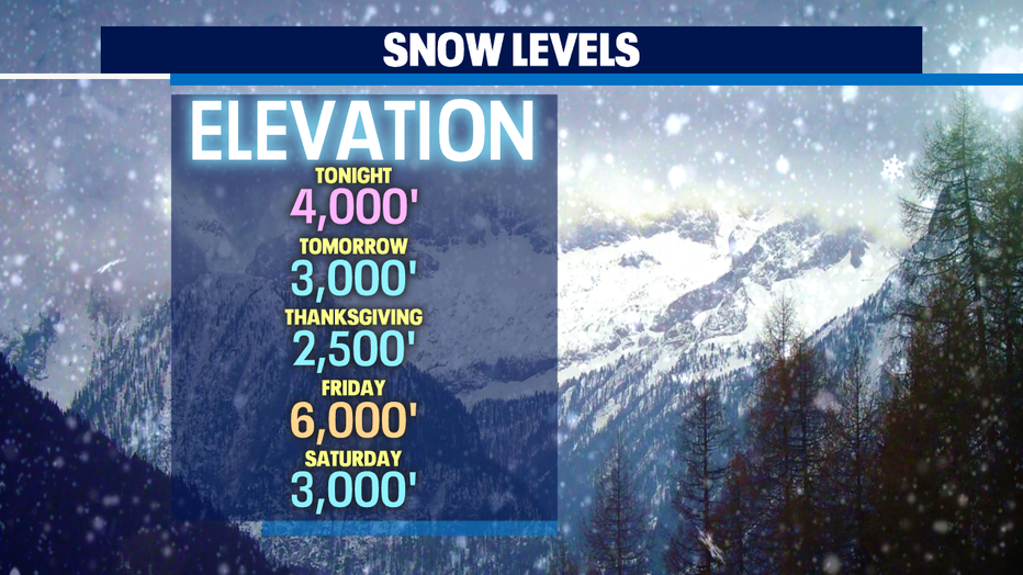
Tonight, showers will continue to fall for the lowlands with a decent amount of snow dropping across the mountains. That's great news for our area resorts and outdoor enthusiasts who are anxiously waiting for more ski areas to open up. We expect a good foot by the time we push through midday Wednesday. Highs for the metro will land in the upper 40s with low to mid 30s in the mountains. Here's a peek at your snow/freezing levels.
Thanksgiving Day will feature a slight chance of few scattered showers Thursday morning around the Southeastern foothills of the Olympics. Otherwise look for dry conditions during the day. By late Thursday night showers may pop up along the NW WA Coast and North Sound. Those showers will fade away in time for the morning commute on Friday. Highs will hang in the upper 40s to low 50s through the end of the week.
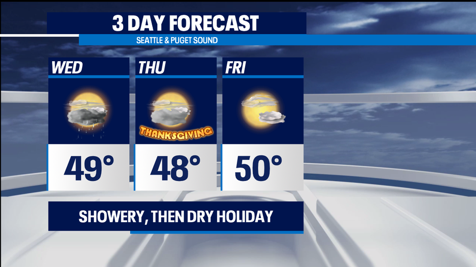
The trend for the weekend is try too. We'll see a chance of showers as we start the work week, but at this point models are not completely agreeing with each other. So for now we'll go with mostly cloudy to partly sunny into Tuesday. Highs will land near 50.
Have a great night! ~Erin
______________________________________________
- Erin Mayovsky, Q13 Forecaster
Twitter: @ErinMayovsky
FaceBook: /ErinMayovsky
Instagram: @ErinMayovsky
______________________________________________