

Lowland flurries possible Sunday, Monday mornings
Believe it or not – we're tracking the chance for lowland flurries Sunday and Monday mornings. For the most part, we're not expecting snow to stick in the lower elevations.
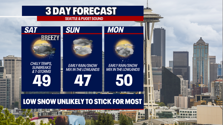
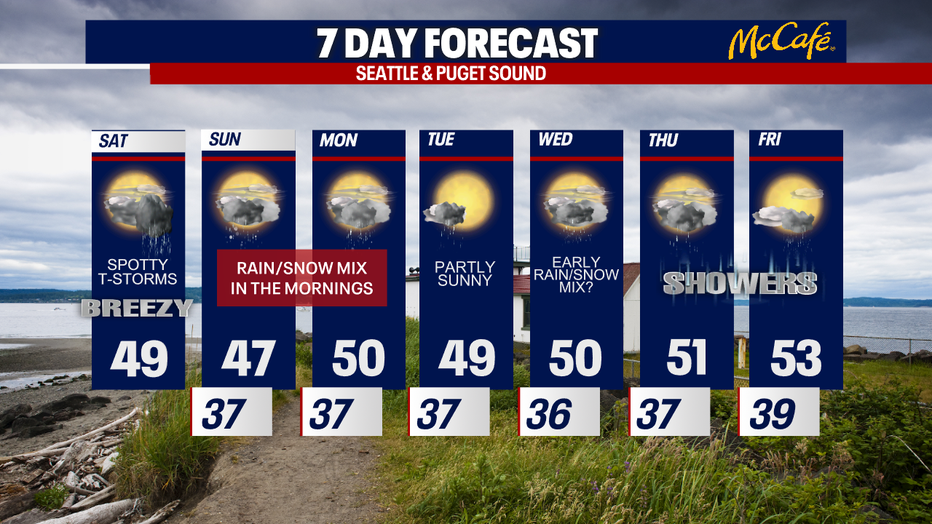
Today will be very similar to yesterday: we'll have sunbreaks, showers and isolated, weak thunderstorms. It'll feel quite chilly with highs only in the upper 40s. Breezy conditions will make the temps feel even cooler.
Already, we're getting reports of hail and snow mixed with showers around Western Washington today. The atmosphere is cool and unstable enough to give us different precipitation types with our showers and thunderstorms. Under heavy shows, hail, snow or graupel could quickly accumulate before melting.
As a refresher, here are reminders about the difference between graupel, hail and sleet:
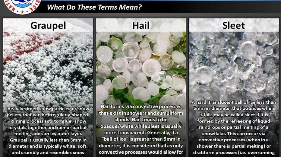
(National Weather Service)
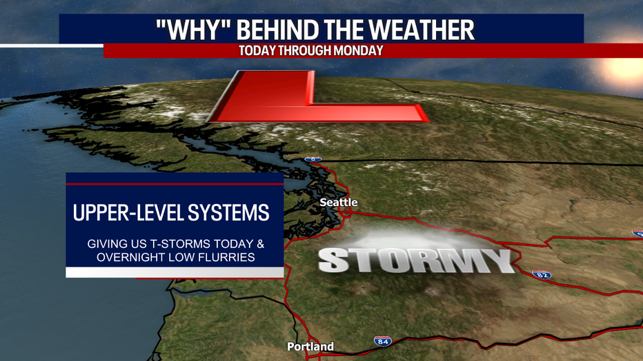
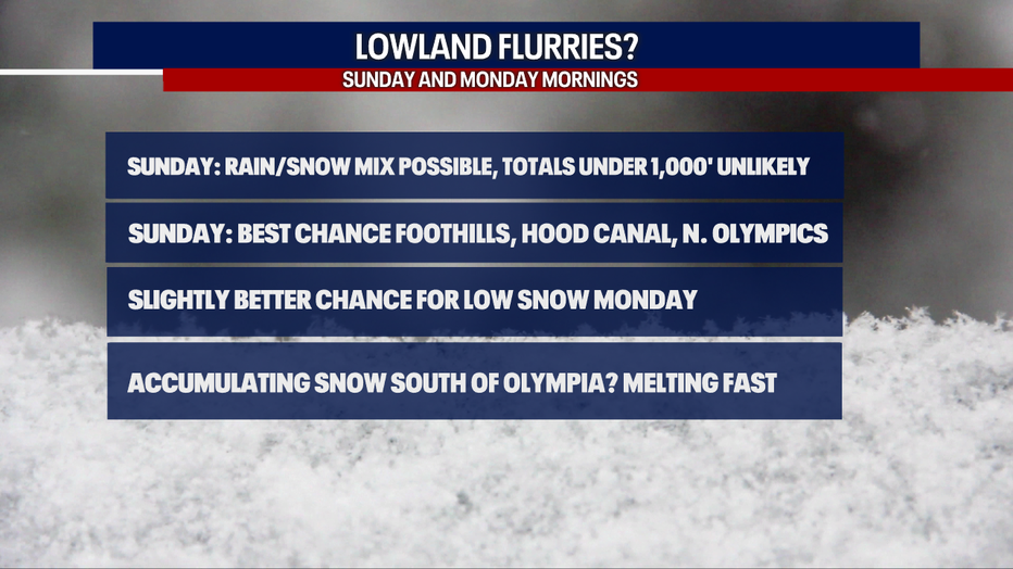
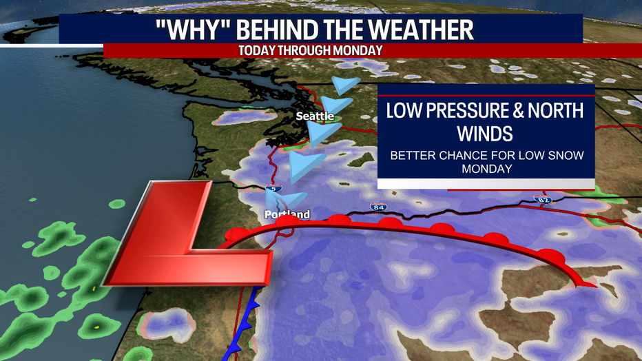
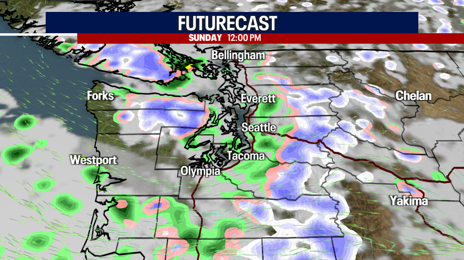
Our unsettled weather and overnight flurries Sunday are due to upper-level systems overhead. Any flurries late tonight and early Sunday will be super brief. Accumulations under 1,000 feet are very unlikely. Even if something stuck to the ground in the lowlands, it would melt quickly. Communities with the best chance for accumulating snow include the Hood Canal, the north slopes of the Olympics and the foothills. Otherwise, Sunday will be mostly cloudy and showery.
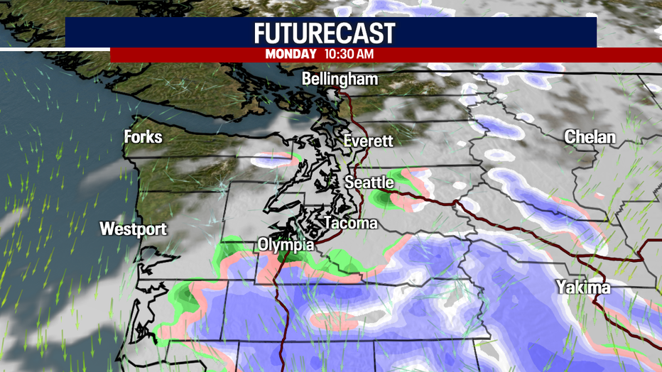
There's a slightly better chance for lowland snow on Monday, but it all depends on the track of our next storm system. Right now, the forecast models suggest that the Olympic Peninsula, the South Washington Coast and communities south of Olympia (including Castle Rock, Chehalis and Centralia) could see snow. In fact, some of it could stick. Once again, even if there's an accumulation, it would melt fairly quickly given highs Monday in the upper 40s to low 50s.
If Monday's storm moves farther north, snow will be more widespread in Western Washington. If it veers farther south, our region would see less snow.
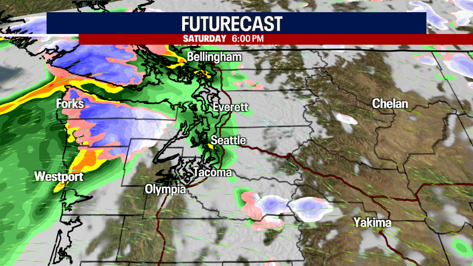
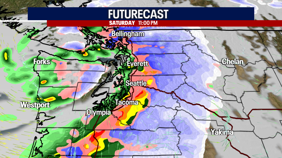
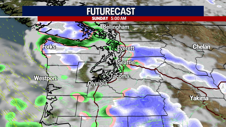
Here's what one model is suggesting in terms of timing and coverage of our precipitation.
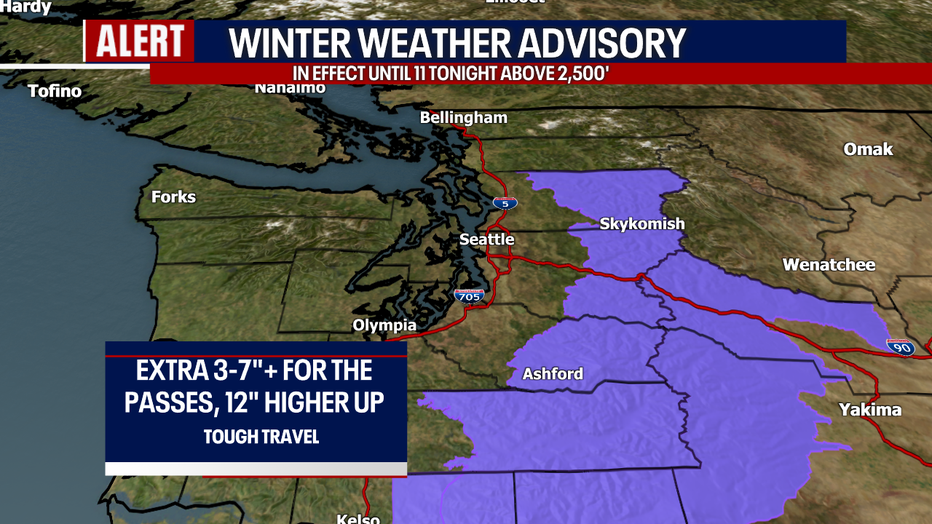
Up over the mountains, a fresh 3-7"+ could stack up over the passes today. A Winter Weather Advisory continues until 11 tonight.
Here's a look at our seven-day forecast! Tuesday will offer isolated showers and partly sunny skies. Wednesday morning, a few snowflakes could mix with rain in the lowlands. Showers are ongoing Thursday and Friday. Quite a chilly week for it being mid-April!
Have a great weekend,
Meteorologist Abby Acone
Follow me on Twitter @abbyacone, Instagram @abbyaconewx, TikTok @abbyaconetv and Facebook (Meteorologist Abby Acone)