

Last weekend of 2020: More lowland rain & mountain snow
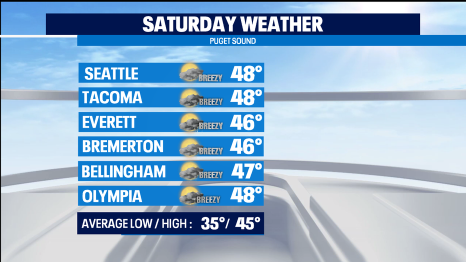
SEATTLE - Some seasonally soggy conditions for the last weekend of the year. That will mean some snow for areas in the mountains and east of the Cascades above 2,000 feet in elevation. Around Puget Sound, the morning looks wetter than the afternoon. High temps very similar to Christmas' high temp of 49 degrees.
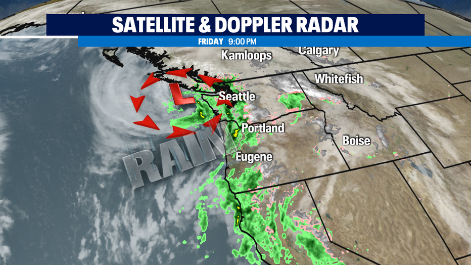
A chance of some raindrops comes back for very late Saturday and the first part of Sunday as the weather system off our coast moves up into British Columbia.
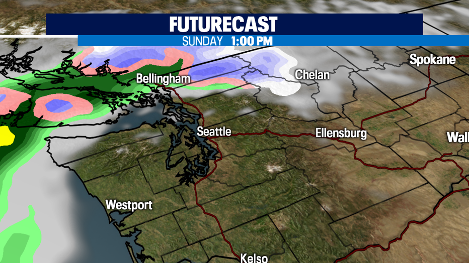
Despite the soggy start on Sunday, I think the rain will move north of Seattle just in time for the Seahawks game at 1:05p as they take on the Rams.
Sunday afternoon's dry weather looks to be the start of a stretch of dry & chilly weather that will be with us for the first couple days next week. That will mean some frosty morning conditions for the Monday and Tuesday commute.
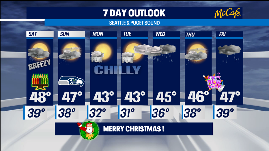
By late Tuesday, raindrops look to return to the lowlands and snow for the mountains. We start getting a bit warmer overnight too. The soggy on/off weather looks to continue for the rest of 2020 and into New Year's Day as well. All those raindrops in the lowlands will be fresh powder for skiiers and boarders in the mountains. Enjoy! -Tim Joyce