

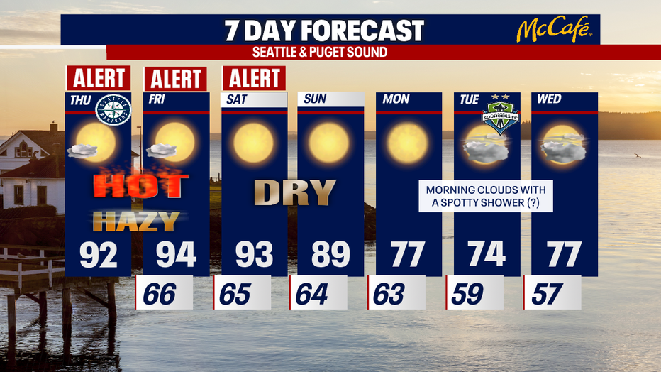
Hot and hazy through Saturday in Western Washington
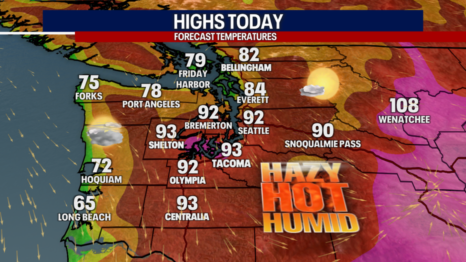
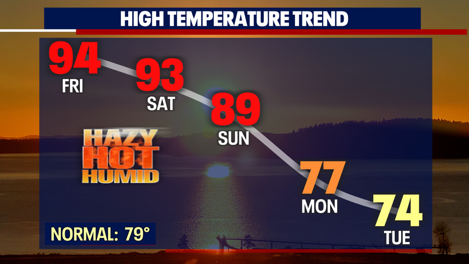
The heat hangs on! Sea-Tac Airport will likely tie the record for the longest 90-degree stretch. The 90s stick around through Saturday before falling to the upper 80s on Sunday.
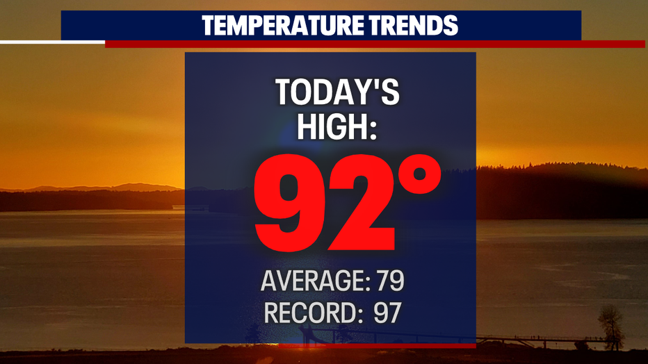
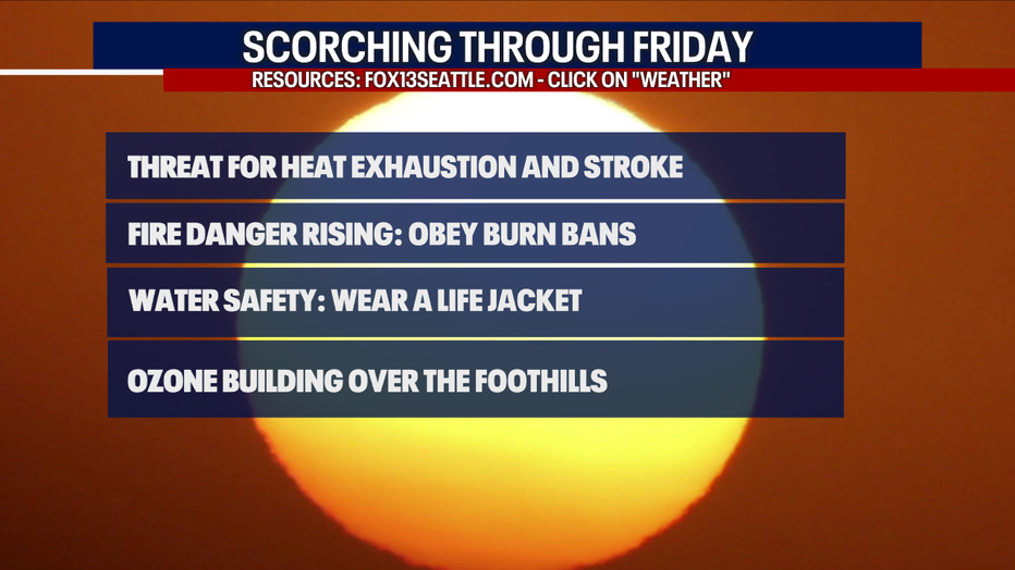
We do not expect any new records for highs this week in Western Washington; however, we are still worried about the risk for heat exhaustion and stroke.
Make sure to drink plenty of water! If you do not have air conditioning at home, consider heading to another building with air-conditioning (e.g. a library, mall or movie theater) to give your body a break. For a list of cooling centers around the region, Click here.
RELATED: Staying cool during Seattle's hottest days of the year: Tips, cooling centers & pet safety
Remember to obey any burn bans in your area. Sadly, fire danger is elevated this week.
If you are cooling off on a lake, river or pool, wear a life jacket.
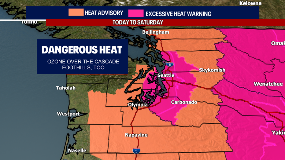
An Excessive Heat Warning and Heat Advisory is still in effect until Saturday:
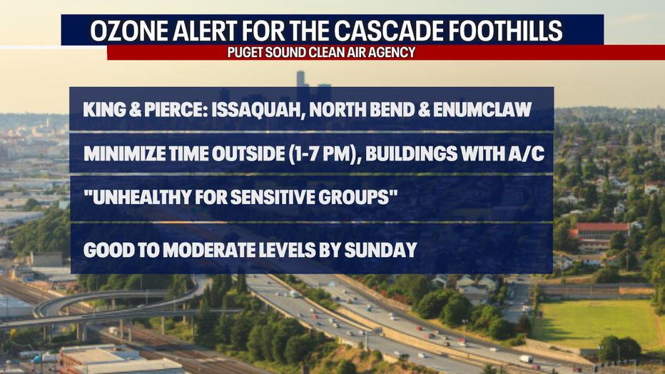
If you look over the Cascades, you will notice a lot of haze. Most of this is smog, but there could still be a little high-level wildfire smoke in our skies (note: the smoke is not impacting air quality this week – but the smog is causing problems). Unfortunately, a significant amount of ozone (smog) is building up over the Central Cascade foothills (for example, Issaquah out to the east, Enumclaw and North Bend. Air quality has dropped to "unhealthy for sensitive groups" in places. This may even drop to "unhealthy" levels Friday and Saturday. Air quality should improve to "good" or "moderate" on Sunday.
If you have respiratory issues or sensitivities, are pregnant, have kids, infants or are over 65 years old, make sure to check out the details of the Ozone Alert here.
Today's weather is truly weird: while Puget Sound stays blazing hot, a weak onshore flow along the coast will keep things cool and cloudy for the beaches. This may usher in a little humidity to Puget Sound, making it feel sticky at times.
Highs drop to the upper 80s on Sunday before dipping to the 70s beginning Monday.
Monday through Wednesday should be remarkably milder with rounds of morning clouds. There could even be an isolated shower or thunderstorm in places.
Please take good care this week!
Sincerely,
Meteorologist Abby Acone