

Seattle weather: Hint of spring on Thursday, wet by Friday
SEATTLE - Enjoy our beautiful weather tomorrow before lowland rain, mountain snow and wind return Friday.
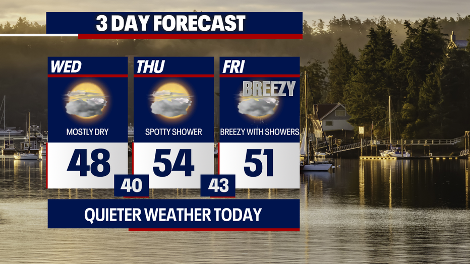
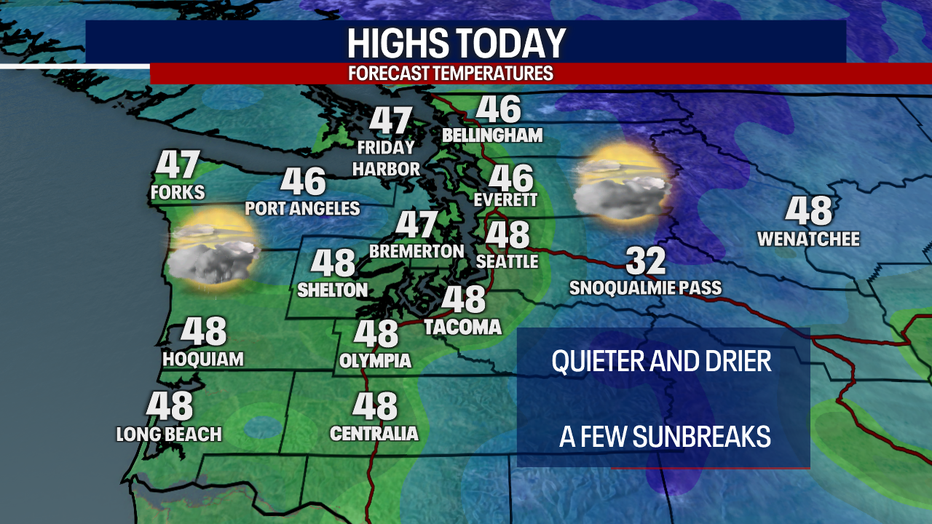
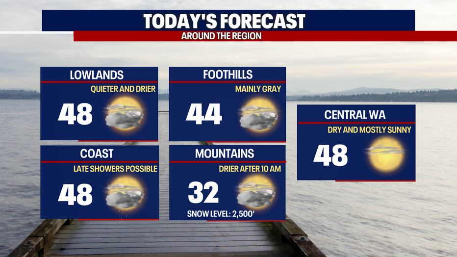
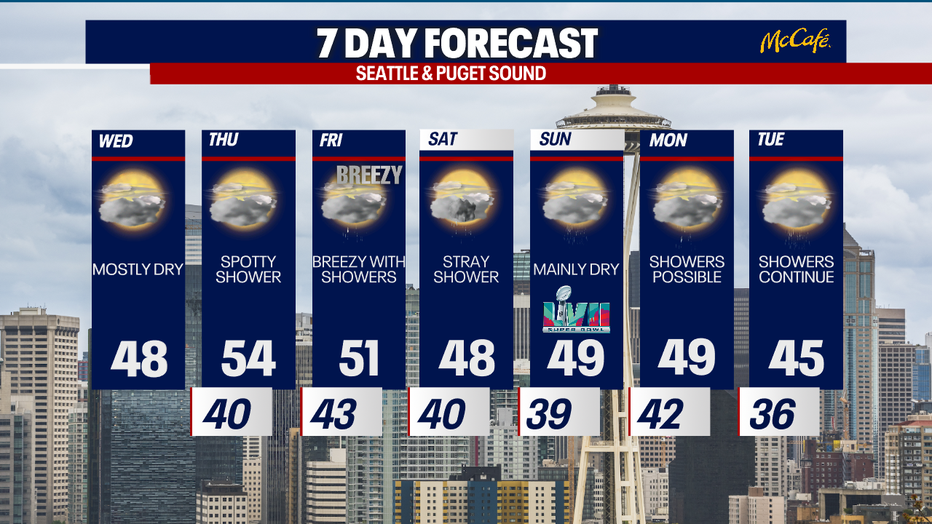
Highs Wednesday afternoon will lift into the mid to upper 40s. A few glimpses of sunshine Wednesday will be lovely. We'll be mainly dry and quiet today, but rain could push into the coast the afternoon and evening.
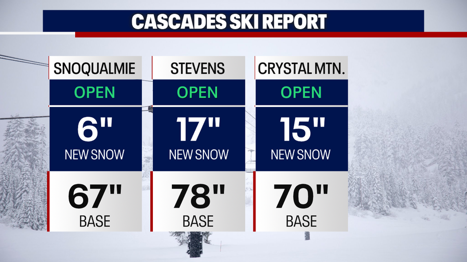
Our wet weather Tuesday gave the ski resorts a healthy helping of snow. Any snow showers over the mountains gradually wrap up this morning.
There may be an early or late shower tomorrow, but Thursday will end up mostly dry with partly sunny skies in the afternoon. Highs will be mild in the mid 50s.
Friday will be breezy, but winds don't look like a big deal for most. Gusts could perhaps blow upwards of 40 mph for the typical spots (e.g. the coast, North Sound and Admiralty Inlet area). An upper-level storm system overhead could trigger a bit of lowland rain and mountain snow.
Saturday and Sunday look fairly peaceful, but we can't rule out a spotty shower. Temperatures cool next workweek. Showers could roll through Western Washington Monday and Tuesday. There may be at least a little mountain snow each day. Stay tuned!
Have a wonderful Wednesday,
Meteorologist Abby Acone
Follow me on Twiter @abbyacone, Instagram @abbyaconewx, TikTok @abbyaconetv and Facebook (Meteorologist Abby Acone)