

Highs soar to the 70s in Seattle
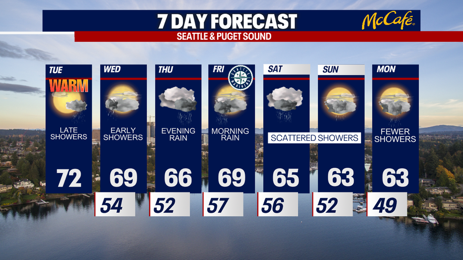
SEATTLE - Highs will soar into the 70s this afternoon across Puget Sound! Enjoy the warmth while we have it because temps plunge to the low 60s this weekend. Overall, the rest of the month is looking cool and wet, too.
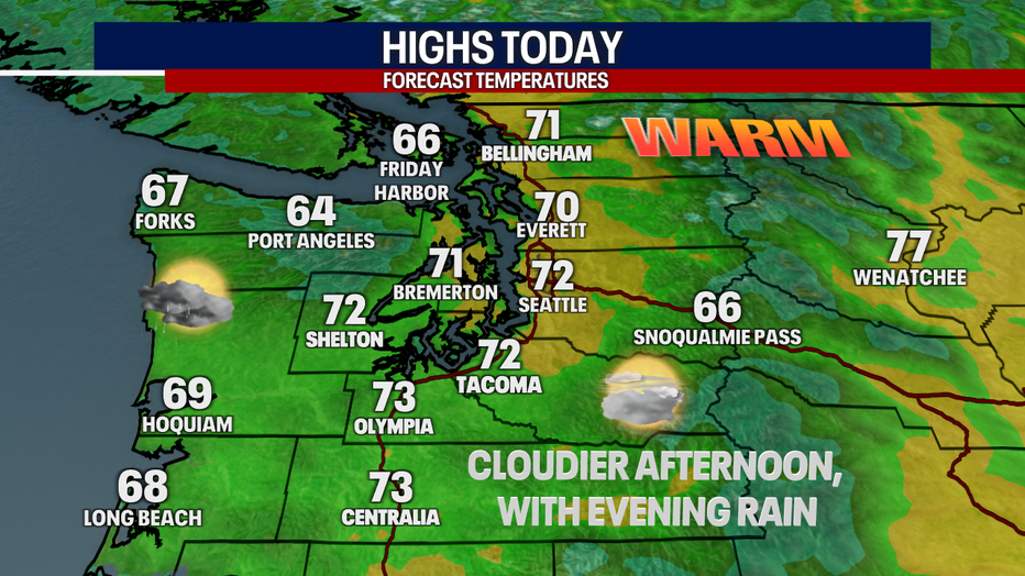
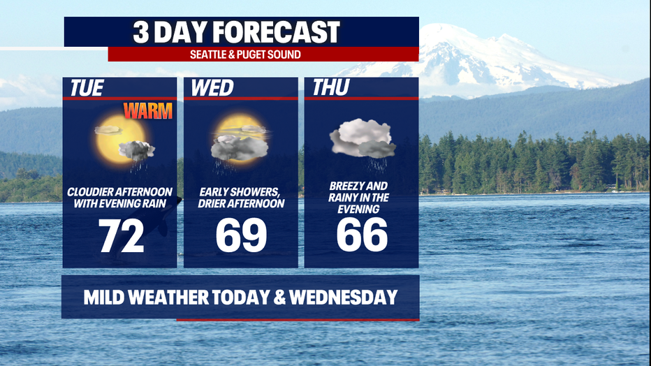
The day is starting off sunny, but clouds increase this afternoon ahead of a low pressure system brewing in the Pacific. This same system could give us scattered rain later tonight through early Wednesday.
Once the showers clear tomorrow morning, Wednesday afternoon should be mild and pleasant. Highs will reach the mid 60s. Clouds will gradually clear in the afternoon. The sunset tomorrow night will be a beauty – keep those cameras at the ready!
Thursday is looking breezy and grayer. Widespread rain should return late Thursday and linger into Friday morning. Showers break apart somewhat Friday afternoon and evening.
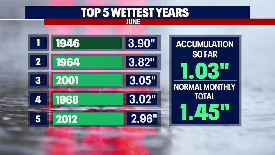
This weekend, scattered rain is in the forecast. Between Thursday to Sunday, many spots in the lowlands could see 1-2" of rain. The mountains could even get upwards of 3" of rain. Flooding is unlikely, but river levels will be rising and nearing flood stage; we'll have to especially watch rivers coming out of the Central and North Cascades.
With even more rain on the way this weekend (and likely thereafter), we'll likely wind up in the top five wettest Junes on record at Sea-Tac Airport!
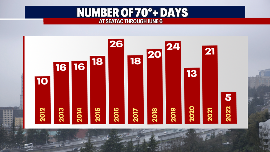
If you think it's also been cooler-than-average recently, you're right! So far in 2022, we've only had five days in the 70s. Last year through June 6, we had 21 days in the 70s or higher.
The key takeaway this week: enjoy the sunbreaks and mild weather while we have it: it doesn't seem like the warmth will last long.
Thanks so much for choosing FOX 13. We're thankful for your viewership!
Warmly,
Meteorologist Abby Acone
Follow me on Twitter @abbyacone, Insta