High clouds and warm temps Wednesday
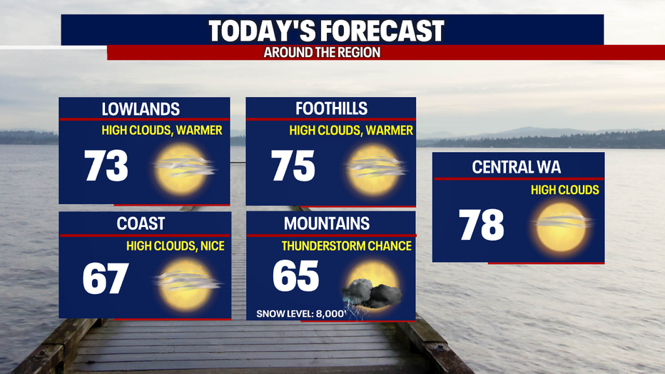
Seattle - Overcast high clouds and a warm air mass will settle in over the Pacific Northwest Wednesday, bringing the area one of warmest days of the year so far.
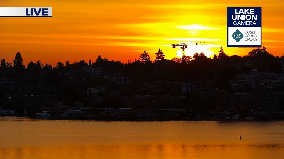
Check out this morning's gorgeous sunrise from the Lake Union Camera atop the FOX 13 studios.
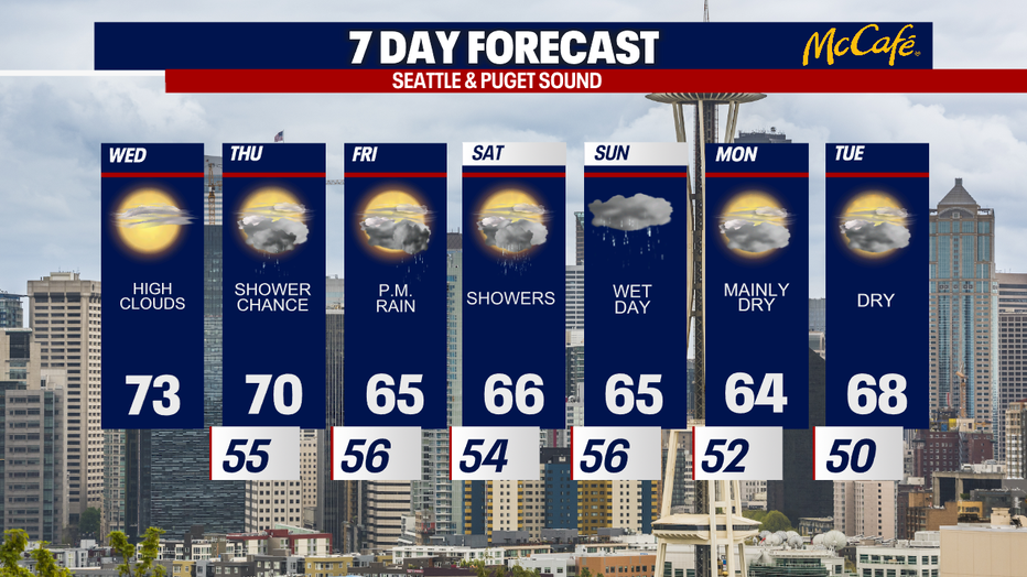
Wednesday will bring filtered sunshine with a chance for more mid-level clouds as the day goes on. Highs will be in the mid 70s. There is a chance for thunderstorms in the higher elevations of the Olympics and Cascades today, but Thursday afternoon will bring a better chance for that.
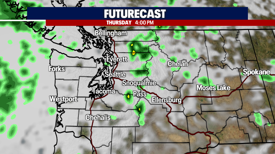
You can see that potential around 4:00 PM Thursday. Showers could also roll off the Cascades into the lowlands tomorrow afternoon, so we can't rule out showers.
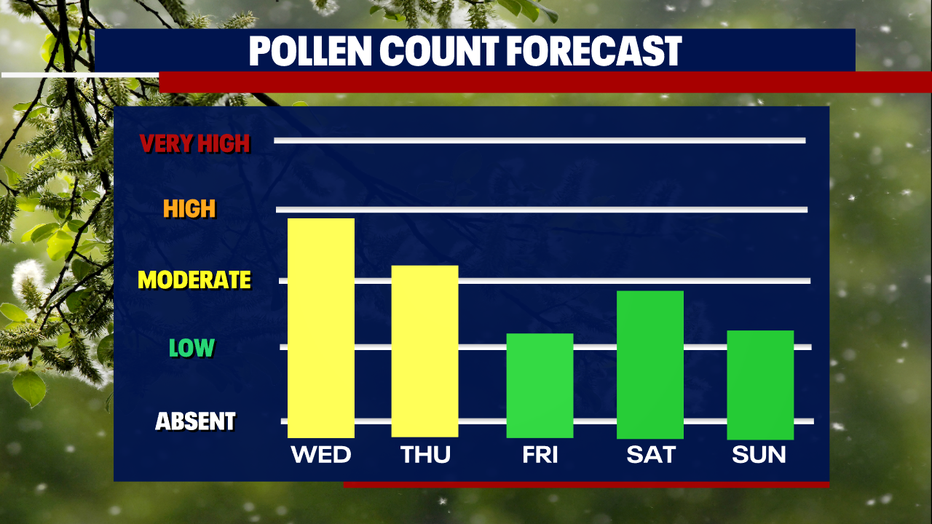
Pollen counts will remain high until our next round of more widespread rain. Wednesday and Thursday, grass and weed pollens will be in the moderate to moderate-high range.
Thursday brings a chance of afternoon showers to the lowlands with Friday looking more likely for rain. Temps will also cool on Friday, back down to the mid 60s.
So far, Saturday looks like the better day this weekend, with Saturday night into Sunday bringing the wettest system of the week.