Heavy rains continue across the region leaving us under a 'Flood Warning' through Saturday
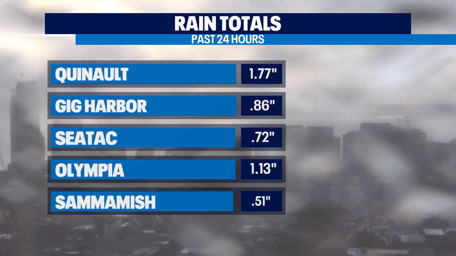
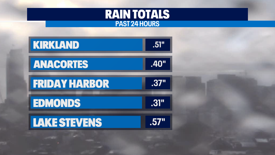
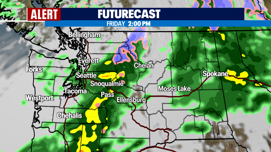
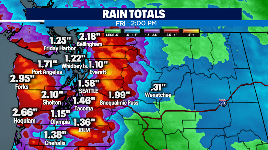
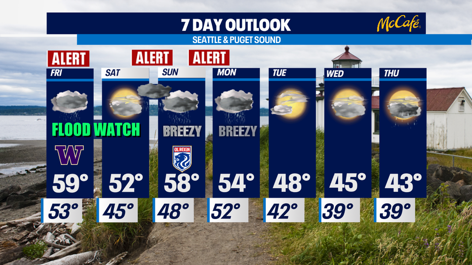
SEATTLE - It's downright sloppy out there and will stay this way through Friday mid-day before we get a much-needed break. We'll continue to see rain totals jump over the next 12-18 hours while we're under a "Weather Alert". As of 5pm Thursday, here's a look at some of the numbers for select cities around the region.
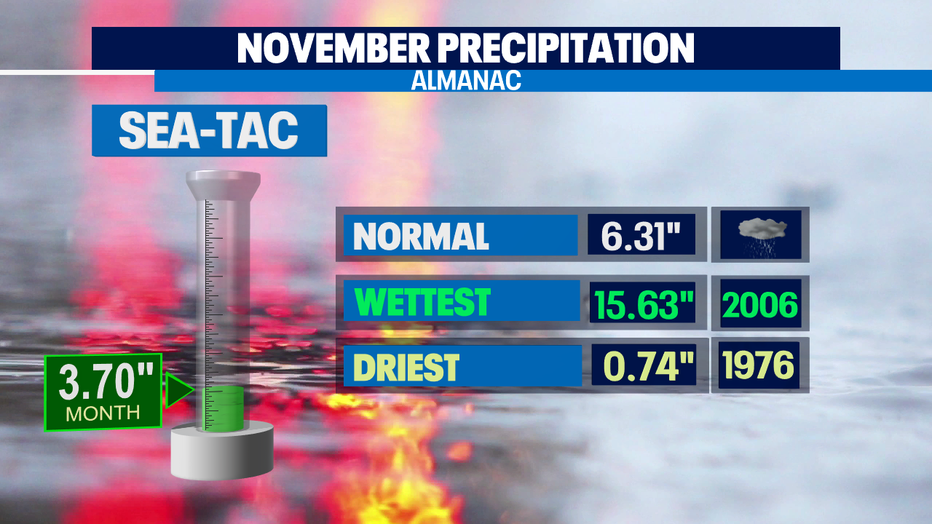
The rain is adding up at #SeaTac for the month as well. We are pushing towards 4" already which is more than half of what we are supposed to get for the whole month and it's only November 11th. And I know some of you remember the soggiest November on record back in 2006 when we saw more than 15" of rain. Let's hope we don't get that much this year! Stay tuned!
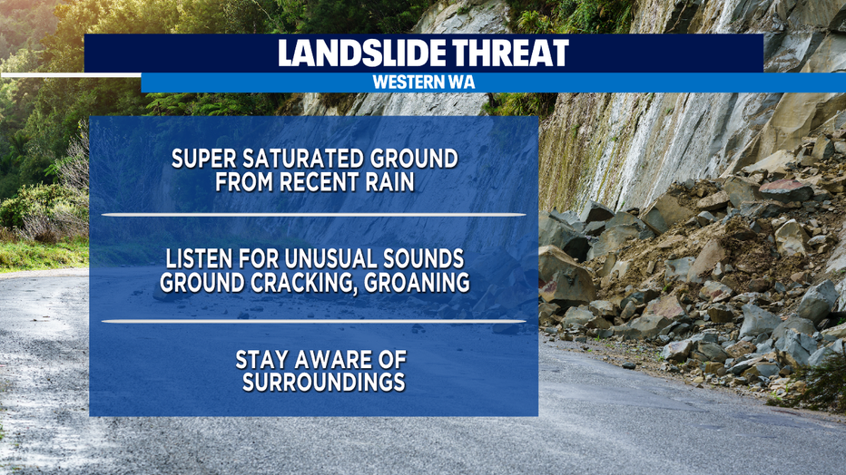
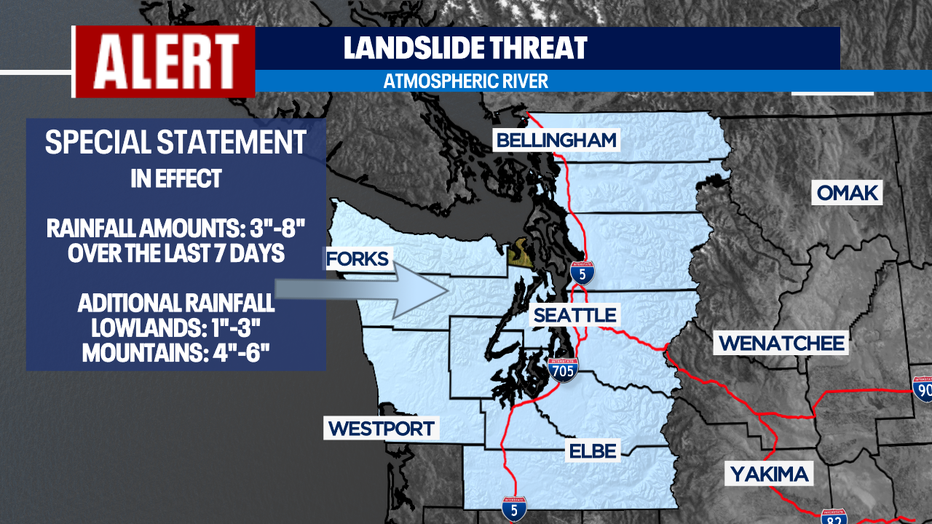
With so much moisture falling, our grounds are heavily saturated increasing the threat of land and mudslides for many. Soils are very vulnerable especially this time of year so please be careful when driving through areas that are prone to slides. Know your surroundings.
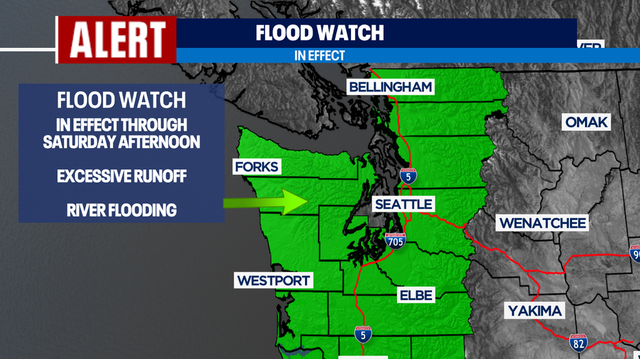
As rain continues and snow levels rise to near 8,000ft, runoff from the mountains will force many rivers, streams, and creeks to flood. The lowlands will see urban flooding too in many communities and neighborhoods. Be careful on highways and roads as ponding of water can create dangerous driving situations.
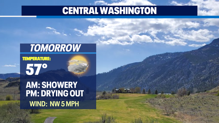
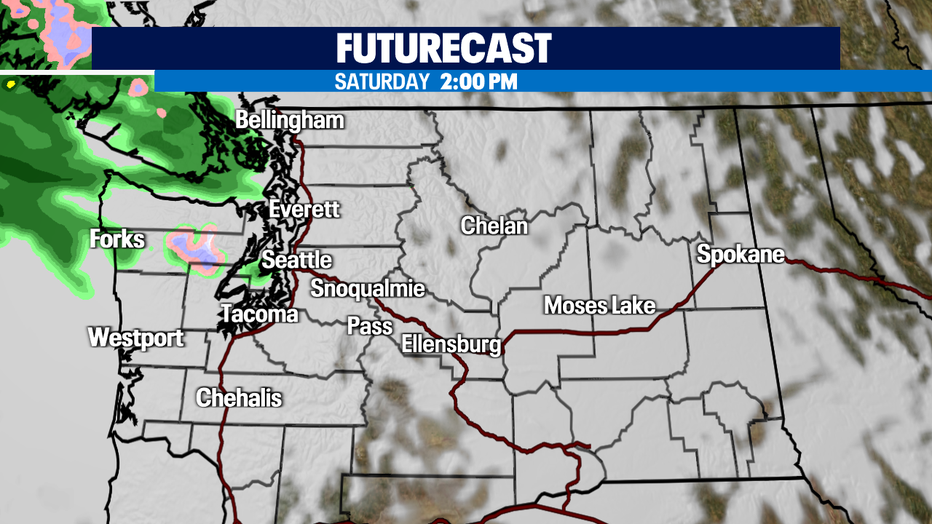
Rain will start to calm down just after lunch tomorrow as the system slides to the SE into the Cascades before finally drying out. Highs warm up above average in the upper 50s to near 60. Normal for this time of year is 53.
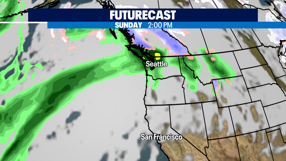
Friday night and most of Saturday look dry! Highs Saturday will fall off into the low 50s, which is right where we should be for almost mid-November. So, enjoy this brief break before the next big weather maker marches in delivering more heavy rain and wind Sunday into Monday.
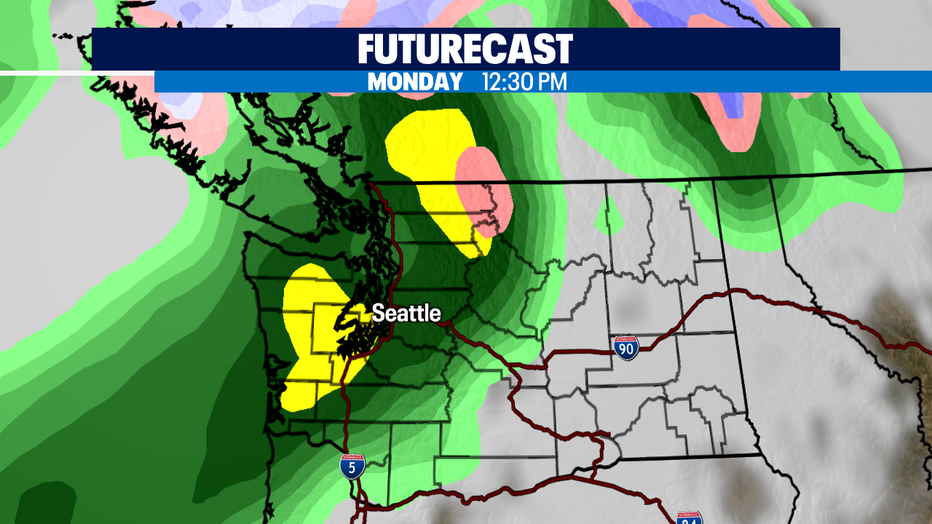
Another atmospheric river set up will pump even more precipitation our way Sunday night into Monday and this is why the FOX 13 Weather Team is issuing an alert during that time. The plume of moisture will be powerful as it stretches from deep in the Pacific to our neck of the woods.
We calm down by Tuesday as the sun should make a nice return for a partly to mostly cloudy day! Highs will be cool though, only running in upper 40s and dropping off even more Wednesday and Thursday. Showers will be back by Thursday too.
Have a great night all! ~Erin Mayovsky, FOX 13 Forecaster
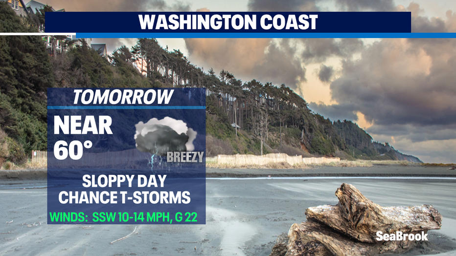
*Beach Forecast
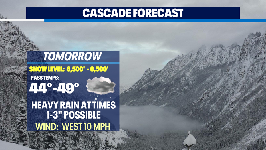
*Mountain Forecast
*Central WA Forecast