Heavy rain and mountain snow this weekend
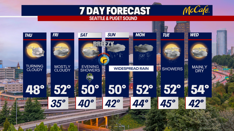
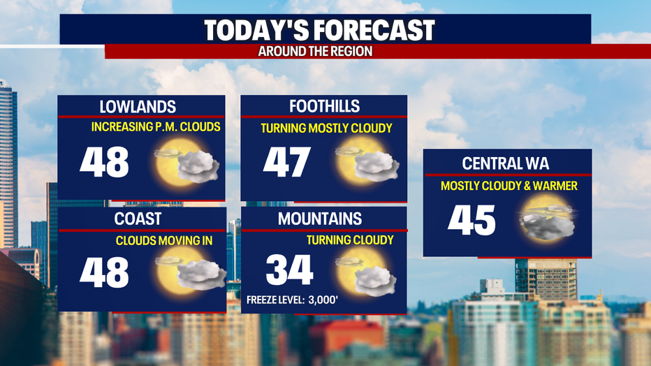
Seattle - It was a very chilly morning in Western Washington with temps in the 20s to start the day in many locations. Temps will warm to the mid 40s today, but the clouds are moving in ahead of our next weather system.
After a mostly cloudy afternoon today, Friday will bring a chance for a few light showers in Whatcom, Skagit, and Snohomish counties. Other than that, most of the area should remain dry with temps warming into the 50s.
Starting Saturday evening, widespread rain will return to the lowlands with widespread snow hitting the Cascades. This system will bring gusty wind and heavy rain at times Saturday night through Monday. More conservative models are bringing 4-6" of snow at the Cascade passes, but other models suggest we could see up to a foot by Sunday night.
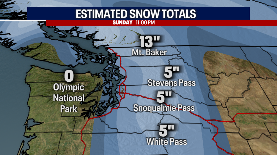
Snow will likely transition over to rain at the passes on Monday as snow levels rise. A warmer atmospheric river situation sets up for late Sunday into Monday. This will bring heavy rain to Western Washington. We will be keeping an eye on area rivers for flooding.
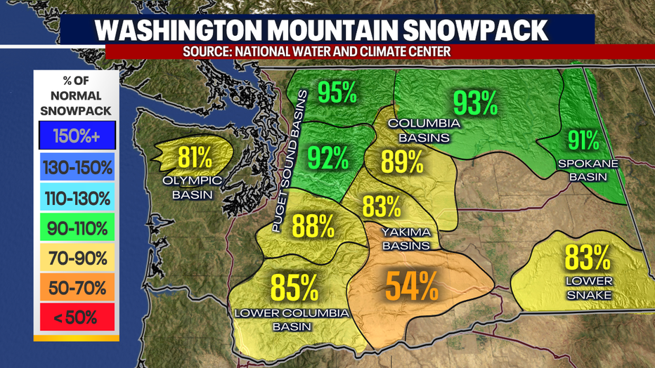
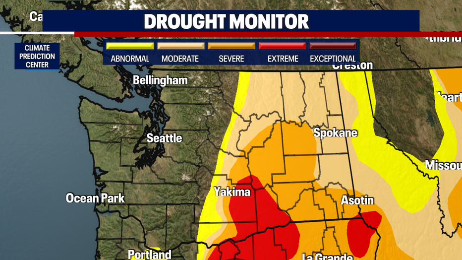
The water supply is still looking okay in the north basins, but south central Washington is struggling.
Here's a look at the latest drought monitor.
The wet pattern continues next week, with Wednesday looking like the only dry day.