

Goodbye, blue skies! Seasonal May showers ahead
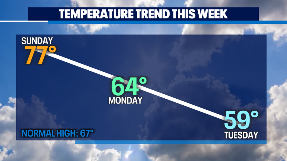
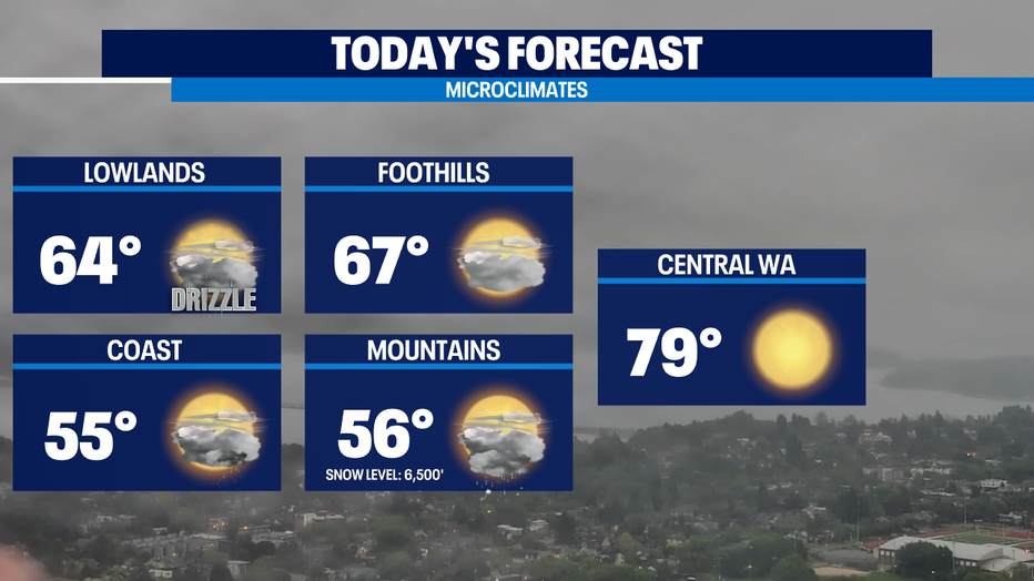
SEATTLE - After a weekend of temperatures that rivaled those of July and abundant sunshine-- we're changing our weather pattern to something that more closely resembles the month of May. Some areas of drizzle this morning but more on/off heavy showers develop as the cold front pushes inland. High temps will be only in the 60s, which is actually normal for this time of year.
Places further east across the Cascades in Central WA will still be quite warm if you want to chase the heat, Ellensburg or Wenatchee or Chelan would be the places to be with highs near 80. Coastal will be the coolest and wettest for today with highs only in the chilly mid 50s.
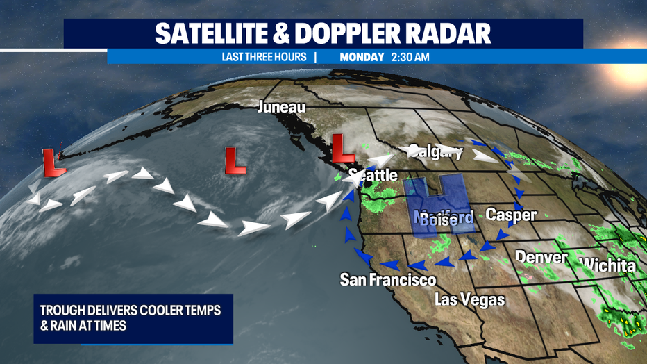
The dip in the jet stream offshore called a trough, will help deliver the clouds and showers for most of this week as several weather systems work across the Pacific NW. At this point, the wettest and coolest day looks like Tuesday and then every day after that we look to warm up a bit and dry out a bit too.
The upcoming weekend is looking pretty pleasant. Saturday looks nice but the forecast models are still picking up the better chance of showers for Sunday.
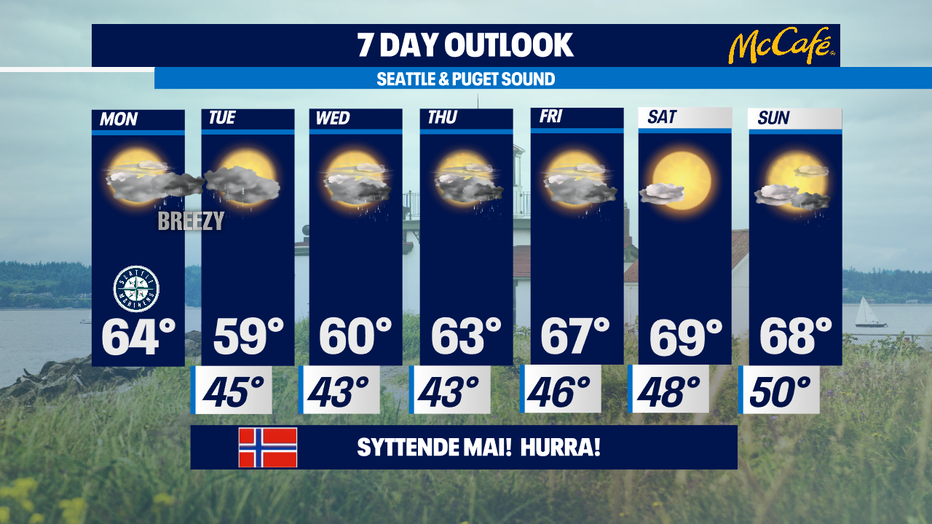
Temps this weekend back up towards 70. Normal is 67 for this part of the spring season. -Tim Joyce