Seattle weather: Get ready for summer heat to kick into gear this week!
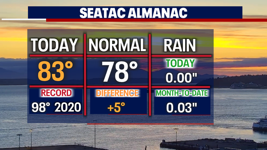
SEATTLE - Above average is where we finally landed Tuesday! Highs up and down the I-5 corridor several degrees warmer than normal with SeaTac hitting 83. The warm-up will continue too, at least for a couple of days!
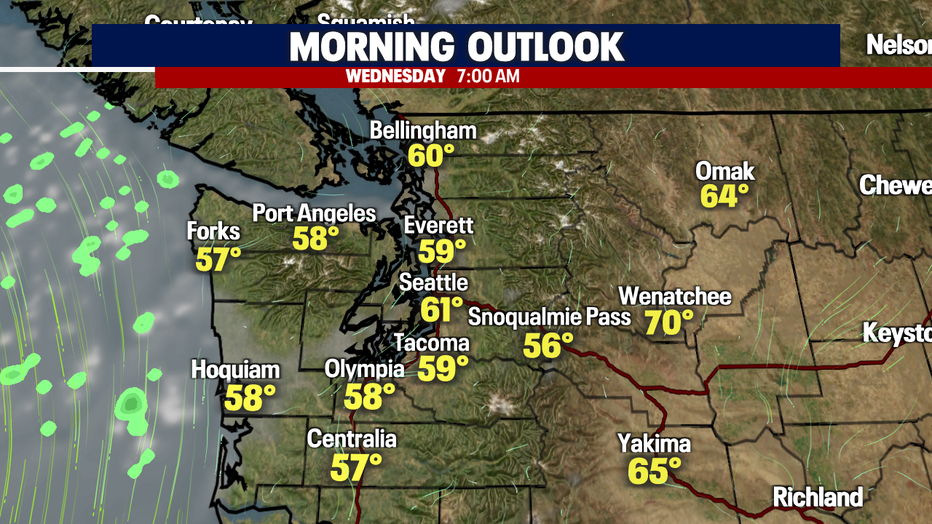
Overnight temps are mild, cooling into the upper 50s to low 60s under clear skies.
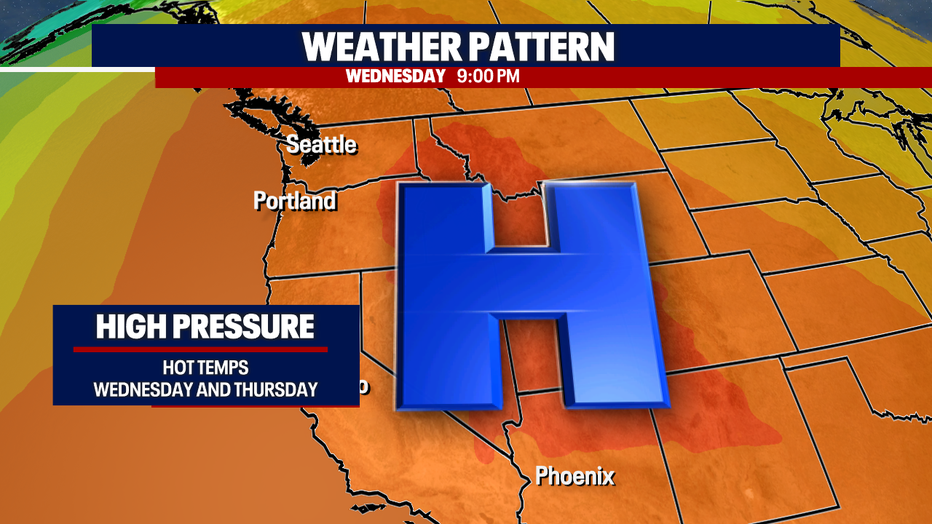
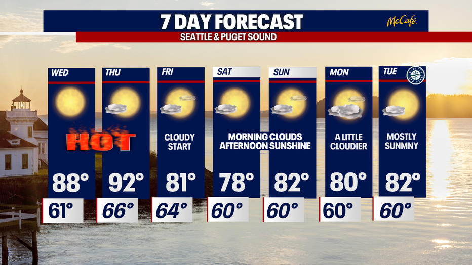
High pressure grabs a tight hold of the Northwest Wednesday and Thursday pushing temps once again into the upper 80s and 90s.
So far this year we've seen 10 days in the 90s, and we'll probably add at least one more. Wednesday's record to beat is 96 with 88 for Thursday—we shall see how close we get to a new record.
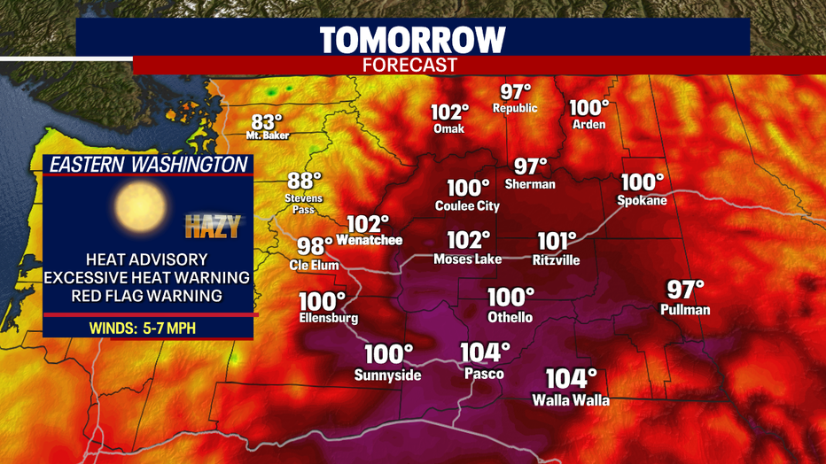
Along with the warm-up comes several alerts across the region. These alerts are not just for Washington, but Oregon and portions of Idaho and California included too.
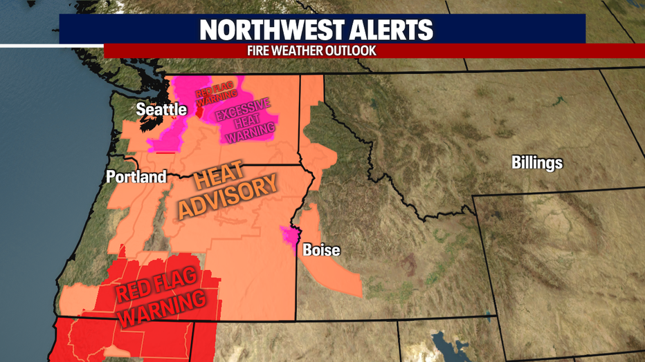
Here's a look at our alerts for this week:
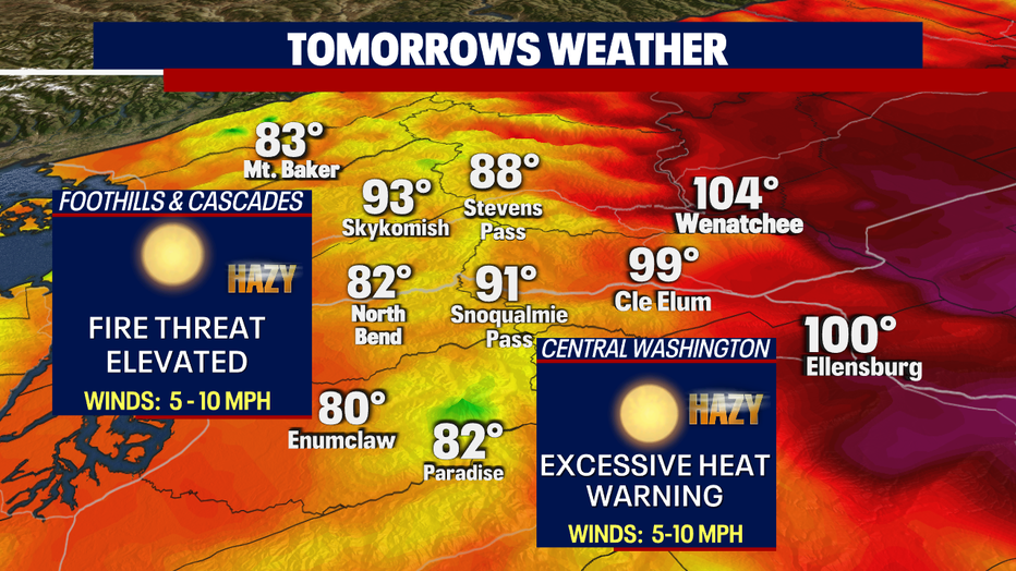
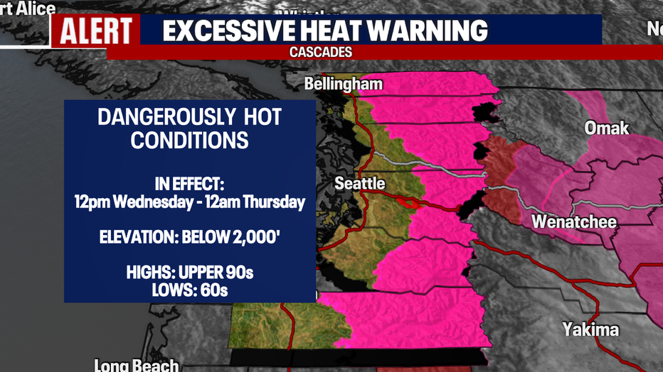
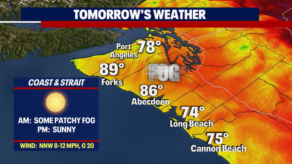
Cascades: An Excessive Heat Warning goes into effect 12pm Wednesday through very early Thursday below 2,000'. Highs jump into the upper 80s to 90s for many valley areas. We're forecasting 91 for the Summit at Snoqualmie tomorrow.
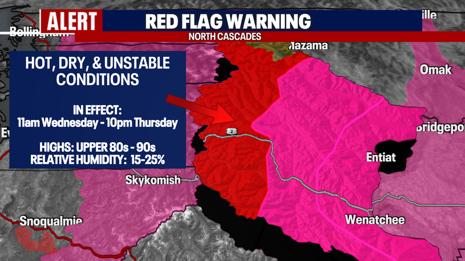
North Cascades: A Red Flag Warning will kick into gear 11am Wednesday through 10pm Thursday for hot, dry, and unstable conditions.
Highs are forecast in the 90s with relative humidity between 15-25%. This is especially dangerous as the ground is so tinder dry. Fire danger is critical as one small spark can ignite a brand-new blaze.
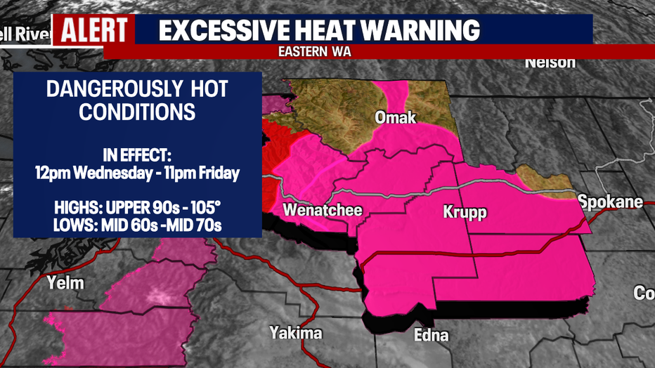
And finally, we're watching the Eastern slopes and foothills of the Cascades into Central WA. We expect dangerously hot conditions with highs forecast near 105 for some communities. And overnight temperature won't see much relief with lows in the mid 70s.
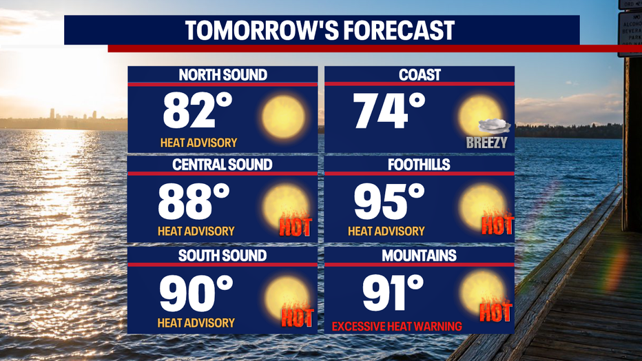
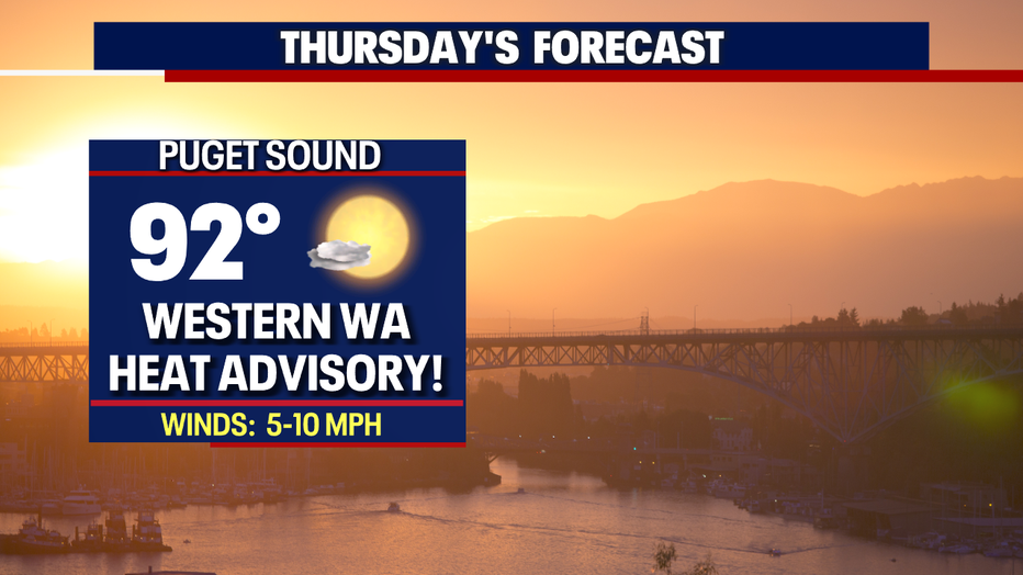
Seattle forecast for Thursday kicks up to 92 with areas to the east and south even warmer! Again, the record to beat Thursday at SeaTac is 88 set back in 1991. Make sure to stay hydrated, use sunblock and limit time outside.
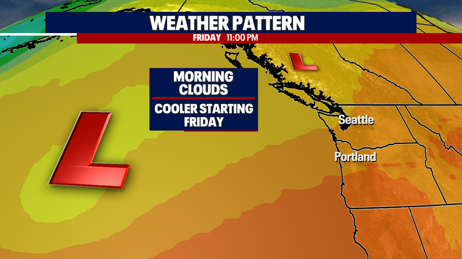
If you're not a fan of the heat we do cool back down pretty quickly. By Friday into Saturday an upper level trough will push into the region. This will bring back our traditional morning clouds to afternoon sunshine. High hang in the upper 70s to low 80s… much more comfortable!
Have a great rest of the week all! ~Erin Mayovsky, FOX 13 Forecaster
*Beach Forecast
*Foothills, Mountains, & Central and Eastern WA Forecast