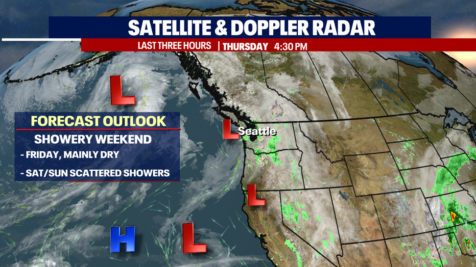
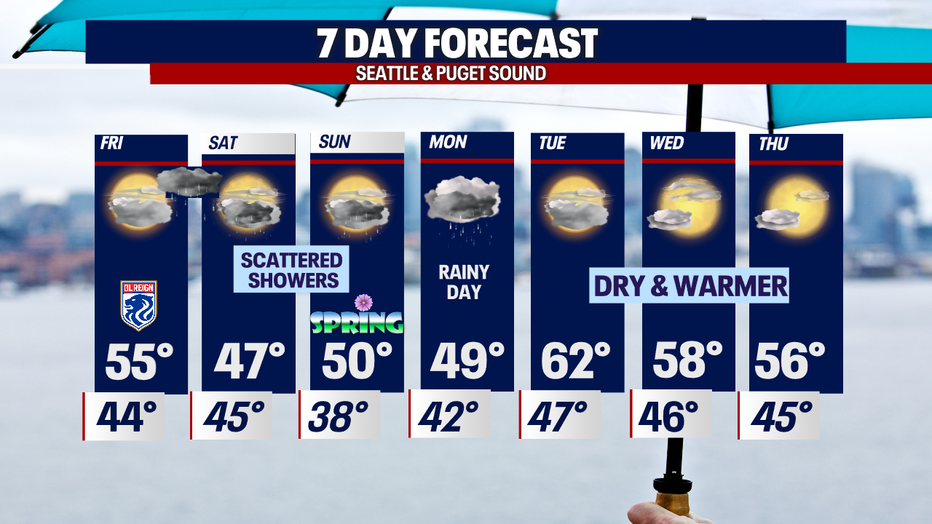
Friday mainly dry, then showers return early Saturday with more unsettled conditions into Monday
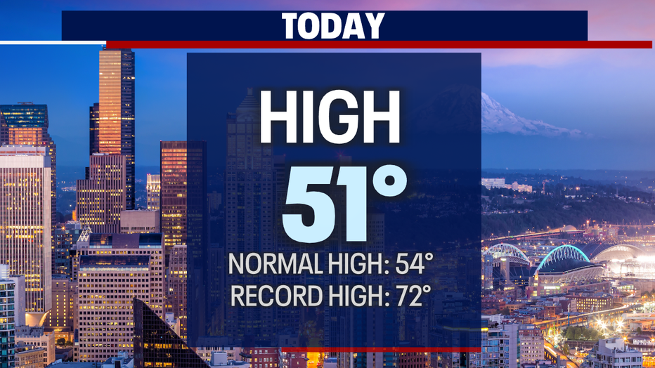
Seattle - Thursday had a hard time making a decision-- skies fluctuated between mostly cloudy to cloudy with some areas seeing showers quickly moving through before sliding east into the mountains. Highs fell short of average (54), landing in the upper 40s to low 50s.
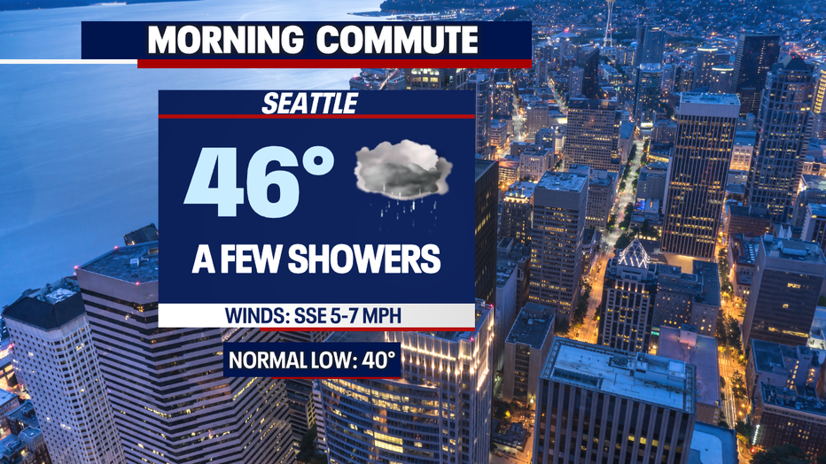
Overnight temps will drop into the low to mid-40s. The metro area sees temps during the morning commute near 46 with a slight chance of a sprinkle.
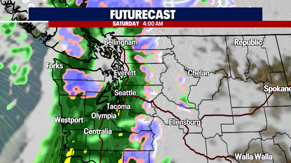
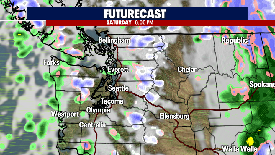
A cold front arrives late Friday night into early Saturday. This system will deliver heavier showers very early Saturday before tapering off to just scattered by the afternoon.
Don't be surprised if some of those heavy showers wake us up in the middle of the night. 4am looks pretty sloppy at this point.
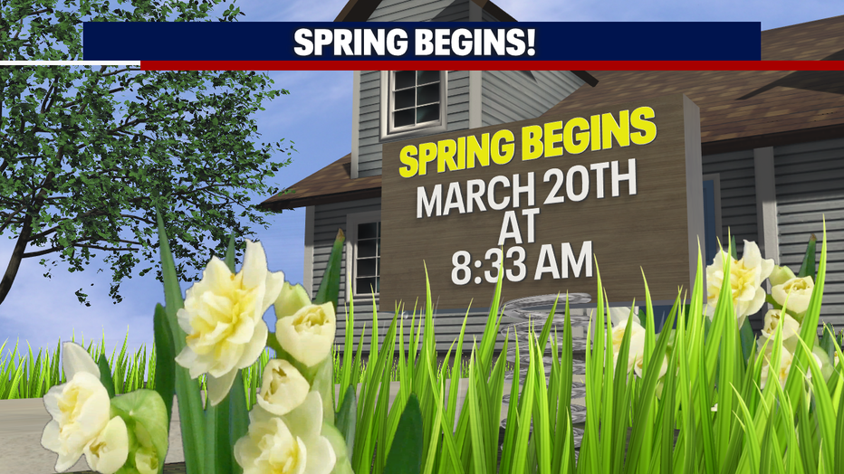
Our official spring season kicks off at 8:33 am Sunday morning, where most of us will experience scattered showers at times. Look for a few pops of sunshine in between light showers.
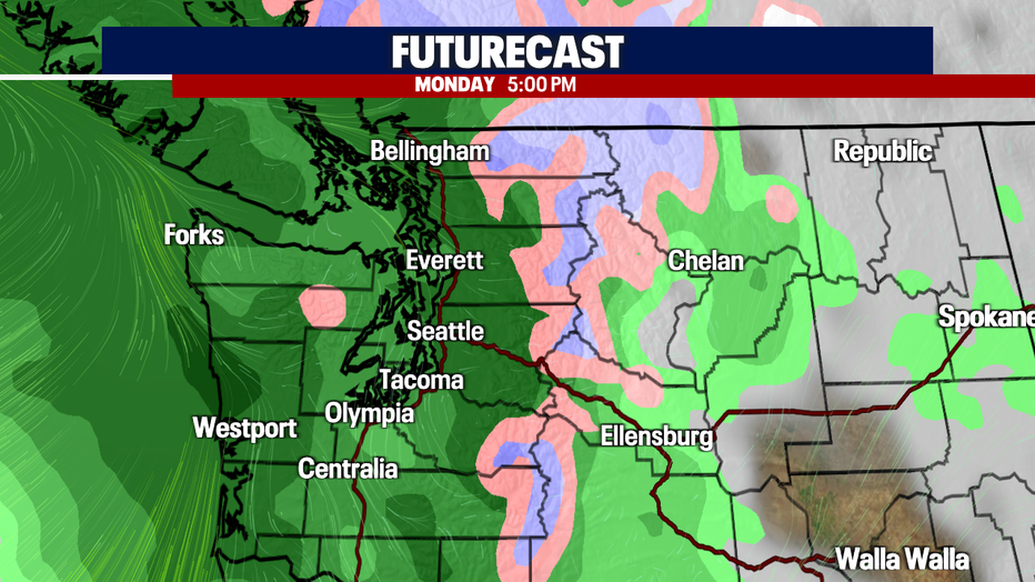
Look for a brief dry break Sunday afternoon into the evening hours ahead of a warm front that will bring back heavy rain at times Monday.
As we push into Tuesday, we're forecasting more sunshine with highs potentially jumping well above normal into the low 60 as a ridge builds into the region.
At this point, models are looking to keep drier conditions for Wednesday and Thursday with highs in the mid to upper 50s, but we may see a weak front pass through that could spray a few showers Wednesday afternoon. Stay tuned!
Have a great rest of the week everyone! ~Erin Mayovsky, FOX 13 Forecaster
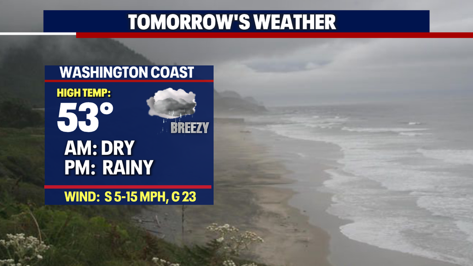
*Beach Forecast
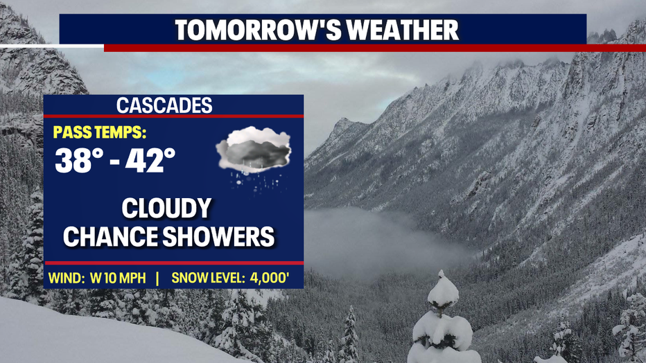
*Mountain Forecast
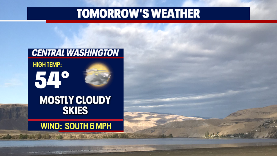
*Central WA Forecast