Freezing fog returns overnight!
SEATTLE - As the temperatures drop, freezing fog once again, becomes a concern. Visibilities will continue to reduce tonight and become dense at times. Use caution if you're commuting tonight or tomorrow morning. Overnight lows will range between 30-34F for most of the lowlands and foothills.
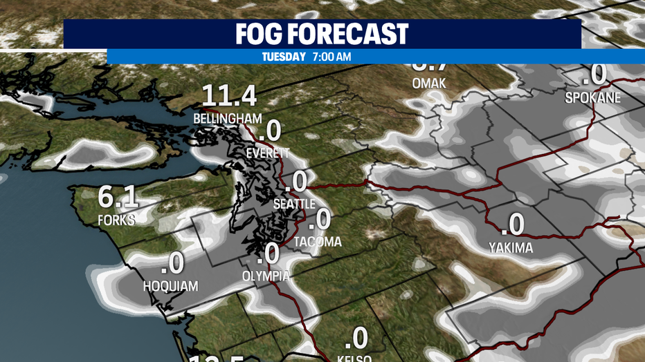
Time stamp above is 7:00 am. Expect Freezing fog along the foothills and up in the passes. This doesn't look like it'll break until the late morning and early afternoon hours.
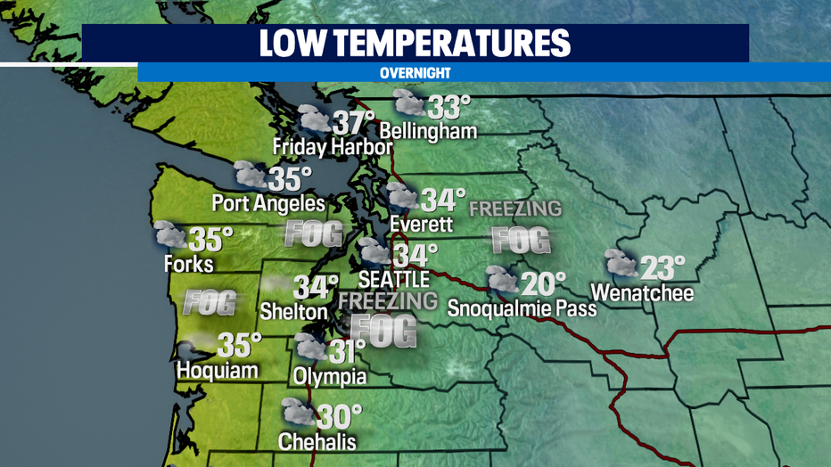
Not only will we be dealing with freezing fog/fog and cold temperatures tomorrow morning in addition to the cloud cover rolling. This is because of an approaching frontal system. We'll start with some light showers Tuesday evening along the Coast. It'll be spotty and light as it tracks eastward.
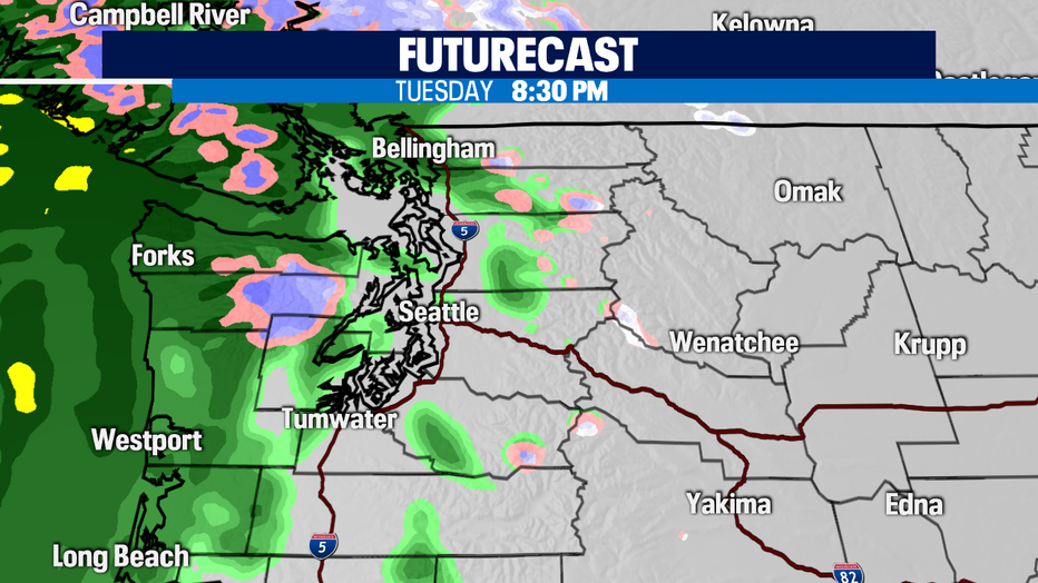
We'll have waves of light and steady rain throughout the night. Pockets of moderate/heavy rain will be embedded and hit at times. This includes the lowlands, foothills and along the coast.
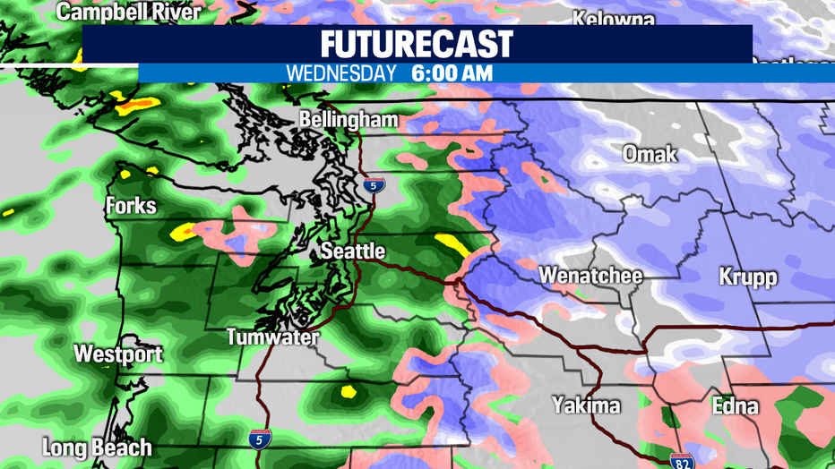
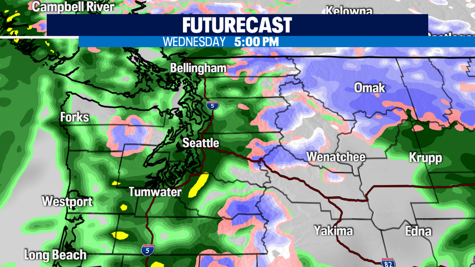
As the rain accumulates, expect ponding and minor flooding on Wednesday. Rain totals will range between .5"-1.25" with this system and it'll continue all morning, afternoon and evening long.
We'll finally have a nice lull in the wet weather pattern on Thursday. The last day of the year! Sun breaks will be possible, but the cloud cover will remain throughout the day.
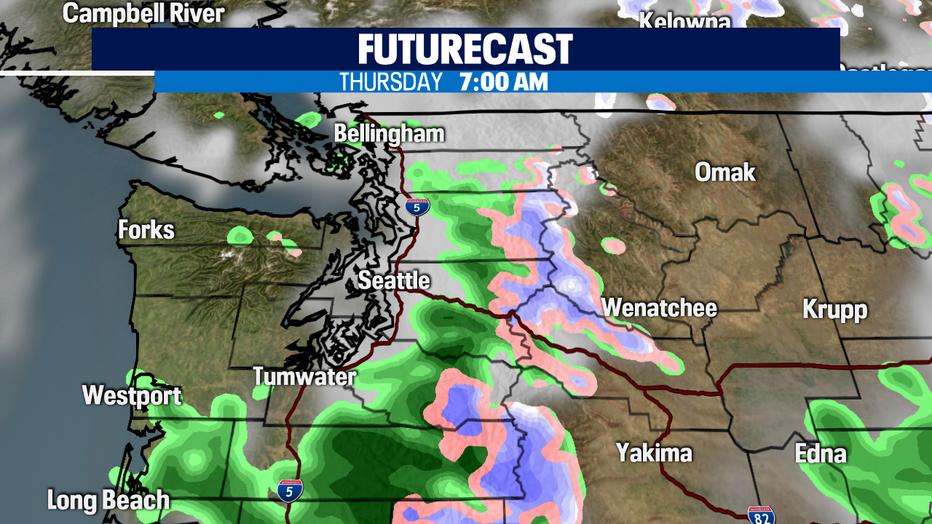
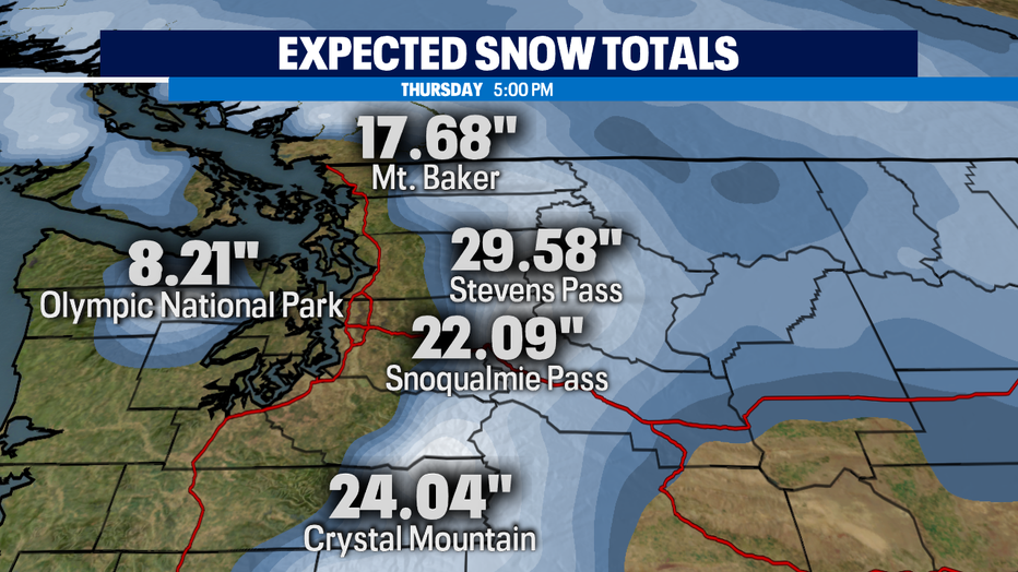
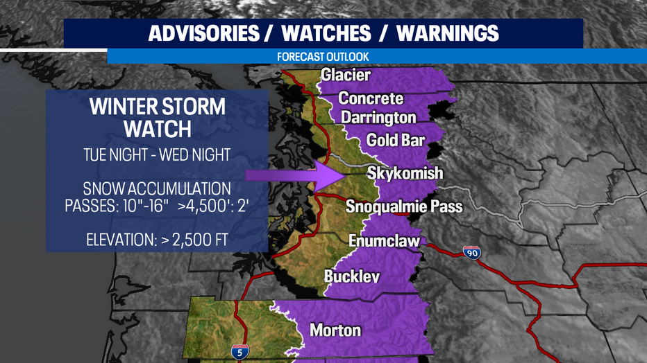
Once the leading edge of the system arrives tomorrow evening, a Winter Storm Watch will go into effect. Snow levels will drop as low as 2,000' but the watch includes areas above 2,500'. Snow totals will range between 10'-24" by Thursday morning. If you are commuting in this area during the storm, use caution.
There's a lot of weather action this week! Stay vigilant and we'll keep you posted on the latest.