

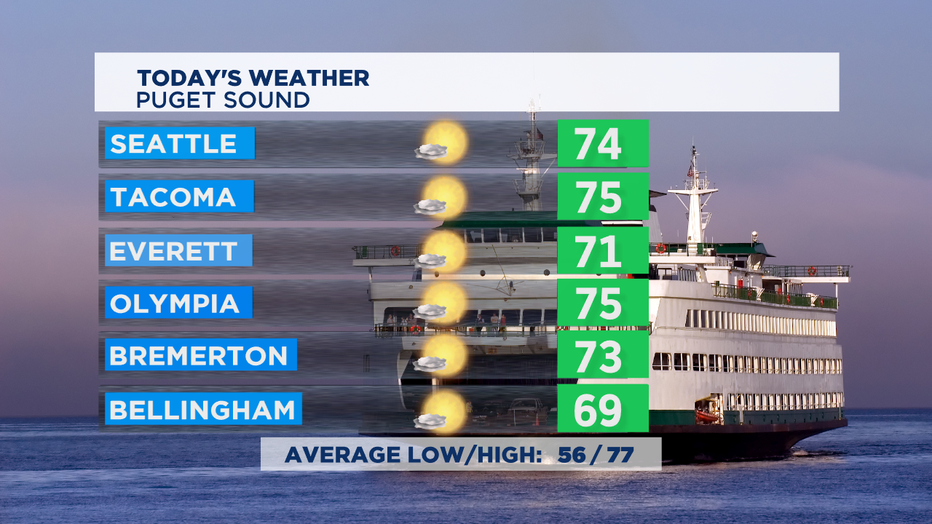
Forecast: Back to the 70s, for now
SEATTLE - Another beautiful day in the Pacific NW-- we're just turning down the temps just a tad today. Cooler air off the Pacific Ocean delivered some clouds overnight to help keep our temps today in the comfortable 70s. Temps will be about 5-8 degrees cooler than yesterday and a bit below the normal high temps of 77.
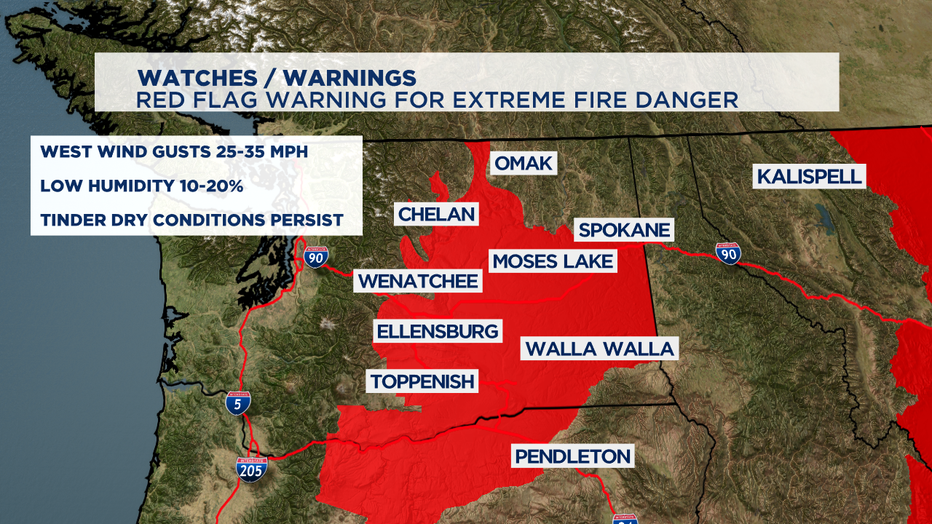
East of the Cascades we've got some hot temps and tinder-dry conditions. Increasing winds will dry out vegetation even more and that increases the fire danger a lot. We've got a Red Flag Warning for a huge part of Central and Eastern WA. People cause an overwhelming number of our wildfires-- so practicing fire safety is super important this time of year.
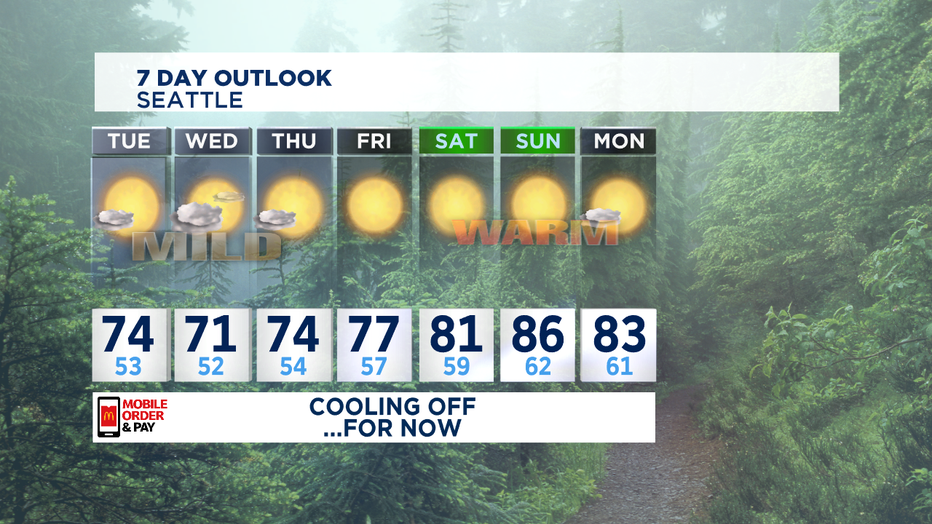
This weather pattern with high-pressure off-shore and the storm track just a bit to our north means we'll stay dry-- just have morning clouds and perhaps a few areas of drizzle the next few mornings. Nice sunshine still emerges each afternoon. I think we'll be in the mid to low 70s until Thursday.
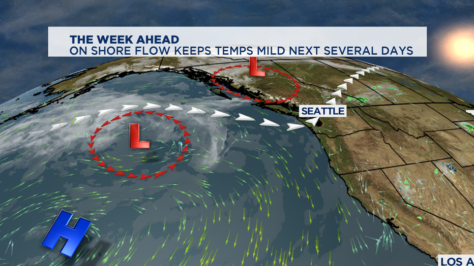
Then high pressure strengthens and we'll see a big weekend warm-up. We'll likely see several days in a row in the 80s. The warmest day out of the next 7 looks like it will be Sunday when we end up in the mid 80s. A few spots in the foothills and South Sound could end up in the low 90s.
At SeaTac, we've only seen 2 days of 90+ temps so far this summer. A typical summer season has 4 of those kind of hot days in the Seattle area.
-Tim Joyce