

Foggy, wet, and breezy Sunday, chilly temperatures on the way
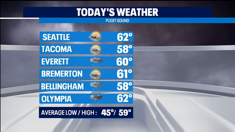
SEATTLE - There are areas of fog this morning and light rain around a rain shadow in central and south Puget Sound that's maintaining dry conditions from Everett down to Seattle and as south as Tacoma. The coast is also reporting light rain. High temperatures will be near the norm in the upper 50s and lower 60s.
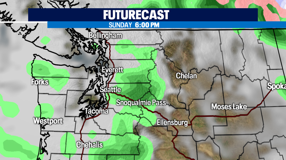
We'll hang onto the rain shadow through the rest of the morning, but by the afternoon, a convergence zone will develop in King and Snohomish Counties, bringing rain later today so keep the rain gear with you even though you're not seeing rain this morning.
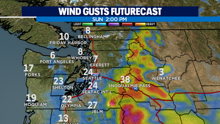
Elevated south and southwesterly gusts of 20-25mph will continue through the mid-afternoon hours.
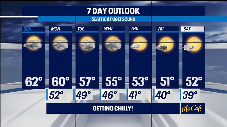
Lingering rain is possible Monday morning in the foothills and north, but otherwise, we'll dry it out throughout the day. Another system arrives on Tuesday bringing another round of rain. Morning showers are possible Wednesday and by the afternoon, skies will be partly sunny. Thursday will be your best bet of seeing dry conditions and a sunny sky, before a stronger system arrives by the end of the week, bringing rain on Friday and causing our temperatures to take a dive! It's about to get chilly with highs in the lower 50s, overnight lows in the upper 30s and lower 40s by the end of the week and into the first half of the weekend!
Have a great day!
-Q13 Meteorologist Grace Lim