Fantastic summer time conditions dominate our forecast!
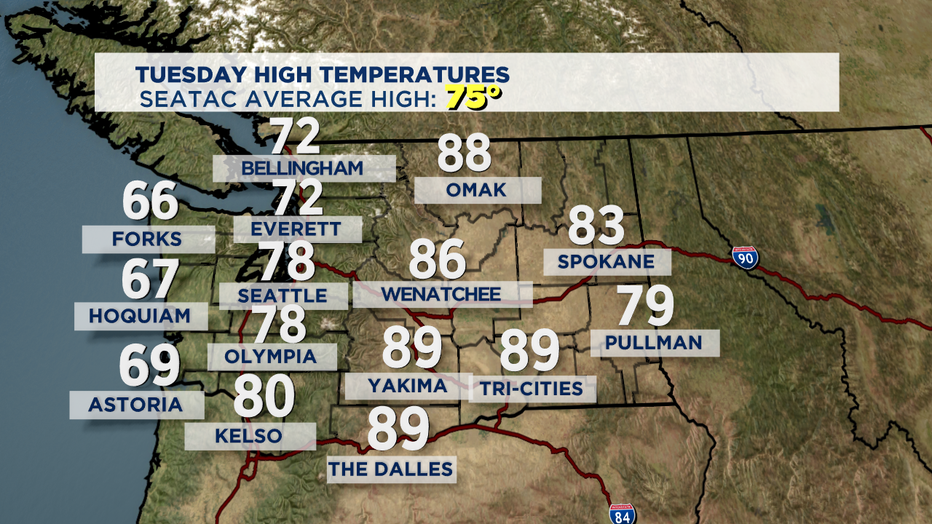
SEATTLE - I don't know about you all, but I'm loving our forecast! I'm more of a mid to upper 70s person and that's exactly what we're seeing around the region. Tuesday highs landing right in that sweet spot of just a few ticks above the norm for this time of year at 75. Some spots to the south finding themselves a few degrees warmer into the low 80s.
So, if you're into this forecast you'll like the rest of the week for sure! Plenty of summer sun and warmth, which is usually our August trend. The coast will continue to see morning clouds and patchy fog for the next couple of days. Inland expect a few clouds finding their way into the forecast, especially places like Bremerton, through the Strait and the North Sound. If clouds end up developing around Puget Sound don't worry they will peel back pretty quickly. Highs will hang near our seasonal average or slightly warmer.
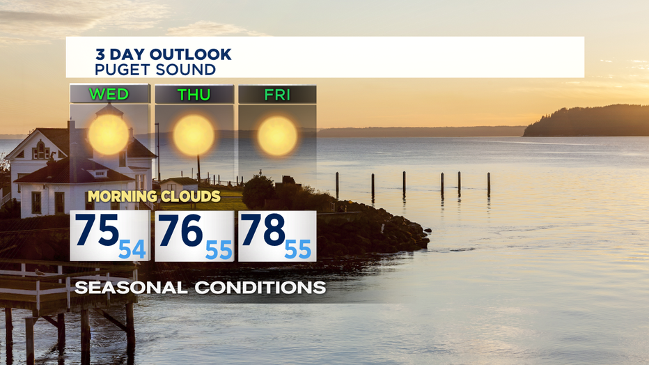
As we approach the week expect more of the same, although there is a chance of a few showers falling to the north, mainly in the Cascades as a disturbance moves through British Columbia late Friday night into Saturday. Otherwise most models have us staying dry with temps falling off a degrees or two, but still near normal.
Have a great week all! `Erin
________________________________
- Erin Mayovsky, Q13 Forecaster
Twitter: @ErinMayovsky
FB: /ErinMayovsky
Instagram: @ErinMayovsky
________________________________