

Drying out briefly before active weather pattern returns
SEATTLE - We're drying things out around Western Washington this morning.
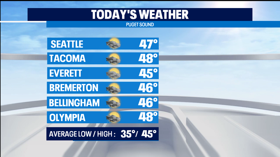
Lingering showers will last until the mid-to-late morning. Some breaks of sun are even possible this afternoon. High temps near 50. Which is warmer than our normal high temp, which today just ticked down to 45 degrees -- the coldest average high we see all year long.
DOWNLOAD THE Q13 WEATHER APP FOR LIVE INTERACTIVE RADAR AND SEVERE WEATHER ALERTS.
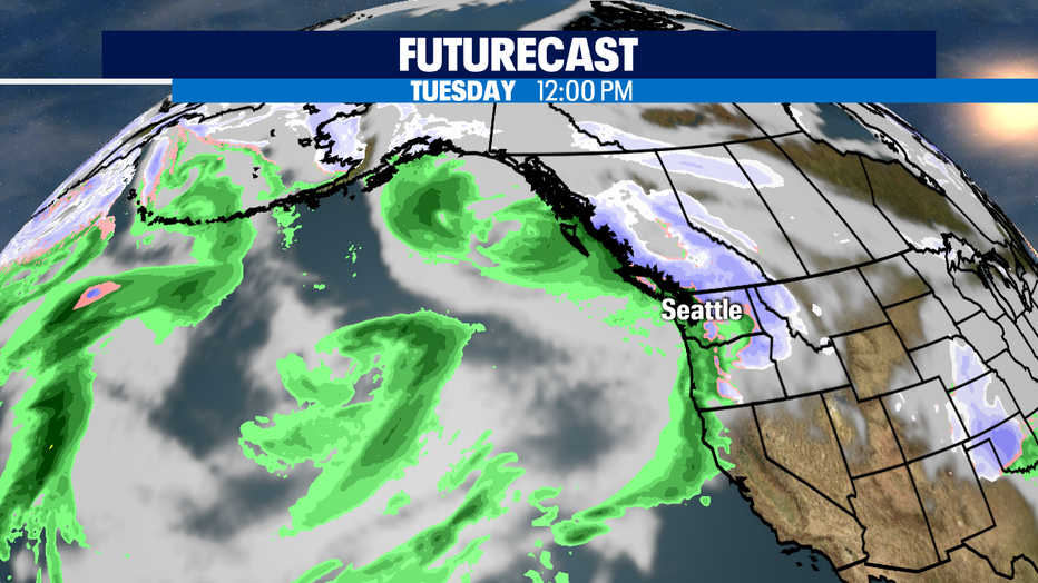
Tonght the rain returns and more snow for our mountain passes. The precipitation will begin to taper off by the late afternoon. But, breezy conditions will persist into Wednesday. Winds will be below advisory criteria. This is the first of many weather systems that will roll through the Pacific NW. We'll see breaks in between about 12-20 hours, but it's a pretty active weather pattern.
Snow levels will be about 3,000-4,000 feet all week -- so our mountain passes and resorts will get hit with more snow every weather system that rolls through. Each one could deliver 5-10" of new snow, so tons piling up at our higher elevations.
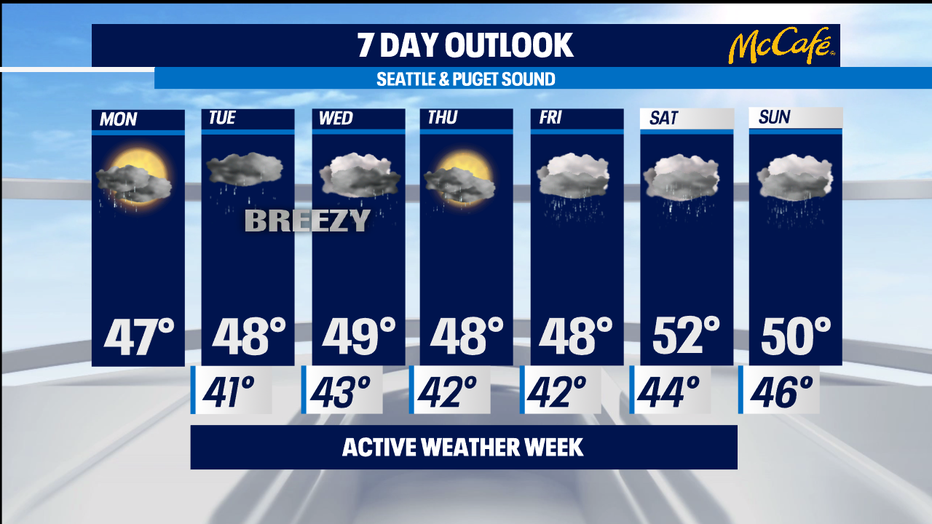
The wetter weather pattern is also a warmer weather pattern. Afternoon highs stay 5-8 degrees above normal and overnight lows look to be in the 40s instead of the seasonal 30s. -Tim Joyce