Dry spell continues with beautiful summer weather for Puget Sound. Fire danger high for Eastern WA.
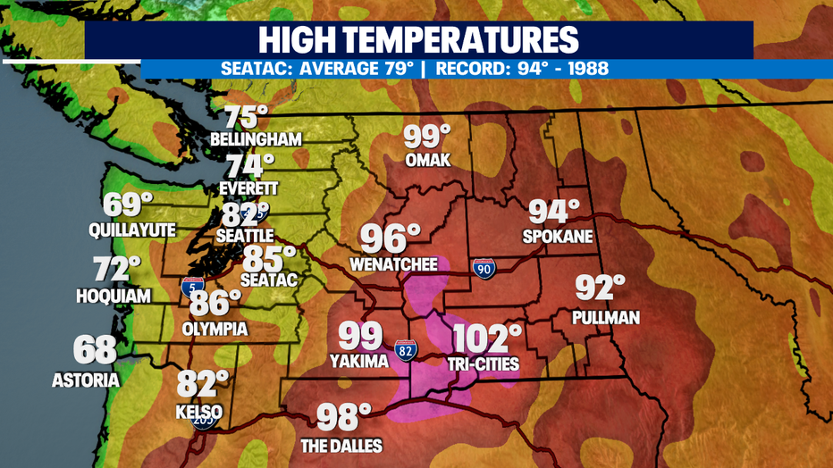
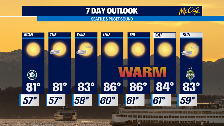
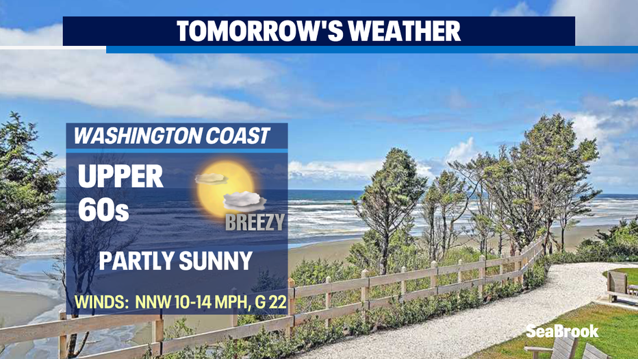
Seattle - Another gorgeous day for Western WA. Highs landing in the low 80s for the metro with mid to upper 60s along the coast.
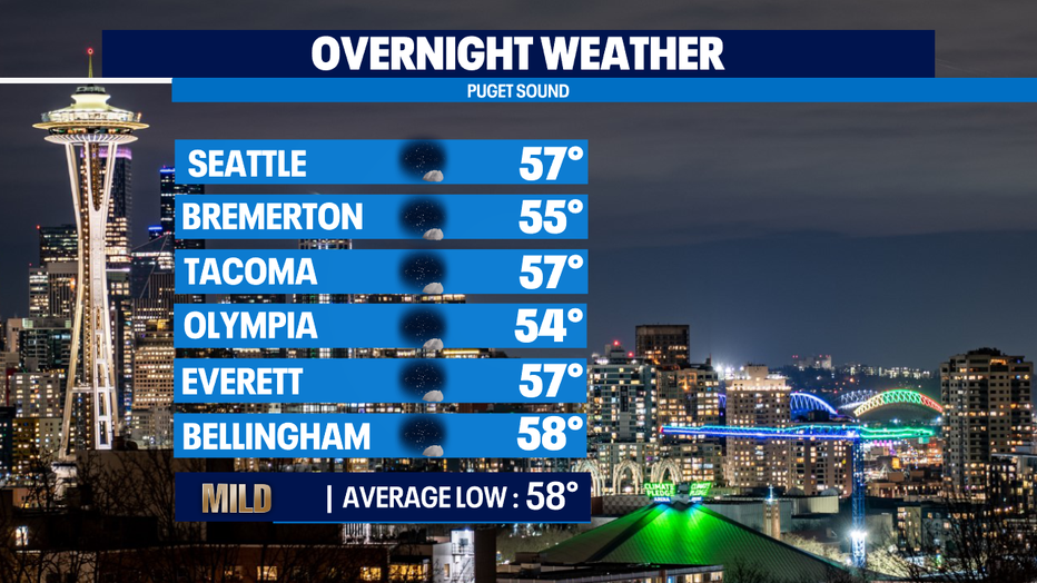
Tonight, overnights will fall off into the mid to upper 50s near normal for this time of year. Skies look mostly clear for stargazing.
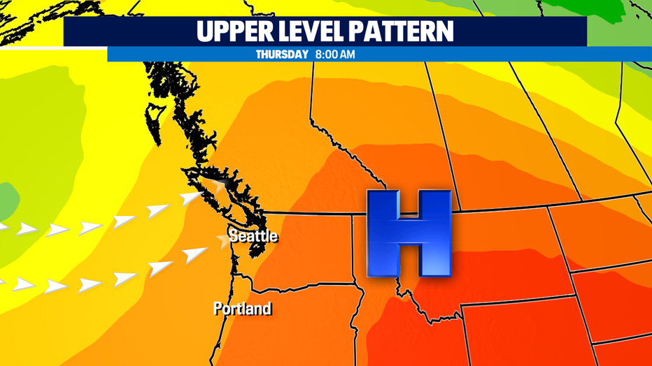
The Northwest will continue to see dry weather through the next week as we close out the month of July. Highs will remain above average for this time of year in the low to mid 80s through Tuesday. This all thanks to an upper ridge hanging out over the region. By Wednesday, the ridge will strengthen and push more into Western WA bringing highs up a couple degrees into the mid to upper 80s.
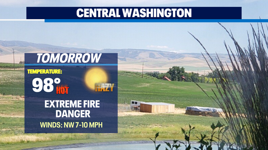
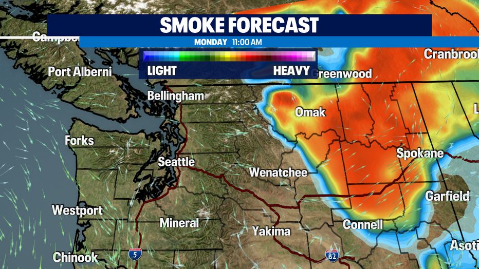
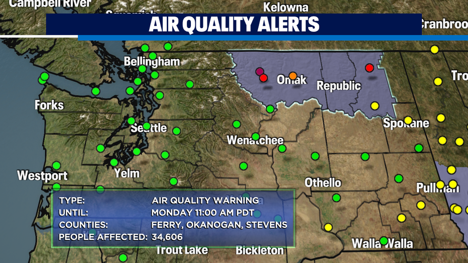
While folks west of the Cascades are enjoying a very pleasant summer that is not the case east of the mountains where fires continue to burn creating unhealthy to hazardous air quality. Alerts remain in effect at least through the start of the workweek and most likely beyond.
As temperatures warm through the week some areas south and east of downtown could see highs climb into the low 90s. Make sure to keep the sunscreen and sunglasses handy while staying hydrated!
Have a great night all! ~Erin Mayovsky, Q13 Forecaster
*Beach Forecast
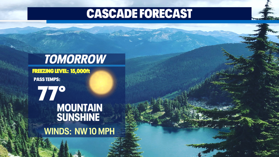
*Mountain Forecast
*Central WA Forecast