

Cooling off for the weekend
SEATTLE - Some heat and haze on our Friday around Western Washington will be tempered a bit from a marine push that will deliver some cooler weather for most of the Labor Day Holiday weekend. We ended up in the low 80s around Seattle. It was our 38th day of 80 or warmer so far this year. In a typical year, we only see about 26 of those type of warm days.
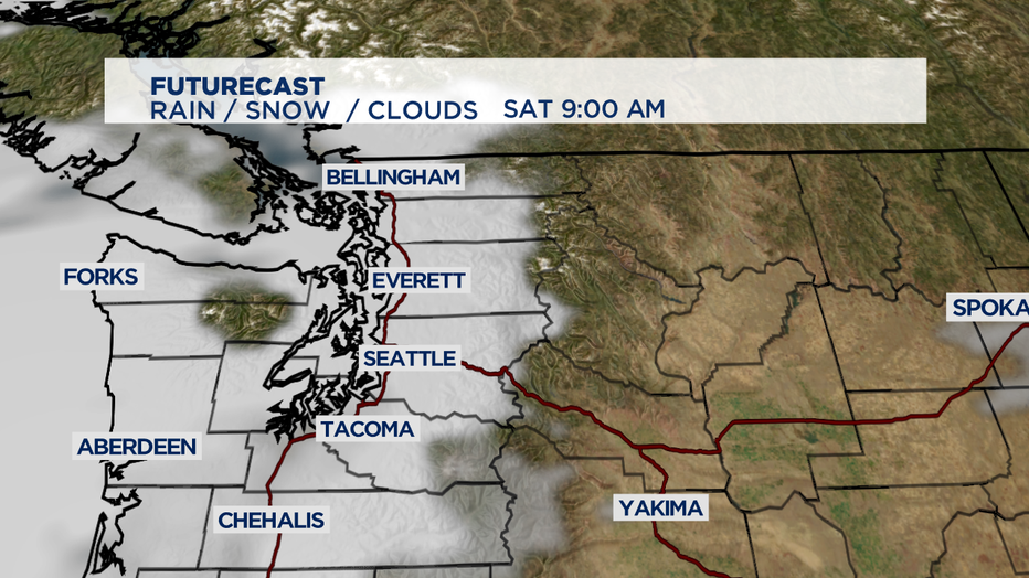
Futurecast shows us that we'll see those westerly and southwesterly winds push deliver some marine layer clouds that should last most of the morning-- and a few spots the early afternoon too.
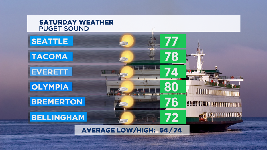
That will help cool us down into the upper 70s, with only a few spots in the South Sound getting up to around 80. We'll see pretty stubborn clouds along the coast and only a few spots on the Central and South Coast getting to 70 degrees. East of the Cascades, it'll be hazy, smoky sunshine with some poor air quality near active wildfires like the Evans Canyon Fire. Gusty NW winds will pick up in the afternoon with possible gusts between 30-35mph.
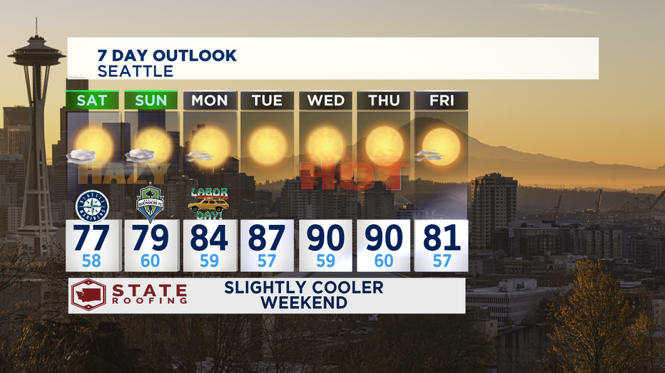
Once the weekend is over, high pressure will build in to deliver some more summer sunshine and even some sizzle towards the middle of the week. We've seen 3 days so far of days 90 or warmer. A typical summer season sees 4 of those hot days. This week could deliver days number 4 and 5 of warmer than 90. At this point, it appears we'll cool off nicely back to the comfortable low 80s for next weekend.
-Tim Joyce