Seattle weather: Cooler Wednesday with rain showers on Thursday
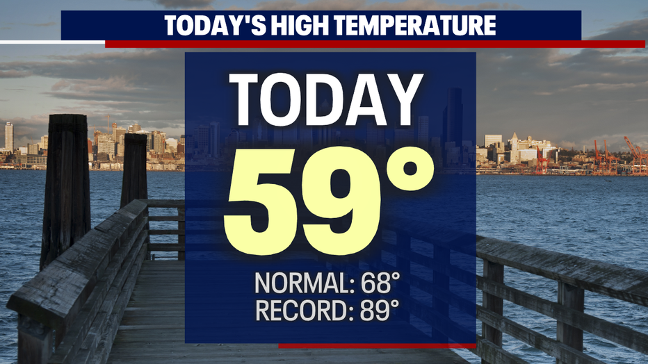
SEATTLE - After a dry start Tuesday, showers moved in just in time for the evening commute with highs cooler than average again. Today we hit a cool 59 at the airport-- that's nine degrees shy of our daily average for this time of year.
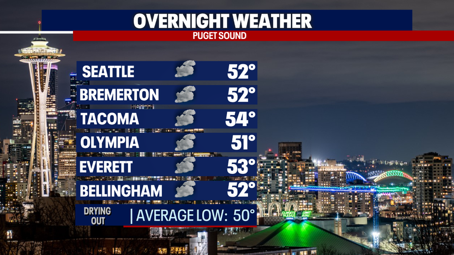
Overnight temperatures will hang on the warmer side of normal in the low to mid-50s.
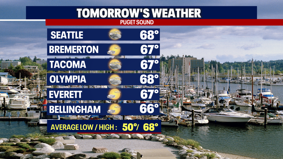
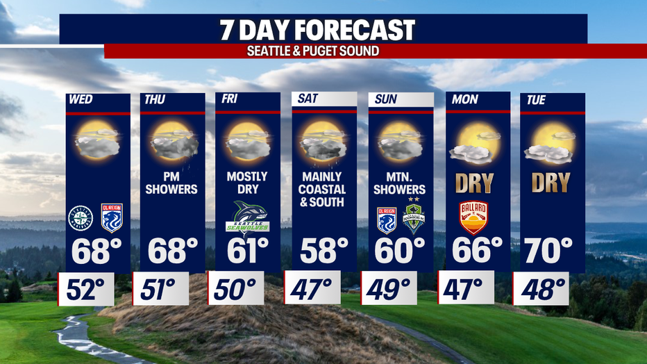
Highs will top out tomorrow near normal. We're forecasting partly to mostly cloudy skies with temps in the mid to upper 60s up and down the I-5 corridor.
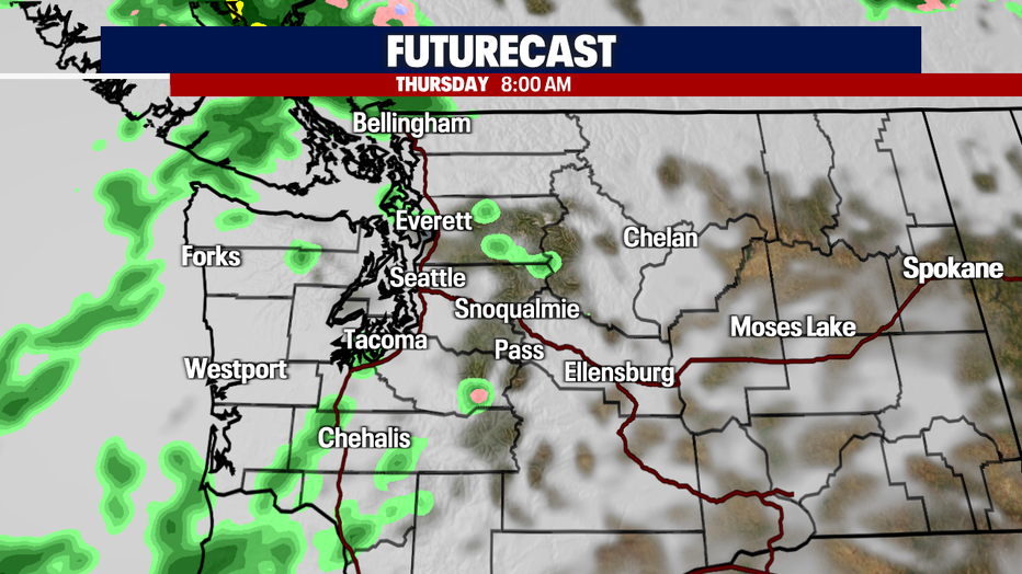
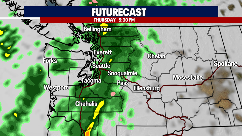
Thursday starts out mainly dry with a few scattered, light showers. A cold front will move through later Thursday delivering widespread showers for the evening commute. And we can't rule out the chance for an isolated thunderstorm as well.
Highs land in the mid to upper 60s for Thursday. Precipitation will linger into the start of Friday before drying out.
Our back-and-forth spring weather continues as we close out the work week. We get going Friday with a few left-over showers, otherwise, we look mainly dry under mostly cloudy skies. Highs cool into the low 60s.
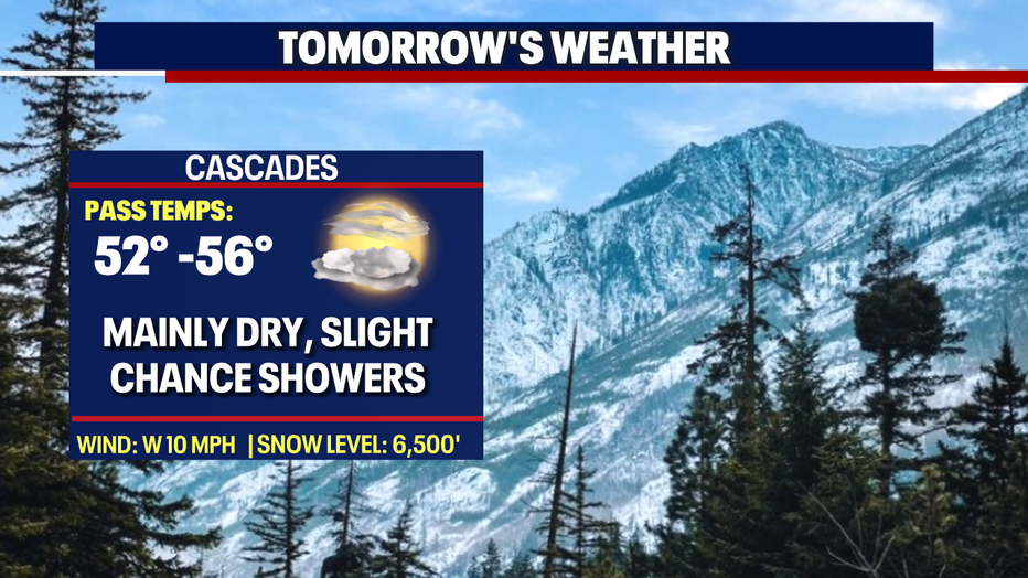
A weak low Saturday sends widespread showers inland, but not everyone will see rain. Most shower activities will hang along the coast, the Olympics, the South Sound, and the southern Cascades. Some showers will linger into Sunday, mainly over the mountains before drying out.
Highs will plummet into the upper 50s to near 60 both days.
Weak ridging builds back in as we start the work week. Highs will rebound into the mid to upper 60s with a chance to hit 70 by Tuesday. Stay tuned!
Have a great night all! ~Erin Mayovsky, FOX 13 Forecaster
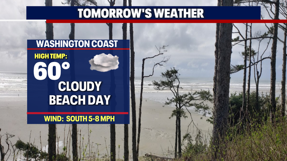
*Beach Forecast
*Mountain Forecast
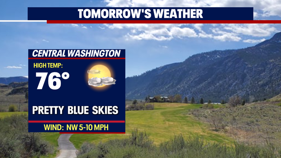
*Central WA Forecast