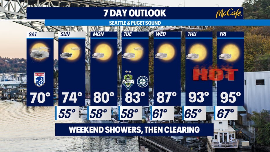
Cool and showery today, then heat starts to kick in to gear with 90s coming our way next week
SEATTLE - Happy Saturday all!
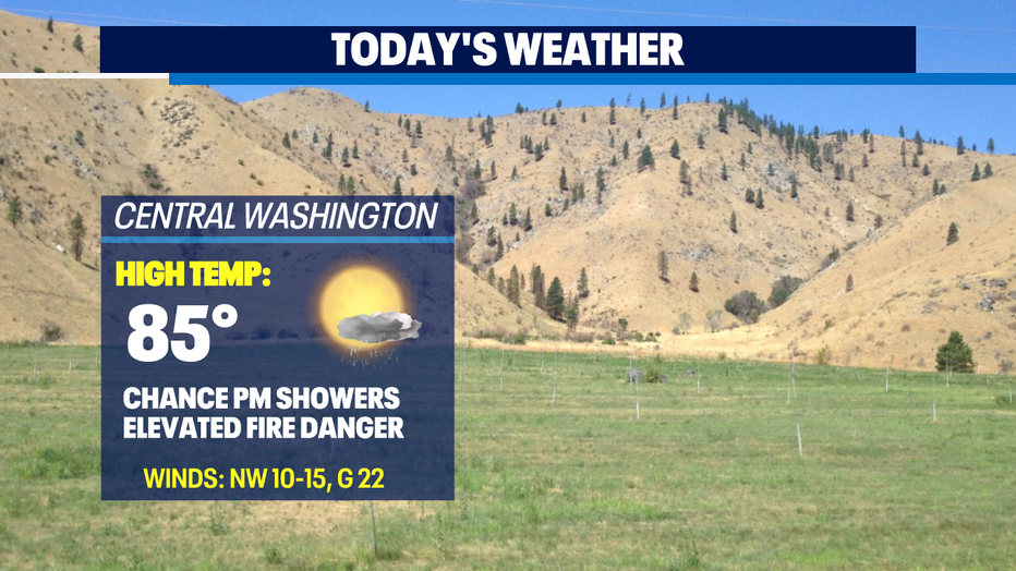
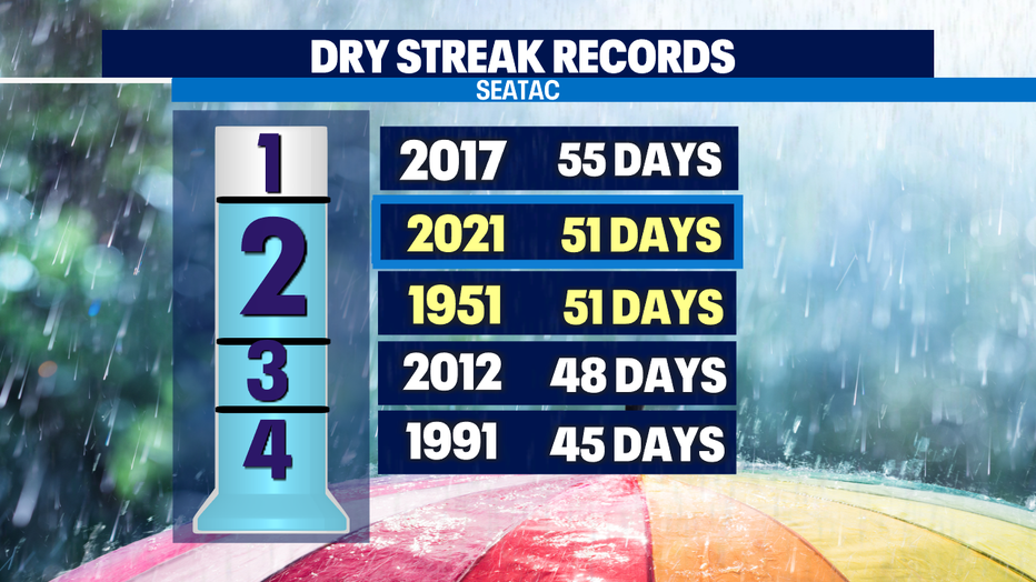
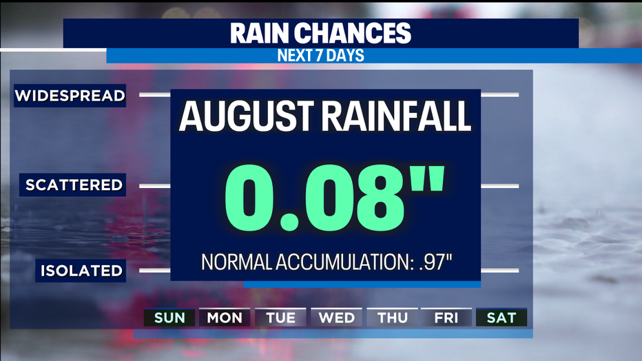
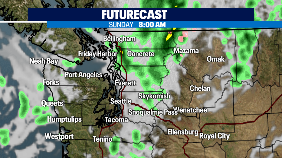
Look for light, scattered showers off and on today across the region. Most of the rain will hang over the mountains. So far this month we've seen just a tad in the rain bucket at SeaTac…and that's just enough to end our long dry stretch. Since our late rain Thursday night that puts us tied in the #2 spot for dry streak records.
Normal monthly precipitation for the month of August is 0.97".
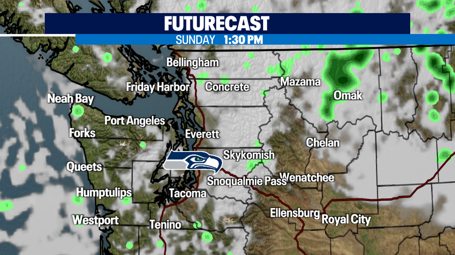
Showers will hang around tonight and through the overnight hours into early Sunday morning before starting to wrap up. Look for partly sunny skies by mid-afternoon with highs warming into the mid 70s, still cooler than average.
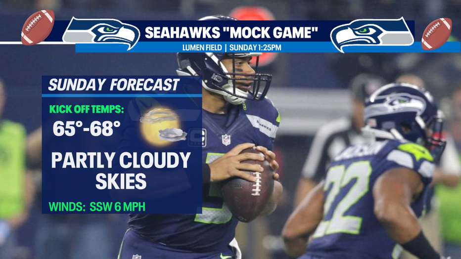
The good news… showers will clear out just in enough time for the Seahawks to take the over Lumen Field tomorrow as they play their annual "Mock Game" in front of fans. Tickets are still available!
As we start the work week, we'll warm up a several degrees each day! Monday lookS for mostly sunny skies with a high just above the normal at 80. The increasingly warm temps will continue all thanks to a nice ridge settling in over the Pacific. This ridge will build and slide east over the region and as it does our highs will start to really jump up. By late week we may see temps in the mid 90s! Stay tuned!
Have a great weekend! ~Erin Mayovsky, Q13 Forecaster
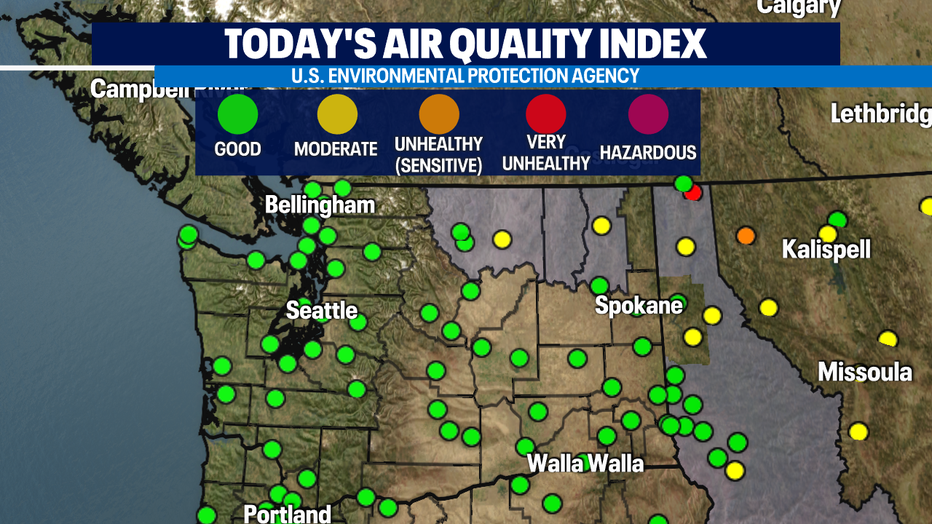
*Fire Weather still elevated for Eastern WA, but the good news is air quality has improved some.