Cool and showery conditions move into the Northwest through the holiday weekend
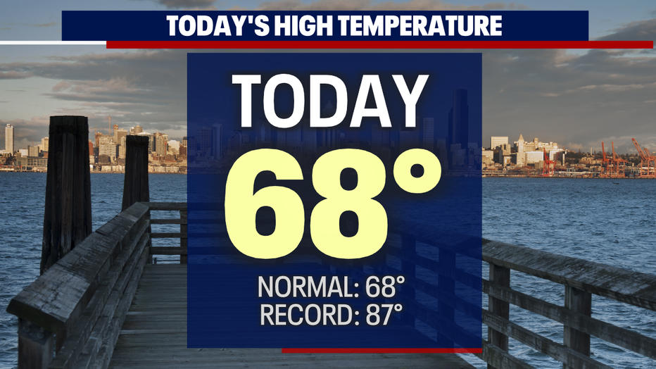
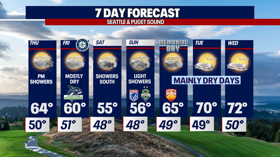
SEATTLE - A beautiful day across the region with highs warming into the upper 60 to low 70s.
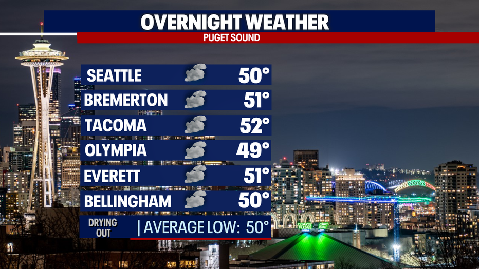
Overnight temperatures will cool to near-average, landing in the upper 40s to low 50s under mostly cloudy skies.
Change is on the way as we cruise into the holiday weekend. The high that was blocking out most systems is breaking down and sliding to the SE opening the door for the next cold front spread showers across the area.
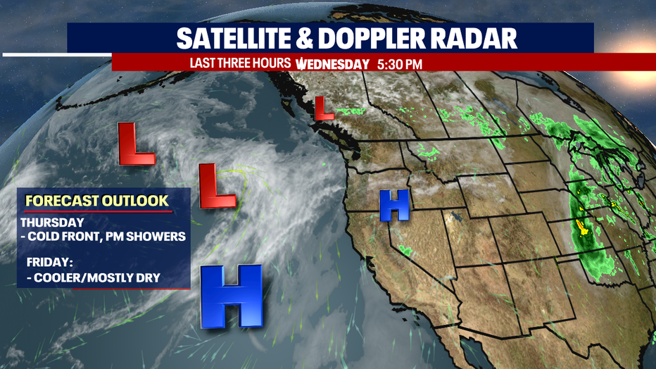
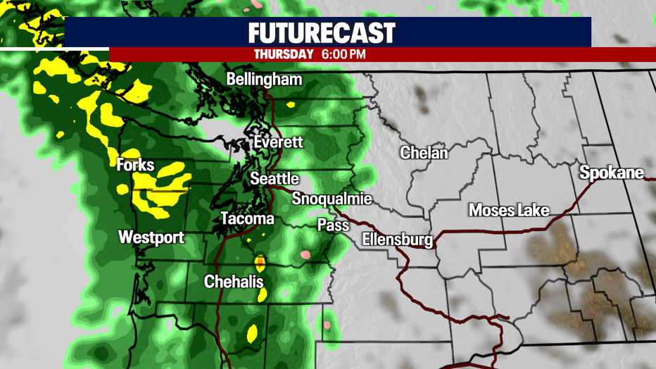
Thursday starts out mainly dry except for a few showers along the coast. As we jump to lunchtime showers march in over the Olympics, and by 6 p.m. we'll see widespread rain over the Sound. Highs drop into the low to mid 60s.
Rain will turn to lighter showers as the system pushes east over the Cascades. By late Thursday into early Friday showers will start to diminish leaving us with a mostly cloudy day. Highs cool to near 60.
Another system slides in Saturday and will linger into Sunday. Temperatures will drop too with most areas seeing about a 10-13 degree fall from average.
We expect the heaviest rain Saturday to develop south of Seattle with the metro area seeing just light showers if any. At this point the North Sound stands to stay dry, but highs will suffer.
By Memorial Day we start to dry out and warm up as a ridge off the coast will help push us back to into the normal zone. Monday we're going mostly cloudy and 65.
Tuesday and Wednesday could warm into the low 70s under partly cloudy skies. Enjoy!
Have a great night all! ~Erin Mayovsky, FOX 13 Forecaster
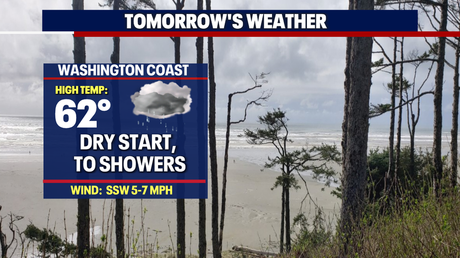
*Beach Forecast
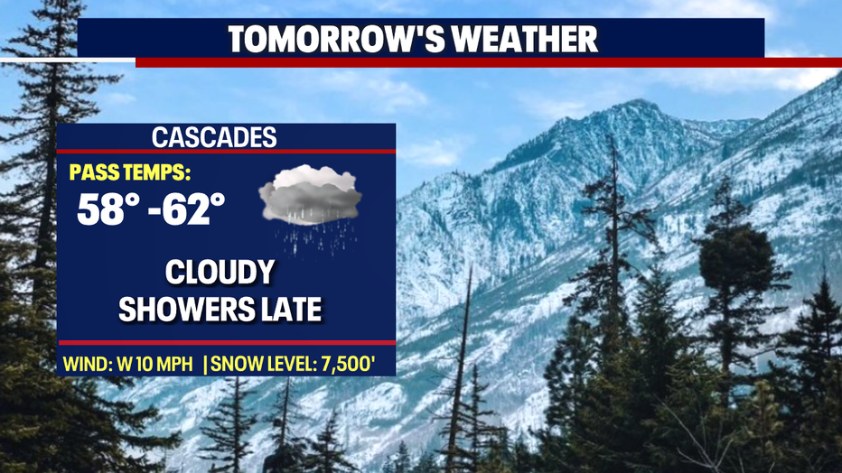
*Mountain Forecast
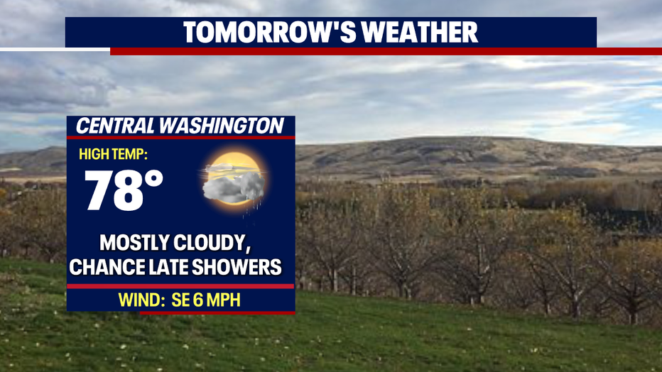
*Central WA Forecast