

Continued chilly with a chance of (snow) showers
SEATTLE - Our cold snap continues with temps about 5-8 degrees below normal for this time of year.
Those hoping for snow, however, are mostly out of luck. Two big factors at play here: temperature and available moisture. While the mornings are cold enough for snow, the afternoons are not-- except for the foothills and mountains. Colder air is also drier air, so not a whole of available moisture to deliver all that much precipitation.
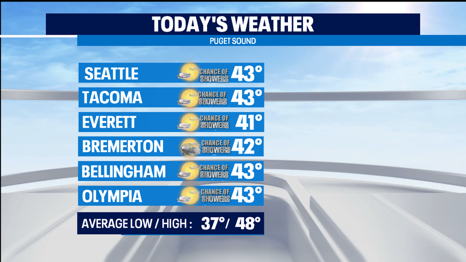
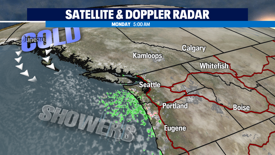
Today the showers mostly hang out along the coast, but a chance of showers are possible around Puget Sound. Tonight areas where skies clear will see temps again down in the freezer again. Most of us getting down into the upper 20s and lower 30s to start out Tuesday. Most of the Tuesday precipitation looks likely to be in the afternoon when temps will be in the mid to low 40s. Snow levels will be pretty low (about 500-1000') through the middle of the week. So, some of the showers in the early mornings or for higher hills could end up being some brief snow showers with pretty minor accumulations of an inch or less to none at all.
We do see a wetter weather system heading our way towards the end of the week. Timing wise it looks to start as all-rain for the lowlands and stay as an all-rain event as overnight lows warm back towards normal in the upper 30s.
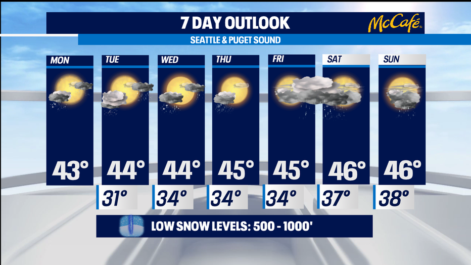
Afternoon highs get back towards seasonal as well. Mountains get some nice snow out of the weekend weather system. -Tim Joyce