

Coming June heat wave looks to shatter some all-time records
SEATTLE - Today is the calm before a huge warm up that will likely shatter all sorts of heat records around the region.
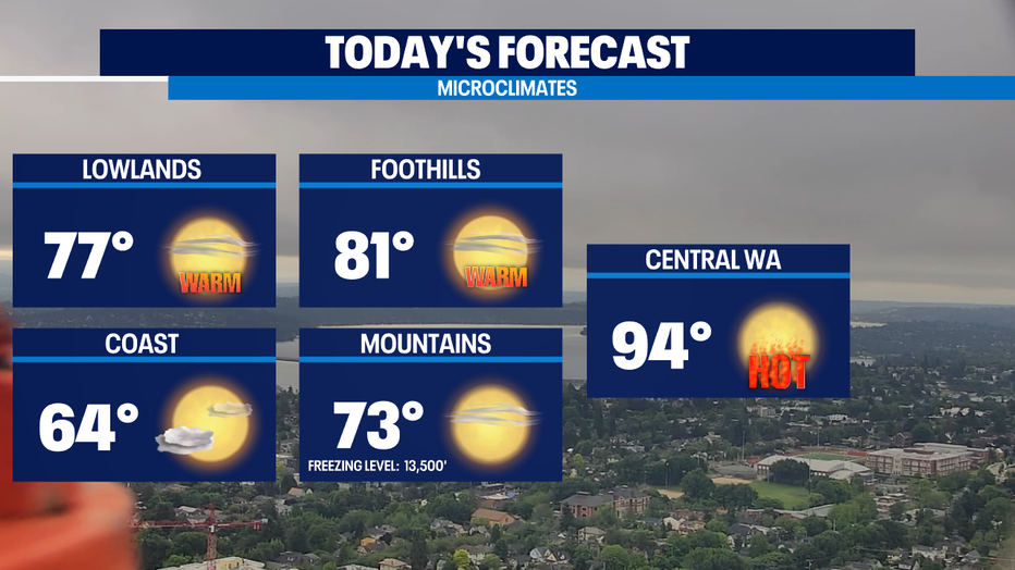
This morning, marine layer clouds have advanced even farther inland than Tuesday morning. We call that "nature's air conditioning" in these parts. Morning clouds will break for afternoon sunshine. As a result Puget Sound lowlands will be right around yesterday's high temps in the mid to upper 70s -- if not a couple degrees cooler in a few spots.
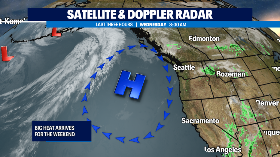
Tomorrow we will start our ascent into some pretty hot weather by the weekend. High pressure offshore will become centered in a sweet spot in SW British Columbia and be perfectly placed to drive in downslope warming winds into the region coming this weekend.
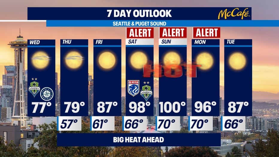
Thursday will be near 80 in the afternoon, while Friday looks to be up in the 85 to 90° range. The NWS has issued an Excessive Heat Watch which begins on Friday and lasts into Monday.
This will become an excessive heat warning as we get closer to this time period the area of concern will be from the Canadian border all the way deep into Oregon and east across the state and includes all of Western Washington with the exception of our coastal areas.
The Q13 weather team has issued Weather Alert Days for Sat/Sun/Mon.
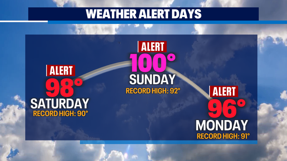
This period will have some of the hottest temps of the year as the mercury goes into the 95 to 100° range each afternoon. Seattle metro has only achieved triple digit temperature readings a few times since record-keeping began in 1894. For a region unaccustomed to such heat, this will be a dangerously hot stretch of weather.
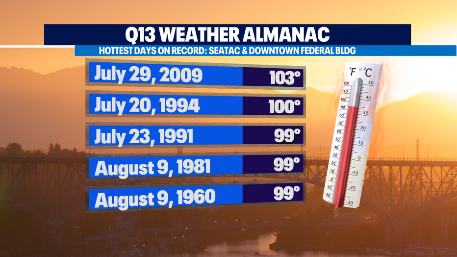
Normal for this part of June is 73. Overnight lows will be uncomfortably warm as well, like 65 to 70° for most of us around Puget Sound. Normal lows are around 53. If we end up hitting 100 at SeaTac this will be only the third time since 1894 we've seen triple digit heat in Seattle. And we've never seen this kind of heat this early in the summer season either. The hottest ever June day is 96 degrees.
This weather pattern does not include any precipitation for the foreseeable future either so fire risk will increase.
Our water temperatures will remain very cold for individuals looking to beat the heat. Puget sound water temperatures remain in the low 50s, Lake Washington has warmed to only 70 so far, and some of our snowpack fed rivers will be only in the upper 40s/low 50s. Practicing fire and water safety will help save lives. -Tim Joyce
Q13 FOX WEATHER RESOURCES:
DOWNLOAD: Q13 Weather and News Apps
WATCH: Forecast and Radar
READ: Closures and Delays
CHECK: Latest Weather Alerts and Live Traffic Map
INTERACT: Submit your Weather Photo
FOLLOW: Lisa Villegas, MJ McDermott, Tim Joyce, Erin Mayovsky, Grace Lim and Scott Sistek