Seattle weather: Comfortable weekend, heating up next week
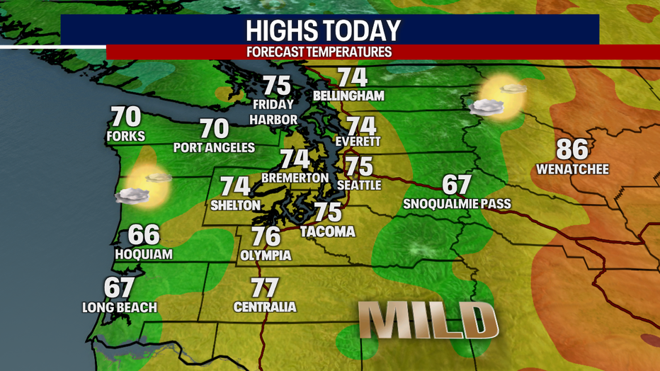
SEATTLE - A low pressure system is moving onshore this morning bringing in thicker morning clouds and cooler afternoon temperatures. Areas on the coast and Olympic Peninsula are also seeing some light showers or drizzle to start the day.
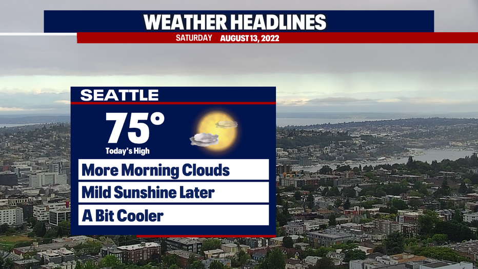
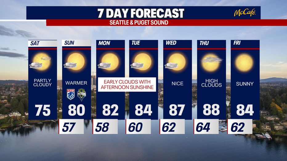
It will take longer for the clouds to evaporate today, but Western Washington will get back to sunshine Saturday afternoon with very comfortable high temps.
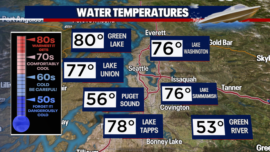
Water temperatures this weekend will stay nice and comfortable in many of our area waterways. Remember to always wear a lifejacket, because you never know what's going on under the surface.
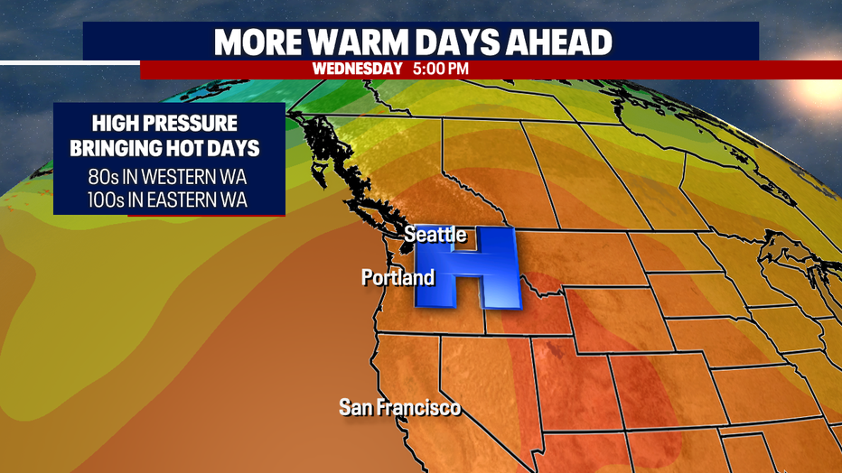
The cooler weather won't last long. A ridge of high pressure will build over the Pacific Northwest by midweek. Wednesday and Thursday, temps will climb into the upper 80s in the Puget Sound area and over 100 degrees east of the Cascades. Overnight lows will be warm midweek as well, in the mid 60s.
Temps should cool a bit by late next week, with no extreme heat or widespread rain expected for at least the next 10 days.