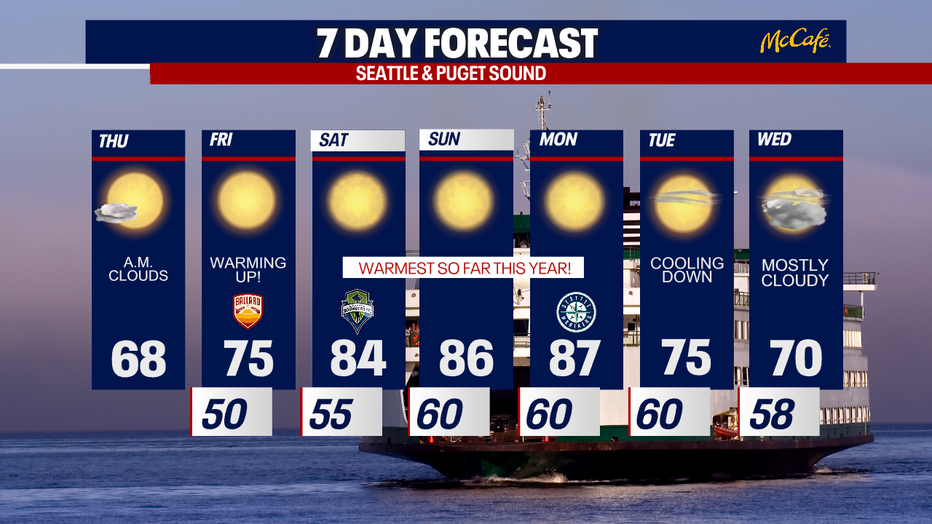
Comfortable sunny Thursday, hot weekend around the corner
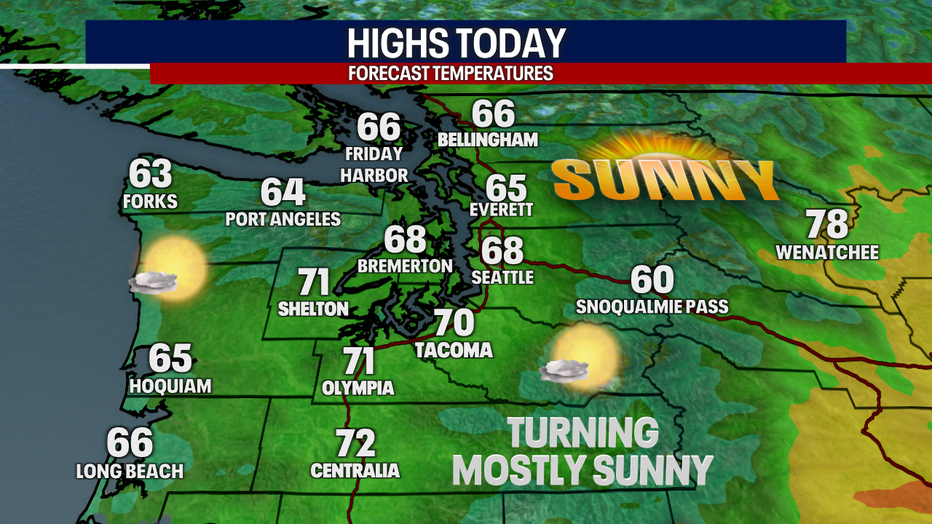
Seattle - The clouds are evaporating this morning, revealing beautiful sunny skies to start Thursday.
A cooler air mass will keep temperatures comfortable today, in the upper 60s and low 70s. Areas to the south will be a bit warmer than to the north.
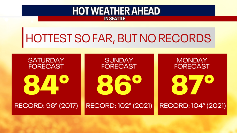
The first strong high pressure ridge of the season will position itself over the Pacific Northwest this weekend and into Monday. High temps will not set records, but they will easily be the warmest days we've seen so far this year. The last time SeaTac hit 80 degrees three days in a row was September 7 through September 9, 2021.
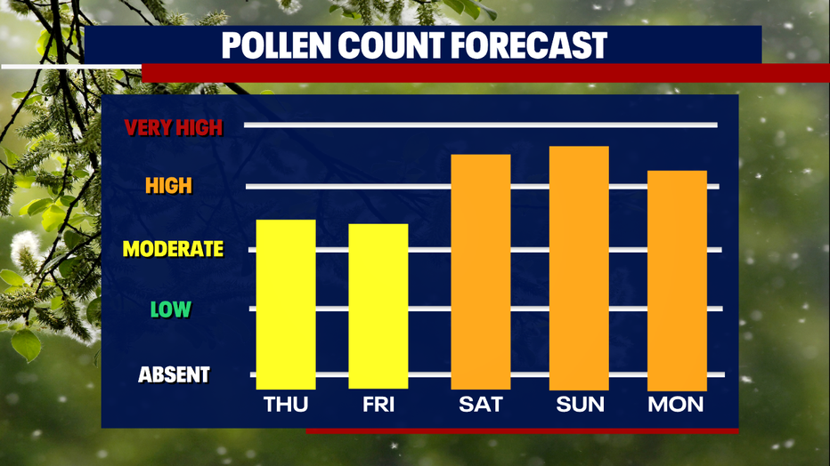
No rain is in the forecast for at least the next seven days, which means pollen counts will be higher. The hottest days of the week will also feature the highest pollen counts.
Even with this heat, overnight low temperatures won't be terribly warm Saturday, Sunday, and Monday nights. Overnight lows will drop to 60 degrees, which should allow you to blow some of the cool air into your house overnight.